The entrance is a disappointment, and it is meant to be. A gate in a town square, a ticket barrier like any other in Turkey – and then a stairway going down, and down again, until the daylight is a rumour and you are standing in the deepest city human beings ever carved under Cappadocia. This derinkuyu underground city guide exists because Derinkuyu is not a cave, not a tunnel and not a hideout with a gift shop. It is a complete town inverted into the earth – stables, cellars, kitchens, a school, a church, wells and graveyard-quiet living rooms stacked level beneath level in the soft volcanic rock – and it repays being read properly, level by level, the way its builders organised it.
Most coverage lumps Derinkuyu together with Kaymakli in a single comparison page, or reduces it to a ticket price and three headline numbers repeated until they sound like measurements. This guide does the opposite. It stays in Derinkuyu, walks the descent in the order the visitor route walks it, and is honest about the numbers – which come from the Ministry of Culture and Tourism’s own museum page, and which are inherited estimates nobody has ever actually counted. The wider region is covered in our Cappadocia travel guide; the town of Goreme and the open-air museum have their own guides on this site. Here, we go down.
One warning before the descent, because everything else in this derinkuyu underground city guide follows from it. Derinkuyu is narrow. Its connecting tunnels were cut for frightened people moving in single file, not for visitors, and parts of the route ask you to stoop, shuffle and wait while strangers breathe next to your ear. For most people that is the thrill of the place. For some it is a genuine problem, and this guide treats it as one, plainly and early, rather than as a footnote. Read the honesty section before you decide – what is down there, eighty-five metres of organised, stubborn human refuge, is unlike anything else in Turkey.
Derinkuyu Underground City Guide at a Glance
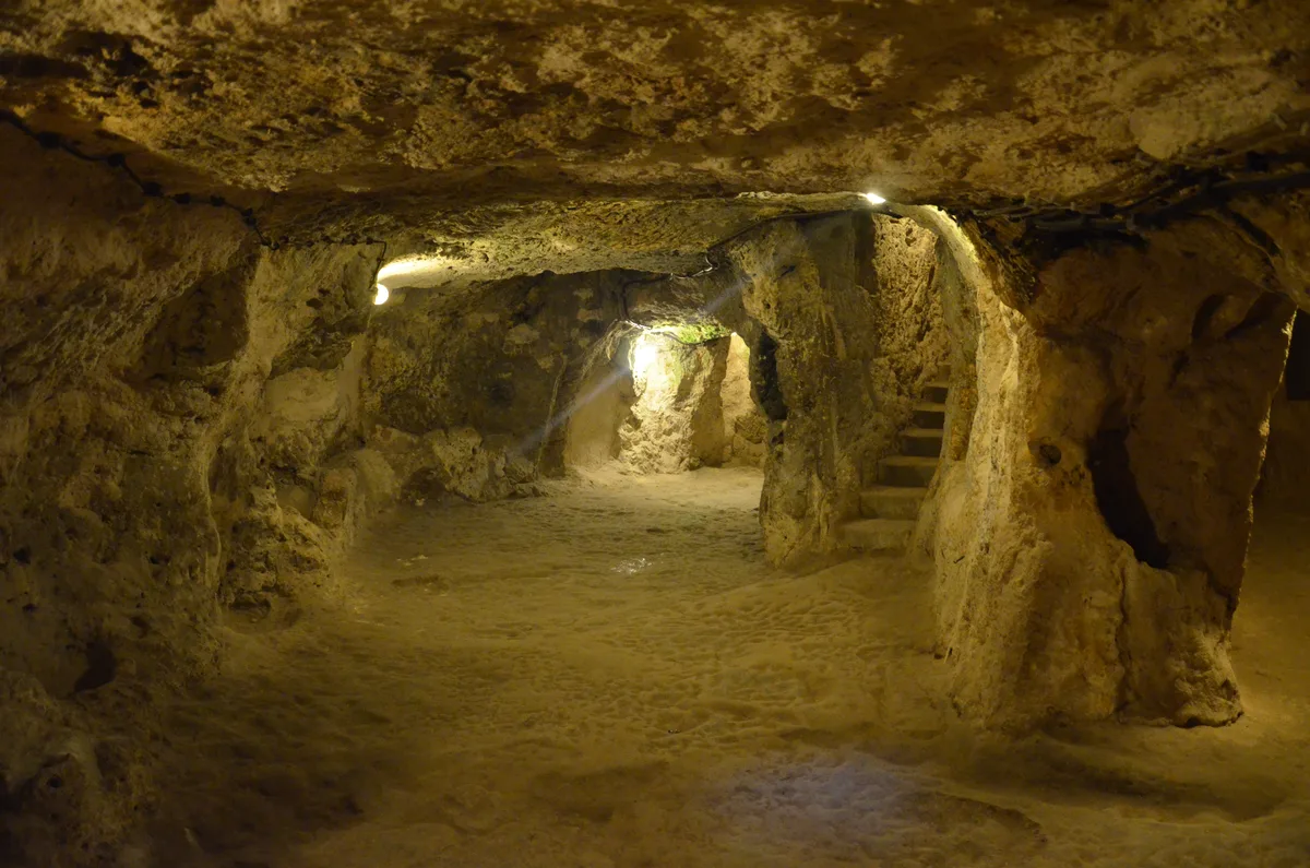
The single most useful thing to grasp before you enter is that Derinkuyu’s unit is not the cave but the floor. Each level is a rough storey of a building turned upside down – rooms, passages and shafts organised around a function, sealable from the levels above and below it, and connected to the surface by one great vertical shaft that served as both lung and well. The Ministry of Culture and Tourism, which runs the site as the Nevsehir Derinkuyu Underground City, describes a depth of about 85 metres and lists the furniture of a working town: stable, cellar, refectory, church, kitchen, and a missionary school with a barrel-vaulted ceiling on the second floor. Only about ten percent of the city, the Ministry says, can still be visited – the route you walk is the edited highlights of something far larger than the visit suggests.
The practical shape of the visit is simple. One entrance in the town of Derinkuyu, one ticket or the Museum Pass Cappadocia, and a managed descent through the upper levels and back up again, taking most visitors between forty-five and ninety minutes. The city is open every day, on the seasonal pattern the Ministry publishes on its museum portal. This table carries the whole derinkuyu underground city guide in miniature.
| Question | Answer |
|---|---|
| What is it | The deepest of Cappadocia’s underground cities – a multi-level refuge town carved into volcanic tuff beneath the modern town of Derinkuyu |
| Where | In Derinkuyu town itself, on the Nevsehir-Nigde highway about 30 km south of Nevsehir – the entrance is in the town, not out in the valleys |
| Run by | The Ministry of Culture and Tourism; the official source for hours and ticketing is its museum portal, muze.gov.tr |
| Depth | About 85 metres in total, per the Ministry’s museum page; the visitor route descends through the upper levels only |
| Levels | Commonly described as 18 levels in total, of which the upper 8 are open – the site’s own panel puts the visitable city at 8 floors |
| Opening pattern | Open every day on a seasonal pattern – a longer summer day and a shorter winter one, with the box office closing before the site; confirm the day’s hours on muze.gov.tr |
| Tickets | The site’s own ticket (also sold as an e-ticket on the portal) or the Museum Pass Cappadocia, valid three days from first entry across the Ministry’s Nevsehir and Aksaray sites |
| Time needed | 45 to 90 minutes underground for most visitors, plus ticketing and recovery time on the surface |
| Do not miss | The missionary school’s barrel vault, a rolling-stone door in its wall cavity, the great shaft, the cross-planned church at the route’s lowest point |
| Conditions | Steep stairs, low single-file tunnels, a one-way flow at busy times; not a visit for anyone with serious claustrophobia or mobility limits |
Note the depth line in particular. The 85 metres is the Ministry’s figure for the whole city, top to bottom – not the depth of your visit, which threads the eight open floors and will still leave your legs in no doubt about how far down you have been. Keeping the two separate is the difference between a guide and a brochure.
A City Turned Upside Down – What an Underground City Actually Is
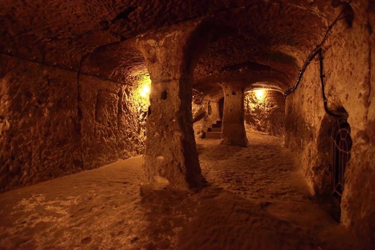
Start with the rock, because everything about Derinkuyu is the rock’s idea before it is anyone else’s. Cappadocia’s plateau is built of tuff, the compacted ash of ancient eruptions, soft enough to cut with hand tools and hard enough, once exposed, to hold a carved room’s shape for a thousand years and more. Below ground, that softness gave something stranger than the fairy chimneys it made above – the possibility of architecture by subtraction on an urban scale. You do not build an underground city. You remove one, room by room, hauling the spoil up the shafts, and what stops you is never the digging. It is the air, the water and the defence, and Derinkuyu is famous precisely because its diggers solved all three so completely.
How many such cities exist is a question with an honest range rather than a number. Museum texts on the region put Cappadocia’s underground settlements at somewhere between one hundred and fifty and two hundred, of every size from a two-room cellar refuge to this – and only a handful are prepared for visitors. Derinkuyu is the largest excavated and the deepest of them, which is why this derinkuyu underground city guide treats it as the type specimen: understand how Derinkuyu breathes, drinks, eats, worships and locks its doors, and you understand the whole Cappadocian idea.
The other thing to understand is the direction of the idea. A castle is a town’s wealth made visible; an underground city is the opposite philosophy – wealth made invisible. From the surface, Byzantine Derinkuyu presented almost nothing: an ordinary settlement around wells and ventilation openings, indistinguishable from a hundred others. Under threat, the population simply went downstairs, pulled the stone doors shut behind them, and waited in a fully provisioned town that an invader in the empty streets above could not see, could not easily find, and could not starve out in any reasonable season. Nor are these rooms bunkers: they have niches for lamps and jars, benches and tables cut from the living rock, mangers, presses, study rooms. People expected to live down here for weeks at a stretch while armies passed overhead. The city was not a last resort. It was a strategy, rehearsed over centuries.
The Town Above and the Name of the Deep Well
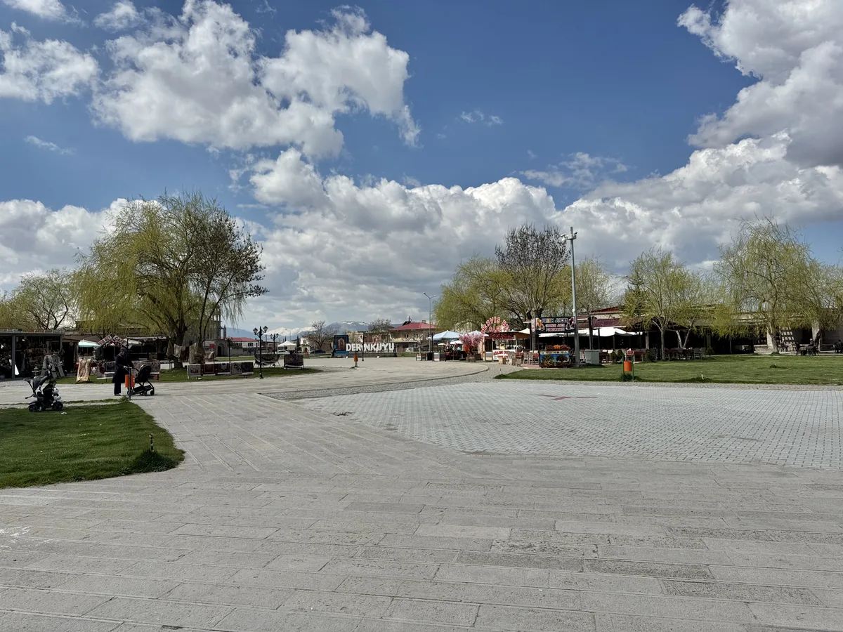
Derinkuyu the modern town is easy to underestimate, which is exactly what it has always been for. It is a working district town of Nevsehir province, thirty kilometres south of Nevsehir city on the highway toward Nigde, with a main square, market stalls, stone houses and the unhurried air of agricultural Anatolia. The entrance to one of the world’s great archaeological sites sits in the middle of it, signed from the square, in the way another town might sign its bus station. Visitors who arrive expecting a valley and a wilderness will recalibrate in the first minute. The underground city is not in the Cappadocian countryside. It is under a town, and it was always under a town – the settlement above and the settlement below are the same community wearing two different centuries.
The town’s older name is usually given as Malakopea, the name its Greek-speaking Christian inhabitants used for it into the twentieth century. The Turkish name that replaced it tells the truth if you translate it. Derinkuyu means “deep well” – derin, deep; kuyu, a well – and the story the town tells about its own name is that the new settlers who arrived in the 1920s named the place for the great well-shaft of the thing beneath them. Whether the naming happened exactly that way is the kind of detail local tradition polishes; the aptness is not in doubt. The deepest feature of the underground city, its ventilation shaft, is also a well.
The rediscovery story comes later in this guide. First, the argument about who started digging, because it is a real argument and you deserve both sides of it.
Who Dug Derinkuyu – the Phrygian Question
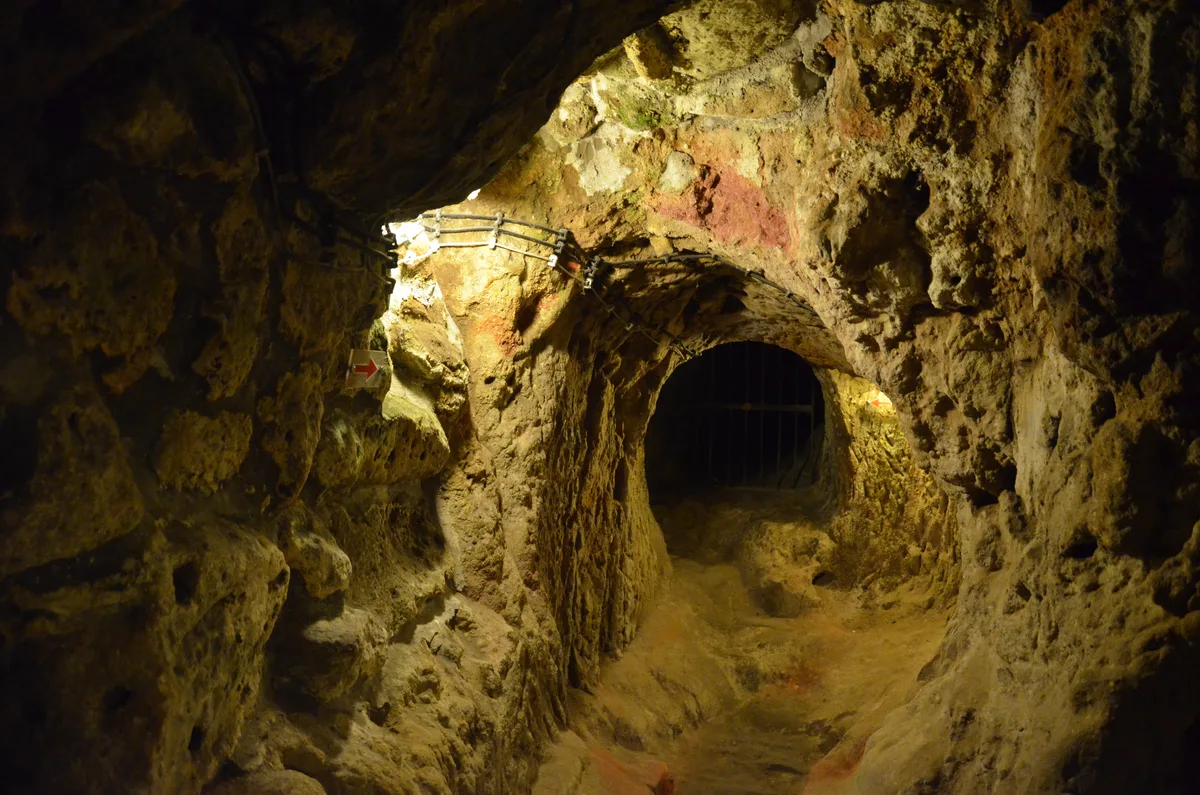
Ask who built Derinkuyu and you will get a confident answer from almost everyone, which is the first sign that the honest answer is “nobody knows, exactly.” No foundation inscription has been found down there. No chronicler describes the digging. What exists is a sequence of educated positions, and this derinkuyu underground city guide lays them out the way the evidence lays them out, because the debate is more interesting than any of the certainties printed elsewhere. The position most often attached to officialdom is the Phrygian one. According to the Ministry of Culture, as the Cappadocia Geopark’s account puts it, the first caves at Derinkuyu might have been cut by the Phrygians in the eighth to seventh centuries BC, when Phrygian power covered this part of Anatolia and the tuff was there for the cutting. Note the Ministry’s own caution in that sentence – “might have been.” It is a hypothesis wearing official dress, not a dated fact.
Against or beneath it sits an older possibility. Some accounts push the first hollowing back toward the Hittites, a thousand years earlier still, on the logic that Cappadocia was Hittite heartland and refuge holes are older than any empire. Nothing found in Derinkuyu proves it. In the other direction, plenty of archaeologists would tell you that whatever early scratches existed, the city as a city – the organised, multi-level, defensible town you walk today – is overwhelmingly a work of the Roman and above all the Byzantine centuries, dug deeper and more cleverly as the threats grew more serious. Cities like this are palimpsests. Each generation inherited a warren and left a town.
What can be said without hedging is the shape of the growth. A settlement that begins as storage cellars and a refuge hole or two becomes, over fifteen or twenty centuries of intermittent danger, an engineered system – because each crisis taught the diggers something the next crisis assumed. The rolling doors answer raids that reached the lower levels. The protected wells answer sieges that tried poison. The school and church answer stays that lasted months rather than days. Derinkuyu’s depth is the sum of its fears.
So when a website tells you flatly that Derinkuyu was “built by the Phrygians in the 8th century BC” or “built by early Christians fleeing persecution,” it is giving you one panel of a triptych and calling it the picture. The Christians were real, and the refuge centuries were the city’s great age – the next section takes them on their own terms. But the first pickaxe probably swung centuries before any church was cut down here.
The Refuge Centuries – Byzantium, Raids and a World Heritage Inscription
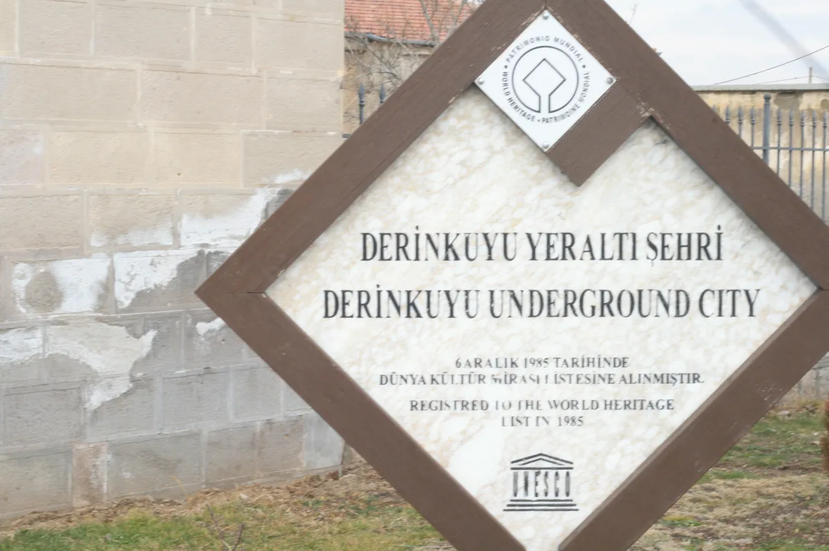
The city’s documented great age is Byzantine, and it is documented in the most authoritative place available. UNESCO’s description of the property it inscribed in 1985, Goreme National Park and the Rock Sites of Cappadocia, explains that as Arab invasions pressed into Anatolia, Cappadocia’s communities “began banding together into troglodyte villages or subterranean towns such as Kaymakli or Derinkuyu which served as places of refuge.” That sentence is worth pausing on. It is UNESCO itself naming Derinkuyu, in its own brief synthesis of the property, as one of the subterranean towns the inscription covers – which is the exact relationship. Derinkuyu does not have a separate World Heritage listing of its own, and it is not merely near the inscribed area. The underground cities of Kaymakli and Derinkuyu are named components of the property, part of what was inscribed in 1985, and the register of protected monuments counts its two underground towns alongside the property’s five troglodyte villages and more than two hundred rock-hewn churches.
The wars that drove people down were the long Arab-Byzantine frontier conflicts, conventionally dated from the late eighth century to the twelfth – centuries in which Cappadocia was a militarised borderland and raiding armies crossed it with the seasons. A surface town in a raiding corridor has three options: walls, flight, or disappearance. Derinkuyu chose disappearance, and refined it into a system. When the alarm came, the community moved down with its animals and stores, sealed the passages level by level behind rolling stones, and let the raid find empty streets, cold hearths and no one to ransom. When the raiders moved on – raiders always move on – the town came back up and got on with its year. Repeat that cycle for four hundred years and you get eighty-five metres of prudence.
The refuge habit outlived the Arab wars. Later centuries brought new armies and new alarms across the same plateau, and the city stayed in the community’s repertoire, maintained and remembered, even as its surface half grew into the Greek-speaking Christian town of Malakopea. Its last regular congregation was not Byzantine at all, but the town’s own Orthodox inhabitants, whose departure in the 1920s is where the city’s story breaks – and then, forty years later, accidentally resumes. Nothing down there is a reconstruction: these are working spaces vacated by history, cleaned, lit, railed and opened.
Abandonment and the Man Who Found a Room
The abandonment is the one part of Derinkuyu’s story told by documents rather than by digging. In 1923, under the population exchange agreed between Greece and Turkey after the Greco-Turkish war, the Greek-speaking Orthodox Christians of Cappadocia – Malakopea’s people among them – were sent to Greece, and Muslim Turks from Greece took their places in towns like this one. The newcomers inherited houses, fields and a town name they would change. What they did not inherit, because nobody thought to hand it over, was the habit of the underground. The new residents used some upper rooms as storage the way anyone uses a cellar, and the deeper city, its doors standing open into darkness nobody needed anymore, dropped out of the town’s memory within a generation. A city that took two thousand years to dig was forgotten in about forty.
The rediscovery is the part told by everyone, and here this derinkuyu underground city guide has to split the documented from the decorated. The documented core is consistent across every serious account, including the Ministry’s presentation of the site. In 1963, a resident of Derinkuyu, renovating his house, broke through a wall and found a hidden chamber behind it that was not on any plan of his house. Following the passages beyond it, first he and then the authorities realised what the town was sitting on. Excavation and clearance followed, and the Ministry’s museum page records the sequel plainly: the underground city was opened to visitors in 1965, the same year the information panel at the site still gives. Some secondary accounts say 1969; the Ministry’s own “opened in 1965” is the figure this guide prints, with the disagreement noted for honesty.
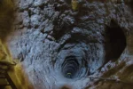
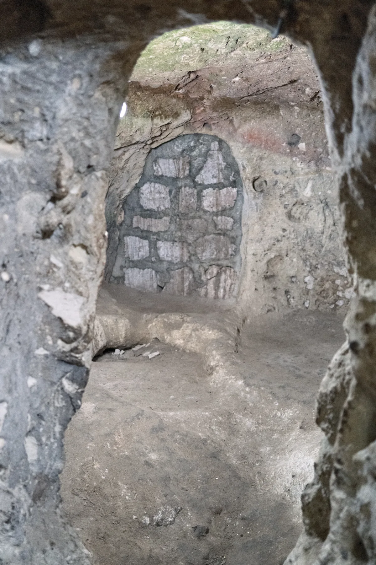
The decorated layer is the one guidebooks garnish – the chickens that kept vanishing through a hole, the wall that sounded hollow at a knock. Variants of those details attach to more than one Cappadocian rediscovery, none can be verified now, and none appears here as fact. What does not need garnish is the shape of the thing: a man improving his house found a room that should not exist, and behind the room, a city that should not have been forgotten. Of the whole complex, the Ministry says about ten percent is visitable today. The rest remains where the town left it, in the dark under the streets – which is why photographs of walled-up passages like the one above are not illustrations of damage, but pictures of the city’s normal state.
The Layout – Levels, Shafts and the Ten Percent You Can See
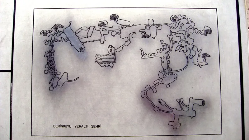
Derinkuyu is organised vertically, and the visitor route respects the organisation. Read the city as an inverted tower. At the top, nearest the light and air, sit the working levels – stables, stores, cellars, the heavy logistics of survival. Below them come the living and communal floors, with the missionary school placed high, on the second floor, where the air is best. Deeper still, the city tightens: passages narrow, doors multiply, and the functions turn to last resorts – protected wells, sealed chambers, and at the bottom of the route the cross-planned church. The Ministry’s page gives the structure its dimensions: a depth of about 85 metres, and about ten percent of the city open to visitors. The description you will meet most often in print – eighteen levels in total, of which the upper eight are open – is the standard published account rather than a Ministry figure; the panel at the site itself describes the town as consisting of eight floors that can be visited. This derinkuyu underground city guide uses the two together, labelled for what they are.
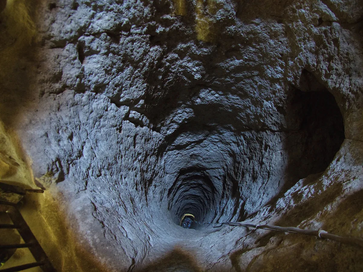
The vertical plan is held together by one piece of engineering, the great ventilation shaft, which drops through the levels like a spine – the Ministry gives its depth as 55 metres where it connects the city to the surface air. Around that spine, each floor was given its own water access from wells sunk to different depths, so that no single failure, and no single act of sabotage, could thirst the whole city out. Movement between floors runs through a small number of stair tunnels, each defensible, each closable with a stone door. Stand on any landing and the plan reads clearly: this is not a warren that grew by accident. It is a building, designed by accretion, with services and security thought through at every floor.
Your visit follows a managed route through that building – down one sequence of stairs and passages, around a loop of the showpiece rooms, and up again, with the flow directed so the narrowest tunnels are walked in one direction; at busy times attendants manage the pinch points. Allow the route its own pace. The sections of this derinkuyu underground city guide that follow walk it in descending order: the working level first, then the school, the living floors, the doors, the water, and the church at the bottom. One piece of orientation is worth carrying down with you: everything in the city is cut, not built – the benches, tables and pillars are simply the rock the diggers decided not to take away.
The First Level – Stables, Cellars and Stores
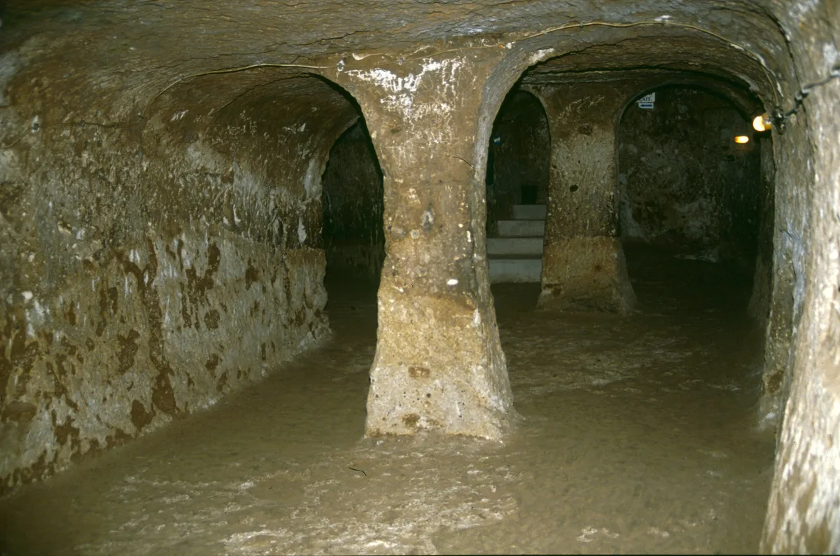
The Ministry’s inventory of Derinkuyu reads like the manifest of a self-sufficient town: stable, cellar, cafeteria – the refectory – church, cooker, meaning the kitchens. The order of your descent follows the same logic the builders used. The first level, the one you reach down the entrance stair, is the city’s farmyard and warehouse floor. The stables are here, on the highest level, and the usual explanation is a practical one any farmer would recognise. Animals are heavy, frightened and filthy; you bring them the shortest distance, keep them where the fresh air arrives first and their smell troubles the living floors least, and keep them where they can be reached and fed without a journey through the whole city.
Around the stables, the first level and the floors just below it hold the storage body of the city: cellars and storerooms, chambers for grain, dried food and the great jars in which a Cappadocian household kept its year. Storage is the unglamorous half of survival, and Derinkuyu is mostly storage, read honestly. A refuge that can hide a town for a weekend needs passages and doors; a refuge that can hide one for a season needs cellars on an industrial scale, and the proportion of the excavated city given over to keeping food is the truest measure of how long its people expected to stay. The refectory, the communal eating hall on the Ministry’s list, belongs to this working world too – a town fed communally, in rows, from central kitchens, because separate family cooking in a sealed rock city would have smoked the community out of its own refuge.
Look at the fabric of these upper rooms as you pass through them: mangers and tethering holes in the stable walls, niches sized for jars and lamps, floors worn smooth by feet and hooves rather than by boots. The visitor route hurries most people through the first level on the way to deeper drama, and this derinkuyu underground city guide suggests resisting the hurry for a minute – the upper level is where Derinkuyu stops being a wonder and starts being a farm, a warehouse and a canteen, which is precisely what made the wonder below possible. The kitchens sit in the same working system, placed high because cooking smoke needs the ventilation only the upper, shaft-served floors could guarantee; soot-blackened ceilings are the signature of centuries of that arrangement. The city cooked high, ate communally, and slept low – the floor plan of a siege, drawn by people who had rehearsed it.
The Missionary School and Its Barrel Vault
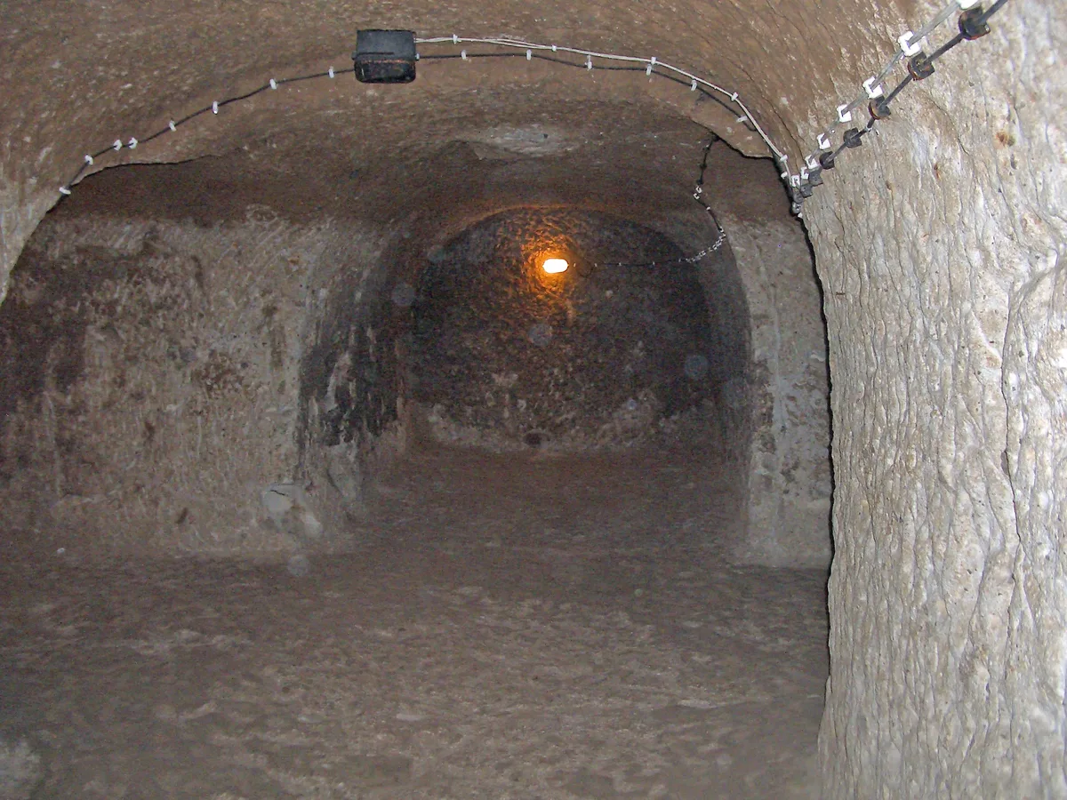
Every underground city in Cappadocia has passages and doors. Only Derinkuyu has this room, and the Ministry’s museum page gives it pride of place for a reason. On the second floor of the city sits the missionary school: a large hall whose ceiling is covered with a barrel vault, which the Ministry notes is rarely encountered in the underground cities, with the spaces to the left of the hall given over to study rooms. Stop and take in what that means architecturally. A barrel vault is a builder’s form – the signature ceiling of Roman and Byzantine construction, made above ground by laying stones over a wooden form. Down here, nobody laid anything. The vault is an imitation of built architecture executed by subtraction, carved out of the solid rock by men who wanted the room to feel like the schools of the surface world, and who had the skill to fake a structure that holds nothing up but itself.
The room’s remembered function explains its position and its grandeur. A missionary school trained the clergy and teachers who served the region’s rock-cut churches, and in the city’s vertical plan it sits high, on the second floor, in the zone of best air. Teaching, like cooking, belongs near the top of a sealed city. The study rooms off the hall complete the picture of a small boarding institution folded into the refuge: when the community went down, its school went down with it. Survival at Derinkuyu was never only about not dying. It was about remaining a civilisation – fed, taught, married and buried in order – for as long as the emergency lasted.
For the visitor, the school is the route’s first great interior. The stables and cellars could belong to any large cave complex in the world; this long, vaulted hall could belong to only one culture – Byzantine, Christian, bookish – and to only one city. Give it a pause: stand at the end of the hall and notice that the people who carved it expected their grandchildren to be educated in it. That expectation, more than the depth, more than the doors, is what separates Derinkuyu from a hiding place. A practical note belongs here too, because the school is where the route’s character first declares itself. To reach the second floor you have already descended stairs and at least one passage where the ceiling asks you to duck, and the visit only gets lower and narrower from here. Enjoy the headroom while it lasts. Then take a breath, and follow the stairs down into the living city.
Living Quarters, Kitchens and the Winery
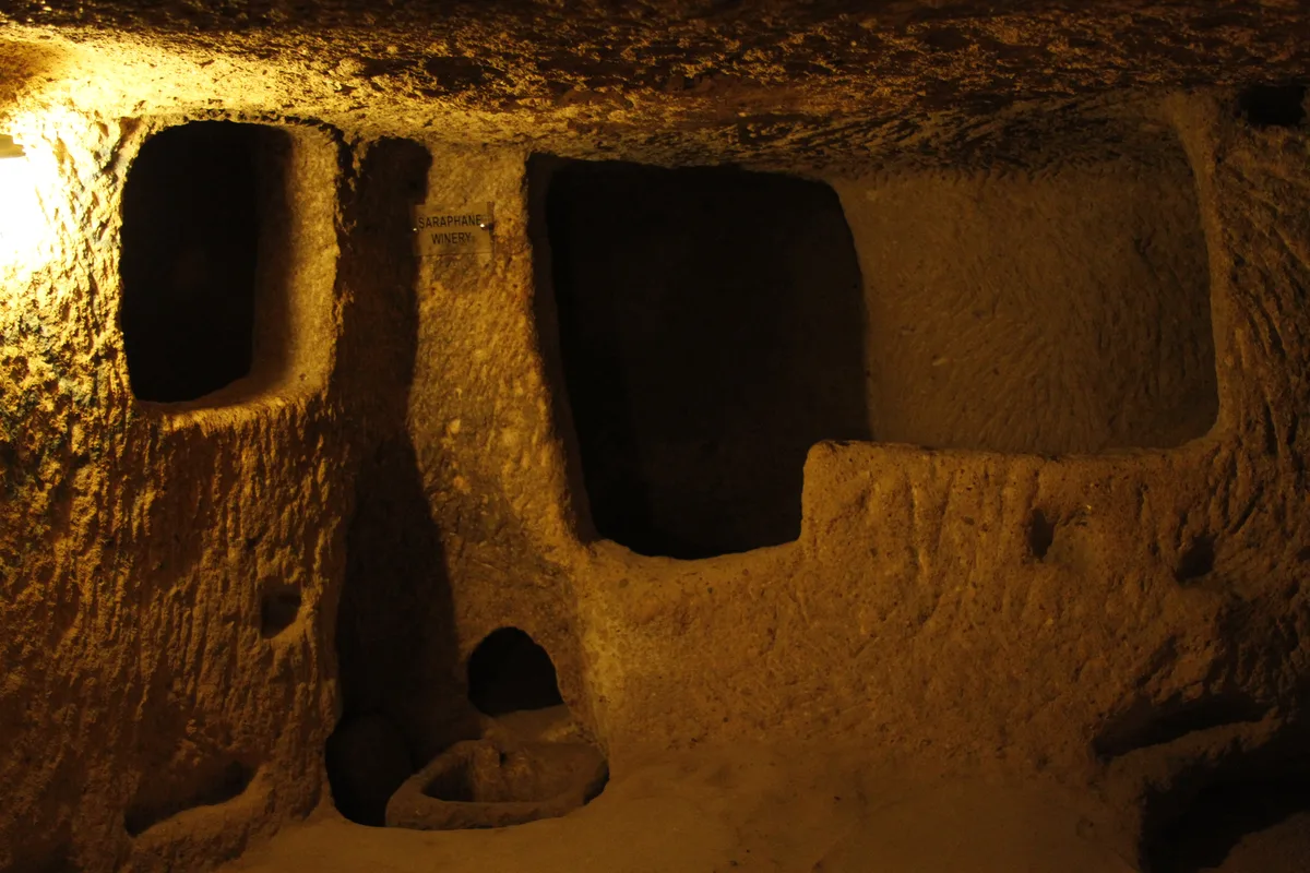
Below the working level, the city turns residential, and the rooms change their grammar. The living quarters of Derinkuyu are family-scaled: chambers and suites of connected rooms, sleeping spaces with benches and niches, the occasional grander apartment around a small hall. Published descriptions of the complex list the full domestic inventory – living rooms, bedrooms, kitchens, dining spaces, storage rooms of every size – and the Cappadocia Geopark’s summary of Derinkuyu adds the production rooms that made the domestic ones possible: wine and oil presses, among the stables, cellars, storerooms, refectories and chapels. A town, in short, with its economy intact. Families did not camp in Derinkuyu. They moved house, downwards, bringing the year’s food economy with them and expecting to run it underground until the surface was safe again.
The winery repays a slow look, because wine in Cappadocia was never a luxury item. It was calories, currency, medicine and sacrament in one jar, and Derinkuyu’s wine-making spaces – pressing areas where grapes were trodden or weighted, channels and basins to run the juice, niches and cellars to store the jars – are that economy’s industrial plant cut into the rock. The wall in the photograph carries the whole process in one face: openings for vessels, basins at working height, the pressing floor at your feet. Oil presses served the same logic for the region’s other liquid staple, the fuel of every lamp that lit these rooms. When you read that the city could sustain a large population for an extended stay, it is rooms like this, not the tunnels, that made the claim plausible. People survive on stores and presses, not on architecture.
Kitchens and refectories complete the domestic machine, and their arrangement repeats the lesson of the stables: cooking centralised and kept high, eating communal, and the living floors below reserved for sleeping, storing and enduring. Even the temperature cooperates. Deep rock holds a steady coolness through the Anatolian summer, which is why a light layer feels good in the lower levels even in August. Walk these floors, then, as neighbourhoods rather than as sights – each cluster of rooms around a passage junction a street of the inverted town, each niche a cupboard, each bench a bed. The romance of Derinkuyu is often sold on its depth. Its real distinction is this ordinariness, preserved entire, eight floors down.
The Rolling-Stone Doors
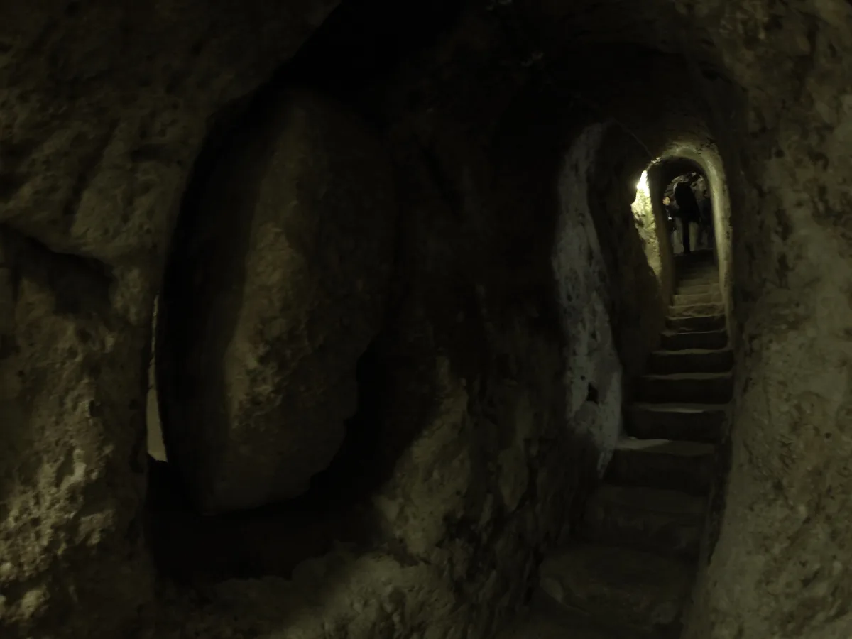
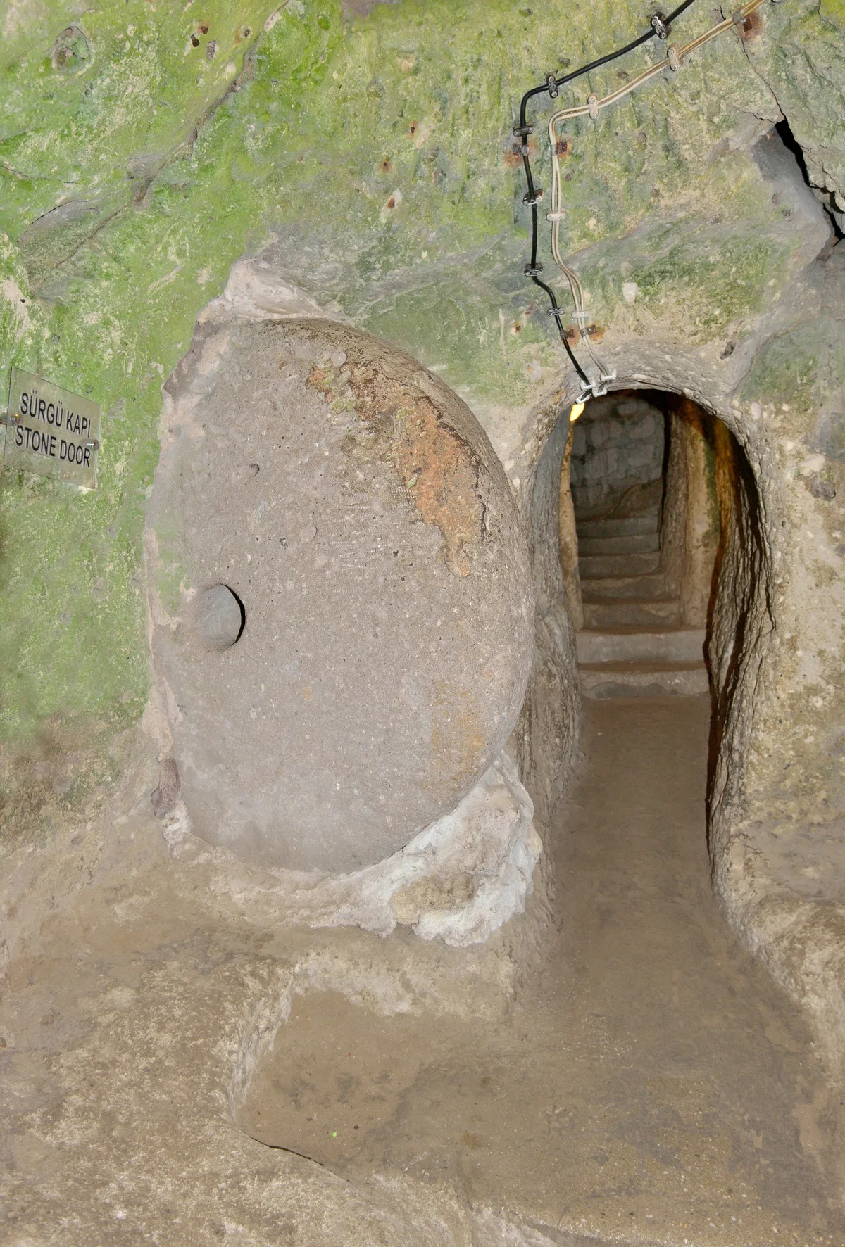
The information panel at the site describes the defence system better than most books do, and this section follows it. The city’s tunnels, the panel explains, were closed by large round stone slabs standing upright in special cavities in the walls, ready to be rolled across the passage. Everything about Derinkuyu’s security follows from that single device. The doors are discs of hard stone, commonly described as around half a metre thick and weighing in the region of half a tonne, pierced at the centre and fitted so that they can be levered and rolled along a slot from inside the passage – and, crucially, only from inside. From the attacker’s side there is nothing to grip, no handle, no hinge, no gap worth a crowbar. From the defender’s side, a small crew could seal a corridor in moments and move on to the next.
The doors are placed the way a military engineer would place them. They guard the junctions between levels and the mouths of the stair tunnels – the city’s few true bottlenecks – so that the defence unfolds in depth. Take one passage and you have won a corridor and a locked door. Take one level, at ruinous cost in a stairwell too narrow to swing a weapon in, and the population has simply gone down one more floor and rolled the stones behind them. The Cappadocia Geopark’s summary makes the same point in a sentence: the city could be closed from the inside with large stone doors, and each floor could be closed off separately. Attackers with a season’s patience could starve a castle. A city whose every floor is a separate castle, stocked from its own cellars and watered from its own protected wells, is a different problem entirely.
For the visitor, the doors are everywhere once your eye learns them – parked in their wall cavities beside open passages, exactly where their last users left them, each one a decision made under fear by people who expected to use it. A castle wall says: we are strong, come and try. A Derinkuyu door says: we are not here. The strongest position in Byzantine Cappadocia was invisibility backed by stone, and the round doors are invisibility’s mechanism – silent, quick, and deniable from the surface, where a raid found only an empty town and nothing to suggest the heartbeats below their boots.
The Great Shaft – Air, Water and the Poison Problem
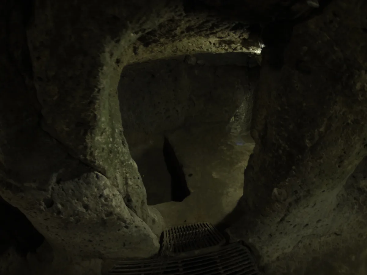
Depth is easy to dig and hard to live in, and the reason is air. A sealed crowd in a rock box consumes oxygen and produces heat, smoke and panic, and the deeper the box, the faster the arithmetic turns. Derinkuyu’s answer is the feature you have already met as the city’s namesake: the great vertical shaft. The Ministry’s museum page states the essentials plainly. The ventilation shaft, 55 metres deep where it ties the city to the surface, is also used as a water well – one hole doing the two jobs a besieged city needs most, air and water, delivered together to the levels it passes. Stand at one of the shaft’s openings on a still day and you can feel the system working: a cool, steady breath moving through the rock, the city’s lungs still functioning twelve centuries after the last refugee climbed out.
The water half of the system is cleverer still, and the Ministry’s description contains the single most chilling detail in the whole complex. Not every well in Derinkuyu connects to the surface. Some wells were deliberately cut so that their mouths did not open on the ground above, because a well that an enemy can reach is a well an enemy can poison. A besieging force that fouled the surface wells would thirst out an ordinary refuge in days; at Derinkuyu, floors drew water from protected shafts the surface could not touch, arranged so that no single contamination could dry out the whole city. Whoever rationalised that system had thought about sieges the way engineers think about failure – not whether, but where, and what still works afterwards.
Air follows the same redundant logic. The great shaft is the main lung, but the interplay of shafts, stairwells and passages keeps air moving to the lowest open levels – which is why, even at the bottom of the route on a crowded morning, the air is stuffy rather than dangerous. The famous population figure belongs to this system. Derinkuyu is often said to have sheltered up to 20,000 people, and this derinkuyu underground city guide treats that as exactly what it is: a widely repeated estimate of capacity at full stretch, not a census – nobody counted, and the whole city has never been excavated. What is not an estimate is the engineering that makes a number in that range conceivable. The shaft, the protected wells, the cellars and the doors are a life-support system, and they are the real marvel of Derinkuyu – the depth is just its container.
The Cross-Planned Church and the Deepest Rooms
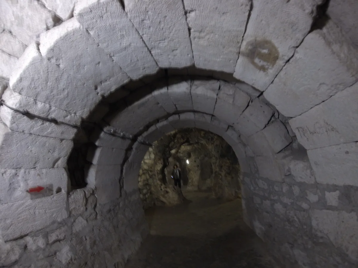
The Ministry’s museum page gives the visitor route its climax in one sentence: after the third and fourth floors, you can go down directly by the stairs and reach the cross-planned church on the lower floor. That placement is the last and clearest statement of the city’s values. The church is not at the top, handy for Sunday. It is at the bottom of the defended world, in the deepest protected space the community had, because when everything else had been stripped away – houses, fields, the surface town itself – worship was the thing the refugees carried furthest down. A cross-planned church is a church laid out in the shape of its own symbol, cruciform, the standard plan of Byzantine sacred architecture reproduced in negative at the bottom of a hole in the ground.
Around the church, the deepest open levels hold the city’s other last-resort rooms: sealed chambers, protected water, and burial spaces for a community that might have to conduct the whole of life, including its end, without surfacing. Derinkuyu’s dead were not carried up through a siege for burial in the churchyard; the city made room for them below, as it made room for births, lessons and weddings. Visitors often describe the bottom of the route as solemn without knowing why. The why is architectural: you are standing in the part of the city designed for the worst week of its people’s lives.
The built arch in the photograph is your clue to how the deepest rooms were finished. Almost everything in Derinkuyu is the rock itself, unremoved. Occasionally – around the church level among them – the carvers stopped subtracting and started building, dressing an opening with a true arch of fitted stones. It is a small thing, and one of this derinkuyu underground city guide’s favourite details in the whole complex, because it proves the diggers were not prisoners of their technique. The church is also where the visitor route turns: from its lowest point the climb begins, up the stairs you descended, past the doors and the wells and the school, toward a disc of daylight that grows from a coin to a doorway. Do not rush the ascent. The climb is the city’s last exhibit – the distance between the refuge and the world, measured in your own calves.
The Tunnel Toward Kaymakli
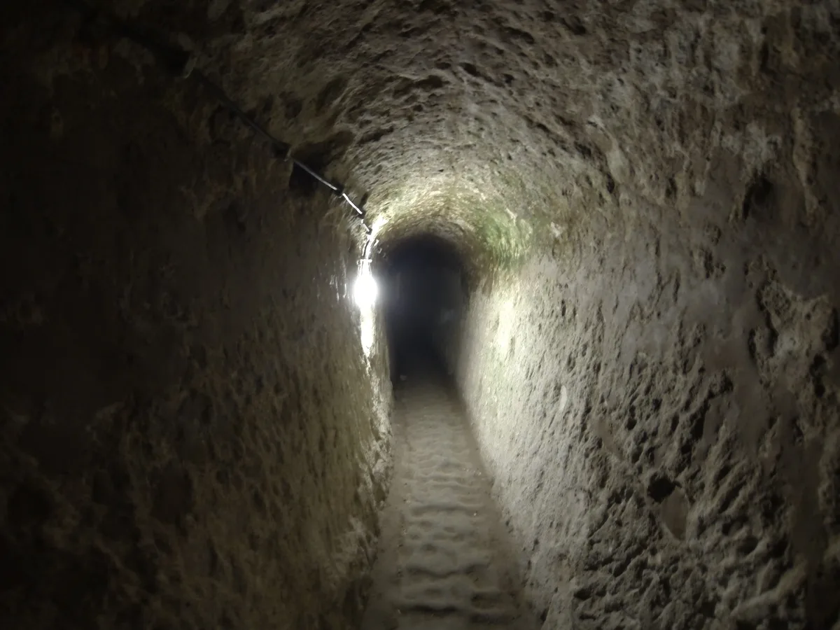
Somewhere below the levels you are allowed to see, Derinkuyu is said to connect to Kaymakli, the second of Cappadocia’s great underground cities, lying roughly nine to ten kilometres north as the road runs. The connection is one of the most repeated claims in all Cappadocian writing: a tunnel through the tuff along which people and messages could pass entirely underground. The length given for it varies by source – nine kilometres is the figure most often printed, eight appears in others – and the honest summary is that a connection is widely reported and entirely unverified as a walkable, continuous passage today. No visitor walks it. No tour enters it. Whether it survives complete, collapsed in sections, or exists as a chain of connected workings rather than one heroic bore, the public record does not settle, and this derinkuyu underground city guide does not pretend to settle it either.
What can be said is that the claim is plausible in the world Derinkuyu’s builders lived in. The two cities were near neighbours in the same refuge system, dug by the same culture into the same cooperative rock, and Cappadocia’s underground is full of documented connecting passages on the smaller scale, between rooms, houses and refuges. A link between the two greatest cities of the system is the kind of project the refuge centuries rewarded – two towns that could reinforce, supply or evacuate into each other without ever showing a head above ground would have been worth years of digging. The Geopark’s account notes, without embroidery, that the city “was connected to other underground cities by kilometers of tunnels” – the network stated as a fact of the system rather than a marvel of one pair.
For the visitor, the tunnel’s function in a guide like this one is disciplinary: it marks the edge of what you can know. Everything in the previous sections stood in front of you, lit and labelled; the tunnel remains a story told at the surface about a darkness nobody alive has fully mapped. Believe that the cities were connected; hold the exact mileage loosely; and when you visit Kaymakli – as the comparison section below will help you decide – look for the same doors, the same wells, the same logic. Whatever the tunnels’ state, the two cities are plainly pages of one book.
Tickets, the Museum Pass Cappadocia and Opening Hours
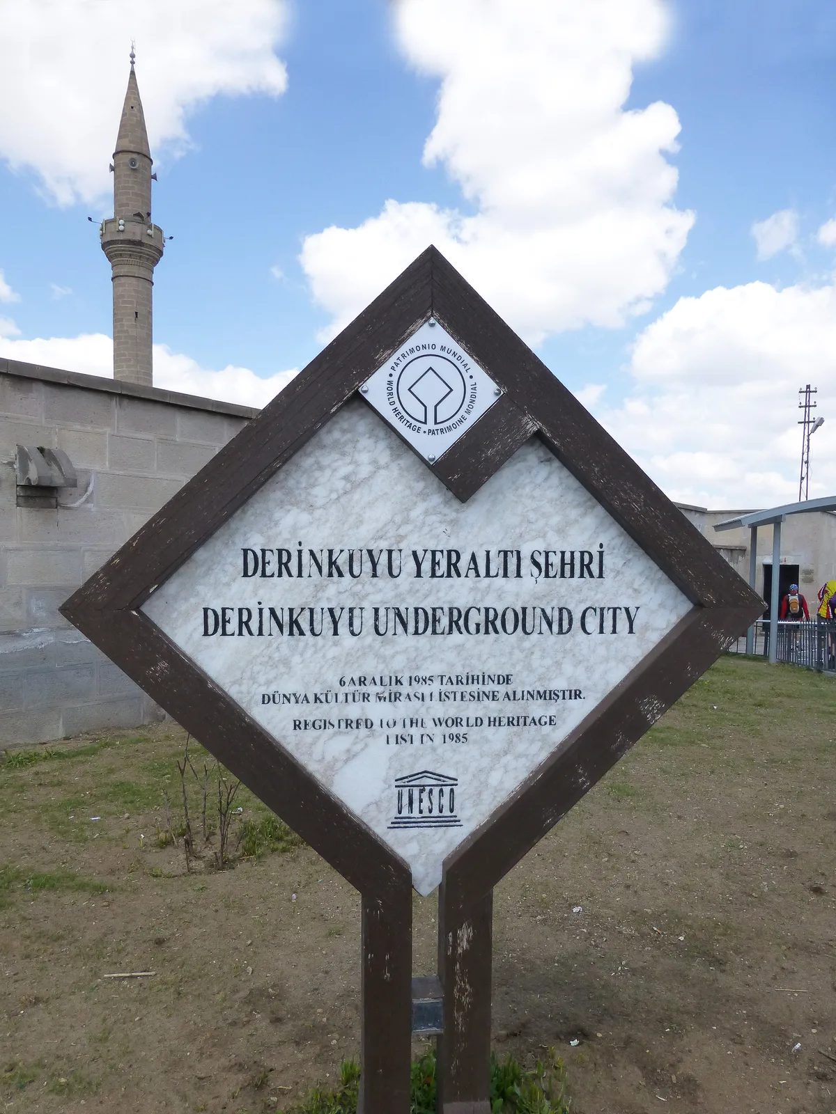
Derinkuyu’s ticketing runs on the standard Ministry system, and – following the rule this site keeps for every Turkish museum – this derinkuyu underground city guide explains the mechanisms and prints no prices, because Turkish museum prices change by decree and season and a printed figure becomes a lie on somebody’s travel day. There are three ways in. The first is the site’s own ticket, bought at the box office at the entrance in Derinkuyu town. The second is the e-ticket sold through the Ministry’s museum portal, muze.gov.tr, which buys you out of the ticket-office queue – though not out of the crowd inside, which is a matter of timing, not ticketing. The third, and for most Cappadocia itineraries the interesting one, is the Museum Pass Cappadocia.
The pass mechanism is stated on the Ministry’s own Derinkuyu page, and it is simple. The Museum Pass Cappadocia lets you visit the Ministry’s museums and archaeological sites in Nevsehir and Aksaray provinces – more than ten of them – for three days, counting from your first entry, and Derinkuyu is on its listing alongside the Goreme Open-Air Museum, Kaymakli and the other Ministry sites of the region. If your Cappadocia days will fill three days of Ministry sites, the pass is the natural product; if Derinkuyu is your only museum, the single ticket is. Muzekart, the discounted card, belongs to Turkish citizens and residents. One limit worth knowing from the same page: the Museum Pass is not valid for Night Museum programmes, the special evening openings the Ministry runs at some sites in season – so if a night opening at Derinkuyu is advertised during your stay, expect it to be ticketed separately. If Istanbul’s museums are also on your trip, the capital runs on different pass products entirely; our Istanbul travel guide walks that city’s museum system separately.
Hours follow the Ministry’s seasonal pattern, stated on the same official page as a pattern rather than a promise. The site is open every day. In the summer season, from the start of April to the start of October, the day runs from 08:00 to 19:00, with the box office closing at 18:15. In the winter season the day shortens, from 08:00 to 17:00, with the box office closing at 16:15. Confirm the day’s exact hours on muze.gov.tr before a long drive – museum hours in Turkey are adjusted by announcement, and the last-entry discipline at the box office is real. Be at the gate at opening, whichever season it is, and the city is a different, quieter place.
A last practical word. The entrance is in the town, with the square’s parking and small businesses around it, and the visit begins and ends in daylight at town level – nothing between the ticket barrier and the stair but a few metres of corridor. Everything you need underground you carry: water for before and after, a light layer for the cool lower levels, and nothing bulky, because the tunnels will negotiate that point with you personally.
Getting to Derinkuyu From Goreme
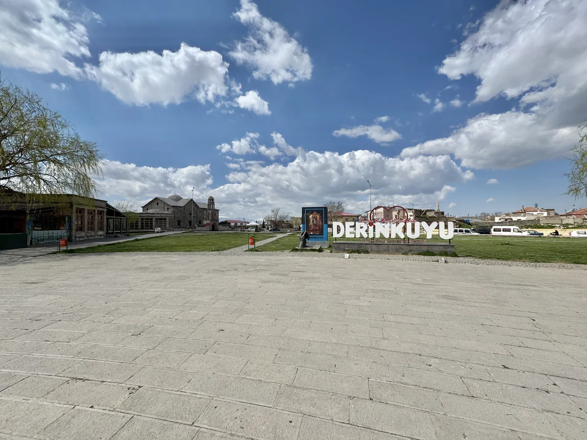
Derinkuyu is the southern sight of the Cappadocia circuit, and getting there is a road problem, not a hiking one. The Ministry’s page fixes the town at 30 kilometres from Nevsehir on the Nevsehir-Nigde highway; Goreme, where most visitors sleep, lies further north-east, and published driving times between Goreme and Derinkuyu cluster around forty minutes by road. The route is simple – south through Nevsehir’s orbit and down the Niğde road – and the signs for Derinkuyu Yeraltı Şehri deliver you, as they deliver every visitor, to the main square with the site entrance in it.
By public transport the journey is a two-leg minibus ride, and it is worth describing the mechanism rather than inventing a timetable, because rural dolmuş times are set locally and change. The pattern is: a minibus or bus from Goreme to Nevşehir’s bus station, then a Derinkuyu dolmuş from Nevşehir down the Niğde road, dropping you in the town centre a short walk from the entrance. Both legs are frequent by Anatolian standards in the daytime and thin out in the evening – check the day’s departures at Nevşehir otogar, or ask your hotel to phone, which in Cappadocia is a normal request politely received. Coming back, ask at the site entrance or the square’s tea houses for the current dolmuş point, because stops move and local knowledge is the timetable.
The third way is the organised tour, and it shapes most visits. Southern Cappadocia day tours – the itineraries sold out of Goreme under names like the Green Tour – typically pair one underground city with the Ihlara valley and a monastery or two, and the underground city on the standard southern route is usually Derinkuyu, precisely because it is the deepest and the famous one. A tour buys you transport and a guide in the tunnels, at the price of the crowd you arrive with and the pace it sets. Nothing about the site requires a guide, though: the route is waymarked, the story is the one in this derinkuyu underground city guide, and arriving under your own power at 08:00 buys you the empty city the tours will never see.
However you arrive, build the visit into a southern day rather than a standalone dash. Derinkuyu pairs naturally with Kaymakli, nine to ten kilometres back up the road, if the comparison below persuades you to do both. What it does not pair with is a balloon morning’s lazy start: the whole value of Derinkuyu compounds with earliness, and the next section explains why.
Read This Before You Duck – Claustrophobia, Ceilings and the One-Way Flow
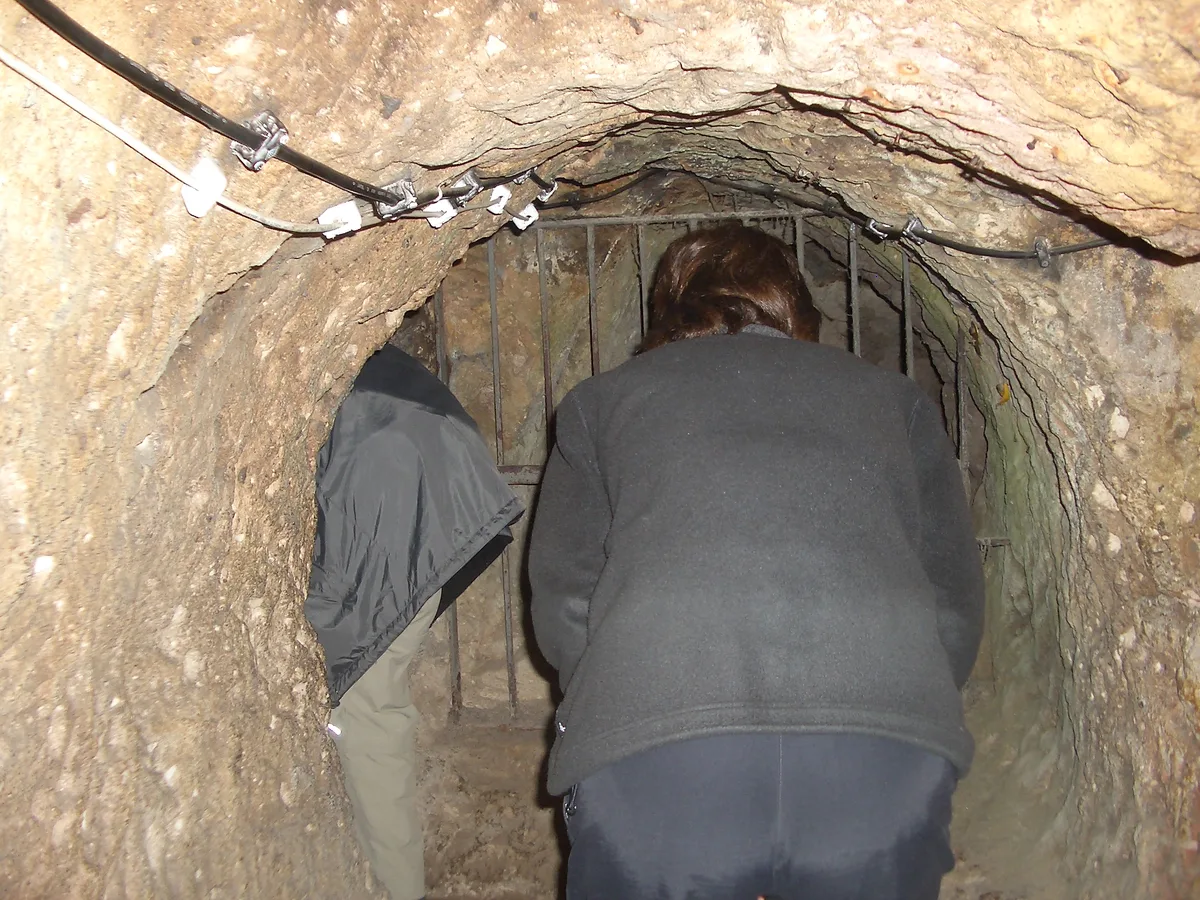
Here is the section most Derinkuyu pages bury, promoted to where it belongs. The visitor route descends through tunnels designed, deliberately, to be difficult: low enough that most adults must stoop through the connecting passages, narrow enough for one person at a time in the tightest stretches, and stepped in long stair runs your knees will remember at the surface. The tunnels are the weapon system – an attacker stooping, single-file, in the dark, below defenders who knew every landing, was an attacker already beaten – and the modern visitor inherits the full design, softened only by electric light and handrails. If confined spaces trouble you, take the description seriously rather than bravely: the tight stretches are not momentary, there are several of them, and the middle of the route offers no shortcut out. Turning back against the flow is possible with the attendants’ help at quiet times; at busy times it is a project.
The crowd question follows from the geometry. In a space where passing is often impossible, the pace of your visit is the pace of the slowest person ahead of you, and at midday in peak season the route runs at a shuffle with queues on the stairs. This is the real reason for the standing advice of this derinkuyu underground city guide to arrive at opening time. The first entry of the day walks an empty, echoing city at walking pace; the midday entry walks the same city as a slow subway. Both pay the same ticket. If you cannot make opening, choose a weekday and the last entry of the afternoon, when the tour tide has gone back to Goreme.
Accessibility deserves plain words rather than euphemism. The route is stairs, stoops and uneven rock from end to end. It is not wheelchair-accessible, it is not realistically manageable with significant mobility limitations, and visitors with heart, breathing or serious knee problems should think as carefully about the climb out as about the descent – the exit is the same stairs, upward, at the end. Children generally love the place and manage it well; keep them close in the crowd, and expect a carried toddler to be hard work in the stooping stretches. Everyone should bring closed shoes with grip – the rock steps are worn smooth in places – and a light layer for the steady underground coolness.
Plan the full ninety minutes the visit can take at a quiet hour, as this derinkuyu underground city guide keeps suggesting, because the showpiece rooms – the school, the church, the doors – repay standing still in. Nobody comes out of Derinkuyu talking about a view. They come out talking about the feeling of an entire civilisation folded into the earth beneath an ordinary town.
Derinkuyu or Kaymakli – Choosing Between the Two Great Cities
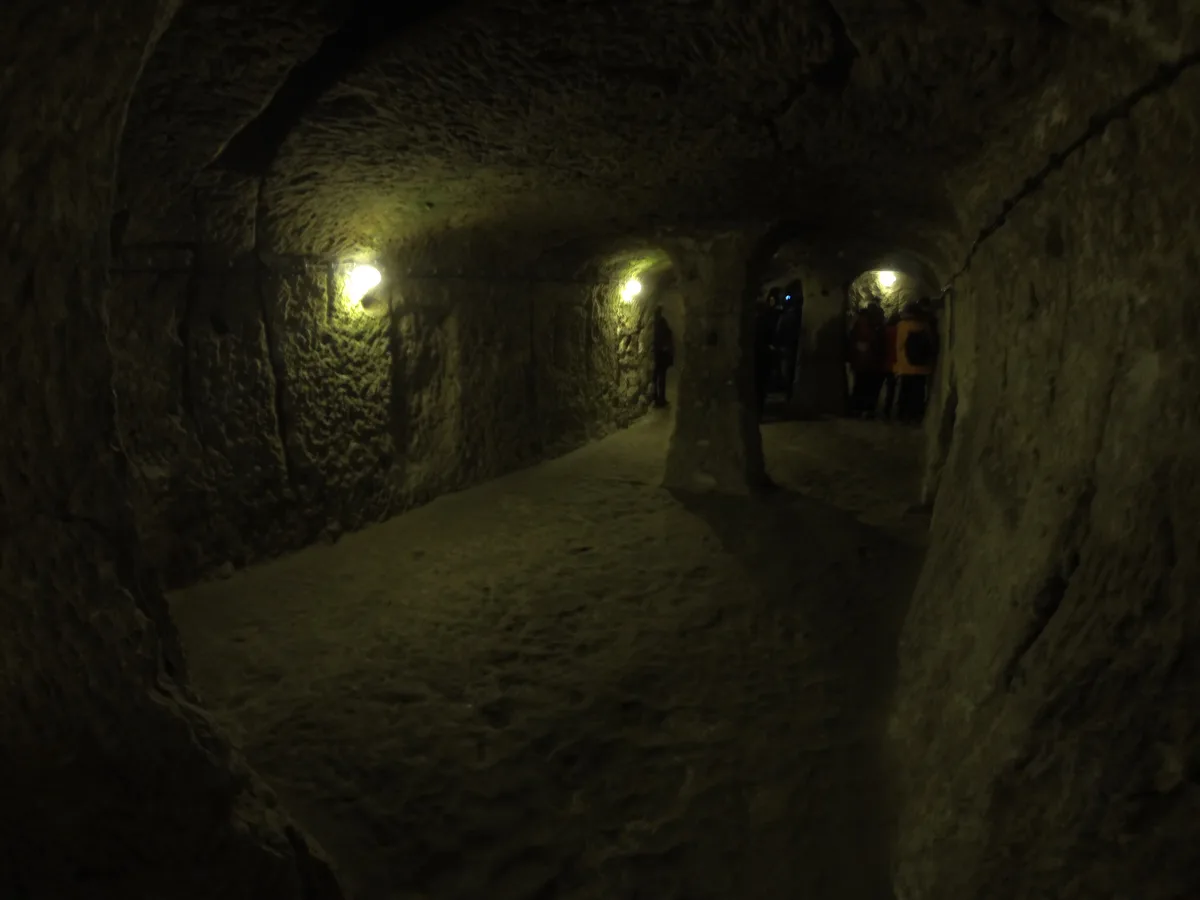
The question every Cappadocia itinerary eventually asks is which underground city, because most trips have time, energy or stooping capacity for only one. This derinkuyu underground city guide is Derinkuyu’s partisan, obviously – but the choice is a real one with an honest shape, and it runs like this. The two cities are siblings, nine to ten kilometres apart on the same road, built by the same culture to the same design language of doors, shafts, stables and stores. Everything that differs is a matter of temperament. Derinkuyu is the vertical city: deeper, organised around the plunge – level stacked on level down its great shaft, with the missionary school as its signature room and the cross-planned church at the bottom of the world. Kaymakli is the horizontal city: the standard descriptions give it eight levels in total too, of which four are open, and its genius is spread rather than depth – broad storage floors, wineries and living quarters unrolled on a gentler gradient, famous in the comparison literature for its storerooms and its copper-working stone, and generally kinder to the visitor who measures a sight in headroom.
Distance argues for Kaymakli; it sits about twenty kilometres south of Goreme, noticeably closer than Derinkuyu, and directly under its own town centre. Depth argues for Derinkuyu; if the phrase “deepest underground city in Cappadocia” is the one that brought you to the region, only one of the two cities satisfies it, and it is not close. Crowds argue, strangely, for Derinkuyu as well: both cities draw the southern tours, but Kaymakli’s gentler reputation pulls the larger share of the cautious. The Museum Pass Cappadocia covers both, on the same three-day listing, so the pass does not arbitrate.
Doing both in one day is physically possible and spiritually debatable – back to back, the two cities blur, doors into doors and shafts into shafts. If your itinerary genuinely holds both, put Derinkuyu first and at opening, while you are fresh enough for its stairs, and let Kaymakli be the afternoon’s gentler echo. But if it is one, let it be the one whose idea excites you. Choose Derinkuyu for the descent, the school, the great well-shaft and the sense of a city built like a siege in cross-section. Choose Kaymakli for breadth, storage-labyrinths and the easier walk.
One asymmetry is worth stating plainly. Derinkuyu’s unvisited ninety percent haunts its visit in a way Kaymakli’s compactness does not; this guide counts that as a feature, but if you prefer a sight that shows you nearly all of itself, that preference is rational, and it points north to Kaymakli.
Frequently Asked Questions
How deep is Derinkuyu, really? The Ministry of Culture and Tourism’s museum page gives the depth of the underground city as about 85 metres, and that is the figure this derinkuyu underground city guide prints – for the whole city, top to bottom. Your visit descends through the open upper levels, not the full 85 metres, most of which remains unexcavated or closed.
How many levels does Derinkuyu have, and how many can I visit? The standard published description counts 18 levels in total, of which the upper 8 are open. The panel at the site says the same from the visitor’s side: the town consists of 8 floors. The Ministry puts the visitable share of the whole complex at about ten percent.
Is Derinkuyu a UNESCO World Heritage Site? Yes, as a named part of a larger property rather than as a listing of its own. UNESCO’s brief synthesis for Goreme National Park and the Rock Sites of Cappadocia, inscribed in 1985, names “the subterranean cities of Kaymaklı and Derinkuyu” among the places the property covers. Derinkuyu is inside the inscription – not separate from it, and not merely beside it.
How long does a visit take? Most visitors spend 45 to 90 minutes underground. The route is a managed descent and climb with no way to hurry the narrow sections, so the honest variable is the crowd: at opening time the visit runs at the short end of the range, at midday in season at the long end, with queuing on top.
I am claustrophobic. Should I go? Only with open eyes. The connecting tunnels are low and single-file by design, several stretches require a sustained stoop, and there is no early exit once you are deep in the route. Mild discomfort is usually manageable, especially at opening time; serious claustrophobia is a reason to choose Kaymakli’s wider route, or an above-ground sight, instead.
Does the Museum Pass Cappadocia cover Derinkuyu? Yes. The Ministry’s Derinkuyu page states the mechanism directly: the pass covers more than ten Ministry museums and sites in Nevsehir and Aksaray provinces for three days from first entry, and Derinkuyu is on the listing. It is not valid for Night Museum programmes, which are ticketed separately.
Can I walk the tunnel to Kaymakli? No. The connection between the two cities is widely reported – most accounts put it at about nine kilometres – but it is not open, not part of either visit, and not verifiable today as a continuous walkable passage. Both cities are visited from their own surface entrances.
The Short Version of This Derinkuyu Underground City Guide
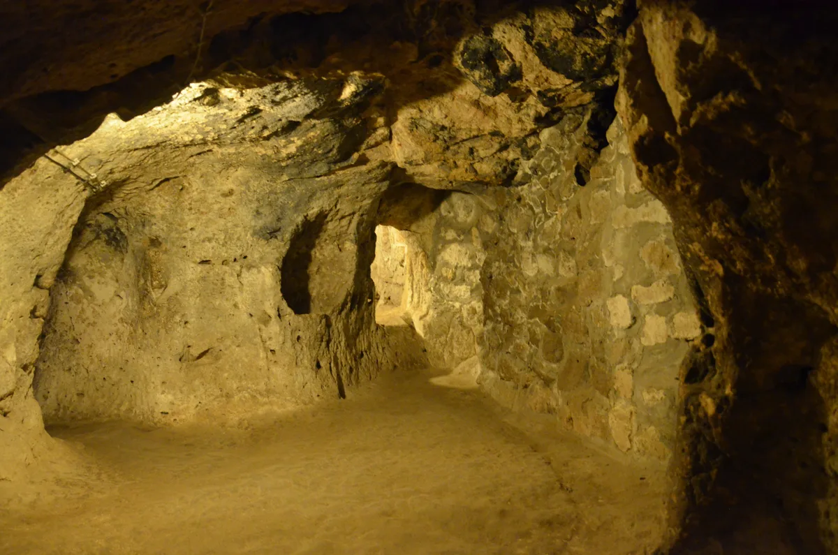
If this derinkuyu underground city guide had to fit on an index card, it would read like this. Beneath an ordinary farming town thirty kilometres south of Nevsehir lies the deepest underground city in Cappadocia – about 85 metres of carved tuff on the Ministry’s own figure, of which the upper eight levels of a commonly counted eighteen are open, and only about a tenth of the whole is visitable at all. It began, perhaps, with Phrygian picks in the eighth century BC, grew into Byzantium’s great refuge against the Arab raids, sheltered its town through a millennium of alarms behind rolling-stone doors that only open from inside, and was then forgotten by the town above it within a generation of the 1923 population exchange – until a resident knocked through his wall in 1963 and found a room that should not exist.
Walk it in descending order: stables and stores at the top where the air is fresh, the missionary school under its carved barrel vault on the second floor, living rooms and the winery below, then the deep machinery of survival – the doors, the 55-metre shaft that is both lung and well, the wells cut to be unreachable by poisoners – and the cross-planned church at the bottom, where a civilisation kept its God in its safest room. Go at opening time, on the site’s ticket or the three-day Museum Pass Cappadocia, having checked the day’s hours on muze.gov.tr and printed no faith in any price, including ours – we print none. Stoop when the tunnels ask, wait when the crowd asks, and surface slowly. There is nothing, anywhere, quite like a town that decided the safest place to live was underneath itself – and was right, for a thousand years.