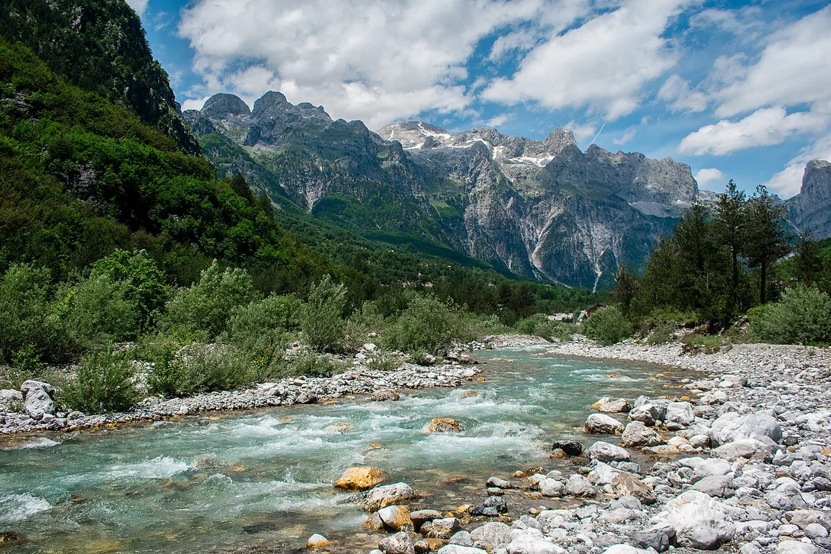
There is a moment, about twenty minutes after the ferry pulls away from the landing at Koman, when the gorge narrows, the cliffs close in on both sides, and everyone on deck goes quiet at the same time. No announcement causes it. The mountains simply get too big for small talk. That silence is the Albanian Alps introducing themselves, and it is the reason this range, in the far north of Albania where the country folds into Montenegro and Kosovo, has gone in a generation from a place Albanians themselves barely visited to the walk almost every mountain traveller in Europe now wants to do.
This albanian alps travel guide is a regional guide, and it is deliberately built that way. It covers the whole of the Albanian side of the Accursed Mountains rather than a single trail – the two great valleys of Theth and Valbona, the high pass that joins them, the lake ferry that is the finest approach journey in the Balkans, the gateway city of Shkodra, and the practical machinery of furgons, minibuses and guesthouses that makes a trip here work. If you are planning the famous pass walk itself, this site also has a dedicated step-by-step guide to the Theth to Valbona hike; here, that crossing gets one honest section of its own, and the rest of the space goes to everything around it, because the country around the hike is at least half the point of coming.
Understand one thing before anything else in this guide, because every plan depends on it. The Albanian Alps are not a resort range with a long season and a safety net. They are a compact, violent, limestone wilderness of shepherds’ paths, blood-feud history, family guesthouses and weather that can turn in an hour, open for business for roughly five months a year and closed by snow for the rest. Travel here rewards preparation and punishes assumption like nowhere else in Albania. For the wider country picture first, start with our Albania travel guide, then come back here – this albanian alps travel guide covers the mountains in full.
The Albanian Alps at a Glance
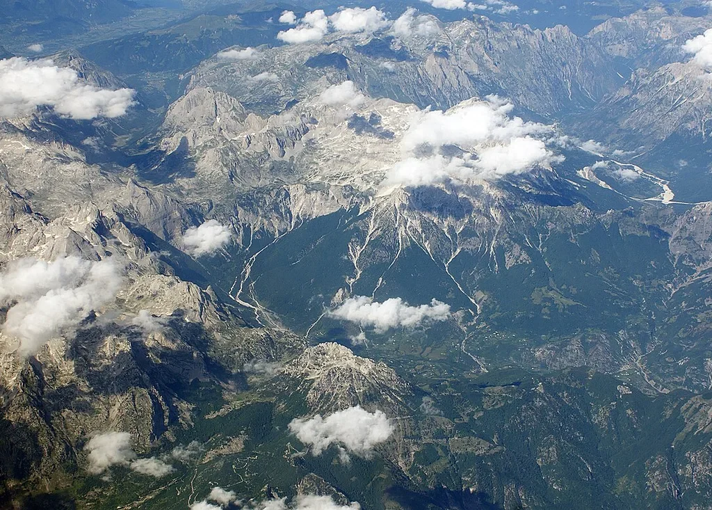
The essentials first, because in this region the essentials decide the trip. The Albanian Alps are the Albanian share of the Accursed Mountains, the southernmost and wildest sub-range of the Dinaric Alps, sitting in the country’s far north against the borders of Montenegro and Kosovo. Almost everything a visitor does here happens in two valleys. Theth, in the west, is a scattered village of stone houses in the Shala valley, reached by road from Shkodra. Valbona, in the east, is a long river valley of hamlets and guesthouses under the highest summits in the range. Between them stands one walkable pass. In front of both of them sits Lake Koman and its ferry. That is the whole geography, and the whole trip.
| Need to know | The short answer |
| Where | Far northern Albania, against the Montenegro and Kosovo borders |
| The range | The Accursed Mountains – Bjeshkët e Nemuna in Albanian, Prokletije in Serbian and Montenegrin |
| Highest peak | Maja Jezercë, 2,694 m, the highest point of the entire Dinaric Alps |
| Base city | Shkodra, for transport, supplies, cash and the night before |
| The two valleys | Theth (west, by road) and Valbona (east, by ferry and minibus or by road via Tropoja) |
| The signature walk | Theth to Valbona over Valbona Pass, about 1,795 m, one long day, seasonal |
| The great journey | The Koman Lake ferry between Koman and Fierzë, roughly two and a half hours on the water |
| Protection | Alps of Albania National Park, created in 2022 from the former Theth and Valbona Valley national parks |
| Season | Roughly late May or June to mid-October for the high pass; the valleys run a little longer |
| Money | Cash, in lek or euros, taken out in Shkodra before you leave – do not rely on finding an ATM in either valley |
| Sleeping | Family guesthouses, almost always with home-cooked meals, booked ahead in season |
Two consequences flow from that table, and both shape every sensible itinerary in this albanian alps travel guide. The first is that the region is a natural loop rather than a line – up one valley, over the pass, down the other, and out by ferry or road – and the loop only works in season, when the pass is clear of snow and the ferry is running. The second is that Shkodra is not an optional extra on the way in. It is the supply base, the cash point, the transport interchange and the weather-waiting room for the entire region, and treating it as a place worth a night rather than a bus stop makes the whole trip run better.
A Range With Three Names
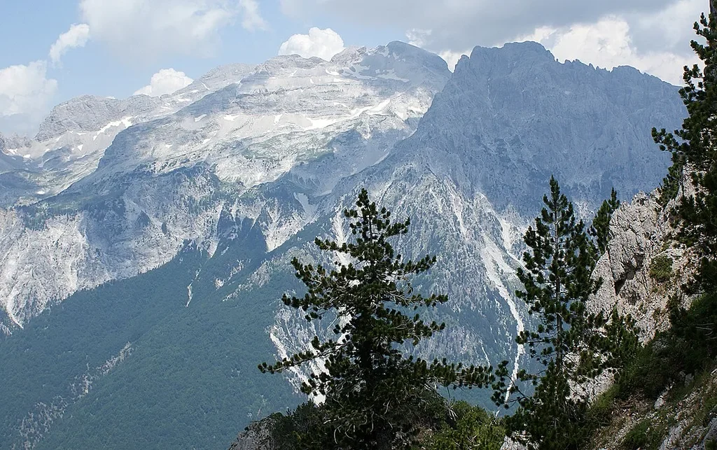
The mountains answer to three names, and each one tells you something true. In Albanian they are the Bjeshkët e Nemuna. In Serbian and Montenegrin they are the Prokletije. Both names translate the same way – the Accursed Mountains, or the Cursed Mountains – and English-language maps have mostly settled on that, with “Albanian Alps” kept as the friendlier name for the Albanian side of the range. It is worth pausing on the curse, because it is not a marketing invention. It is what the people who had to live in, cross and survive these mountains actually called them, in two different languages, independently.
Why accursed? Local tradition offers more than one explanation, and honesty requires saying that all of them are tradition rather than documented history. One story has medieval soldiers, struggling through the passes, cursing the range for its impassability. Another, closer to the bone, comes from the valleys themselves – shepherds and travellers killed by avalanche, rockfall and sudden storm in mountains where help was days away, in an era when the valleys were also governed by feud. Whichever telling you prefer, the substance underneath is the same and verifiable on any visit. This is an exceptionally harsh piece of country – steep, waterless at height, short of passes and long on weather – and for most of history it was one of the most isolated inhabited corners of Europe, a place where the Ottoman state barely reached and where mountain tribes governed themselves.
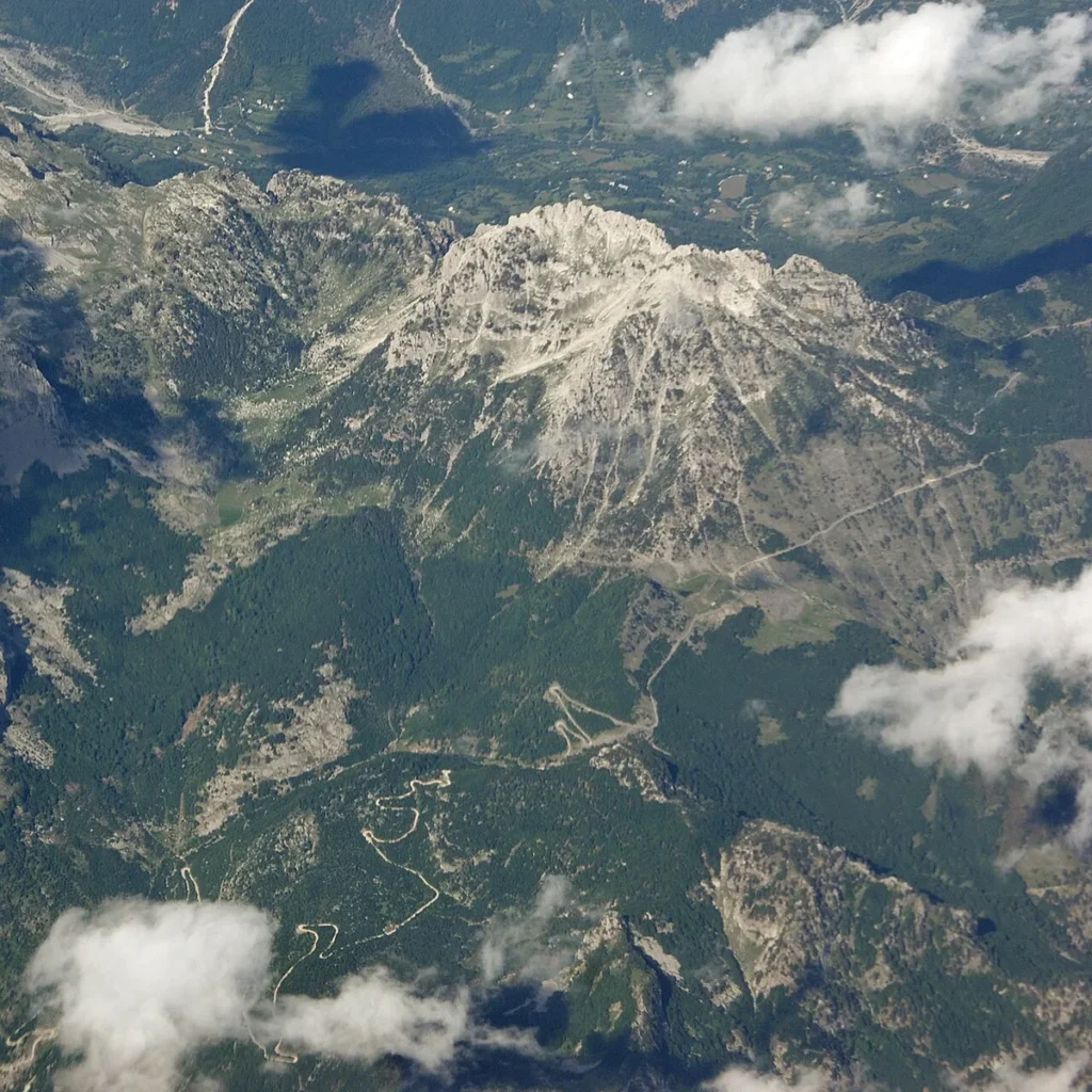
Geography underlines the point. The Accursed Mountains are the southernmost link in the Dinaric chain, the great limestone spine that runs for roughly a thousand kilometres down the eastern Adriatic, and they are its climax. The range’s highest summit, Maja Jezercë at 2,694 metres, is not only the highest peak here but the highest point in the entire Dinaric Alps, and it does not stand alone. Around it crowd some two dozen summits above 2,400 metres, split between Albania, Montenegro and Kosovo – Montenegro’s highest peak and Kosovo’s highest peak are both in this same range, a few kilometres apart across the borders. The rock is almost all limestone, carved by ice into cirques, knife-edge ridges and deep U-shaped valleys, and drained by karst springs that can make a river vanish into its own gravel bed and reappear further down, as the Valbona famously does.
For the visitor, the practical translation of all this geology is simple. The scenery operates at a scale out of proportion to the distances – Theth and Valbona are only a day’s walk apart, yet each sits inside its own complete mountain world – and the walking is on old shepherds’ and mule paths between valleys rather than on a managed alpine trail network. That combination, huge mountains at close quarters with almost no infrastructure between the villages, is exactly what people mean when they say these Alps feel like the Alps of a century ago. It is also why every honest albanian alps travel guide, this one included, keeps returning to season, weather and preparation. The curse is folklore. The conditions that inspired it are not.
One Park Now – The Alps of Albania National Park
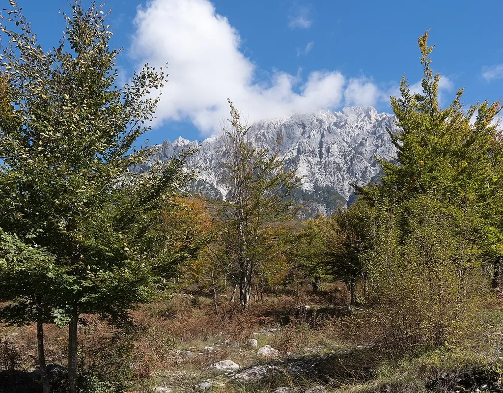
Older books and websites will send you to two parks here – Theth National Park and Valbona Valley National Park – and you will still see those names on signs, maps and guesthouse walls all over the region. The names are history now. Theth was first protected in 1966, one of Albania’s earliest national parks, and the Valbona Valley followed in 1996. Then, on 26 January 2022, Albania merged the two parks together with the Gashi River Strict Nature Reserve into a single, much larger protected area – the Alps of Albania National Park, covering more than 82,000 hectares and administered, like all Albania’s national parks, by the National Agency of Protected Areas, known as AKZM. When you plan or search, any current albanian alps travel guide should use the new name for anything official and the old names for almost everything else, because daily life in the valleys has not caught up with the paperwork.
The merger matters to a traveller for one main reason – it joined the two famous valleys into one continuous protected landscape, with the high country between and around them included rather than left as unprotected gaps. The park runs from the Montenegrin border in the north down towards the Nikaj-Mërtur hills in the south, and it protects the full vertical sweep of the range – river gravels and village meadows, deep beech and pine forest, alpine pasture, and bare limestone summit country above. The Gashi river forests in the east of the park are serious enough to be inscribed on UNESCO’s World Heritage list, as part of the transnational Ancient and Primeval Beech Forests of Europe – old-growth beech woodland that has never been logged, in the strictest category of protection Albania has.
Wildlife is the other thing the park status quietly guarantees. These mountains hold brown bears, wolves, chamois and roe deer, golden eagles over the ridges, and – on the park’s own lists, though almost no visitor ever sees one – the Balkan lynx, among the rarest cats in Europe. Treat that list the way the park rangers do, as a statement about the habitat rather than a promise of sightings. What you will actually experience is the habitat itself – forest that smells of resin and leaf mould, pastures loud with cowbells, rivers running an improbable turquoise – and the knowledge that it survives as a system, not as scenery arranged for visitors. Theth adds one more layer of protection on top. The village was declared a Protected Historic Centre in 2017, which is the state’s way of saying its stone-built fabric is heritage, not just housing stock. Keep that in mind when you read the downsides section later in this guide, because the tension between the protected village and the building boom is the live argument in Theth right now.
Shkodra – The Gateway City
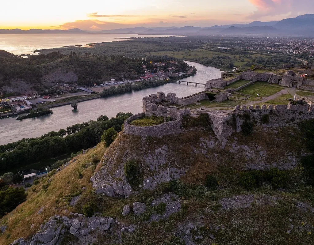
Every journey into the Albanian Alps begins and ends in Shkodra, whether the traveller plans it that way or not. Shkodra is one of Albania’s oldest and most civilised cities, sitting on the plain where the Buna and Drin rivers leave Lake Shkodra, the largest lake in the Balkans, and it has been the market town, garrison and front door of the northern mountains for well over two thousand years. The mountains begin where its suburbs end. Rozafa Castle, on its rock above the river confluence, watched over the roads into the high valleys for Illyrians, Romans, Venetians and Ottomans in turn, and the view from its walls – lake one way, plain the other, and the grey wall of the Accursed Mountains filling the northern horizon – is still the single best orientation lesson the region offers. Go up there the afternoon before you head in, and the whole trip makes sense at a glance.
Shkodra’s role in your trip is practical before it is romantic. This is where the furgons and minibuses for Theth load in the morning. This is where the minibus for the Koman ferry leaves from. This is where the ATMs, supermarkets, pharmacies, bakeries and gear shops are – the last full set of all of them you will see until you come back down. It is also where the guesthouse network effectively has its switchboard, because Shkodra’s hostels and small hotels book the mountain transport, phone the valley guesthouses, arrange the ferry tickets and store the luggage you do not want to carry over the pass. Arriving in the mountains without a booking is possible outside high summer. Arriving in Shkodra the night before, eating well in the old town, drawing cash and confirming every onward leg in person is simply how the region works best.
Give the city its due while you are there, because it earns it. Shkodra has a handsome pedestrianised old centre of Italianate facades and café terraces, a serious photographic museum in the Marubi National Museum of Photography, a cycling culture that feels imported from the Low Countries, and a lakeside strip of fish restaurants out towards Shiroka that locals treat as their front parlour. None of that is filler before the real trip. It is the lowland half of a journey whose whole charm is the contrast – café city at breakfast, and by the following evening a stone village where the loudest sound is the river.
Getting In – Two Roads and a Lake
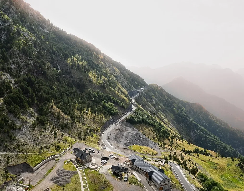
There are exactly three ways into the Albanian Alps, and understanding how they connect is the single most useful thing this albanian alps travel guide can teach you. The first is the road to Theth. From Shkodra it runs north-east through Koplik, climbs through Boga and over Qafa e Thorës – the Thores Pass – and drops down a wall of hairpins into the Shala valley. Until very recently the descent from the pass was a rough track that filtered out ordinary cars entirely. It was paved in 2021, and the road is now asphalt from Shkodra to Theth’s door, passable by normal cars and by the minibuses that run the route in season. Do not let the word asphalt relax you. It is a narrow, steep, endlessly winding mountain road with long drops beside it, it takes around two to three hours from Shkodra depending on stops and conditions, and in winter snow it can close at the high section. In season, shared minibuses and guesthouse-arranged transfers do the run in the morning; the rest of the day, you are hiring a vehicle or driving your own, slowly.
The second way in is the famous one, and it is not a road at all. From Shkodra a minibus runs east to the hamlet and dam at Koman, roughly an hour and a half to two hours of increasingly mountainous road. At Koman you board the ferry across Lake Koman to Fierzë, and from Fierzë a second minibus runs up into the Valbona valley, about another hour to an hour and a half. Three legs, three different vehicles, one chain – and in season the chain is sold and coordinated as a single journey, booked through your guesthouse, a Shkodra hostel or the ferry operators, with the vehicles timed to meet each other. That coordination is the part travellers most often misunderstand. These are not three separate adventures to be improvised on the day. In high summer the morning sailing fills, the Valbona minibuses meet the boat and leave, and a missed connection is not a delay, it is a lost day. Book the chain, confirm it the day before, and be at the Shkodra pick-up point early.
The third way in is the land route to Valbona – east by main road through Kukës and Bajram Curri, the workaday town at the valley’s mouth, and then up the valley road to the guesthouses. It is longer, plainer and entirely road-based, which makes it the fallback when the ferry is not running and the sensible entry for anyone driving their own car to Valbona. Most visitors, though, arrange the region as the loop it begs to be – in one way, over the pass on foot, and out the other. The classic pattern runs Shkodra to Theth by road, Theth to Valbona over the pass on foot, and Valbona out by ferry, which puts the lake journey at the end as a victory lap. Run it the other way and the ferry becomes the overture instead. Either direction works. What does not work is attempting any of it outside the season without checking, leg by leg, what is actually running – the ferry is seasonal, the pass is seasonal, and the Theth road’s high section answers to the snow, not to the timetable.
Theth – The Village Under the Wall
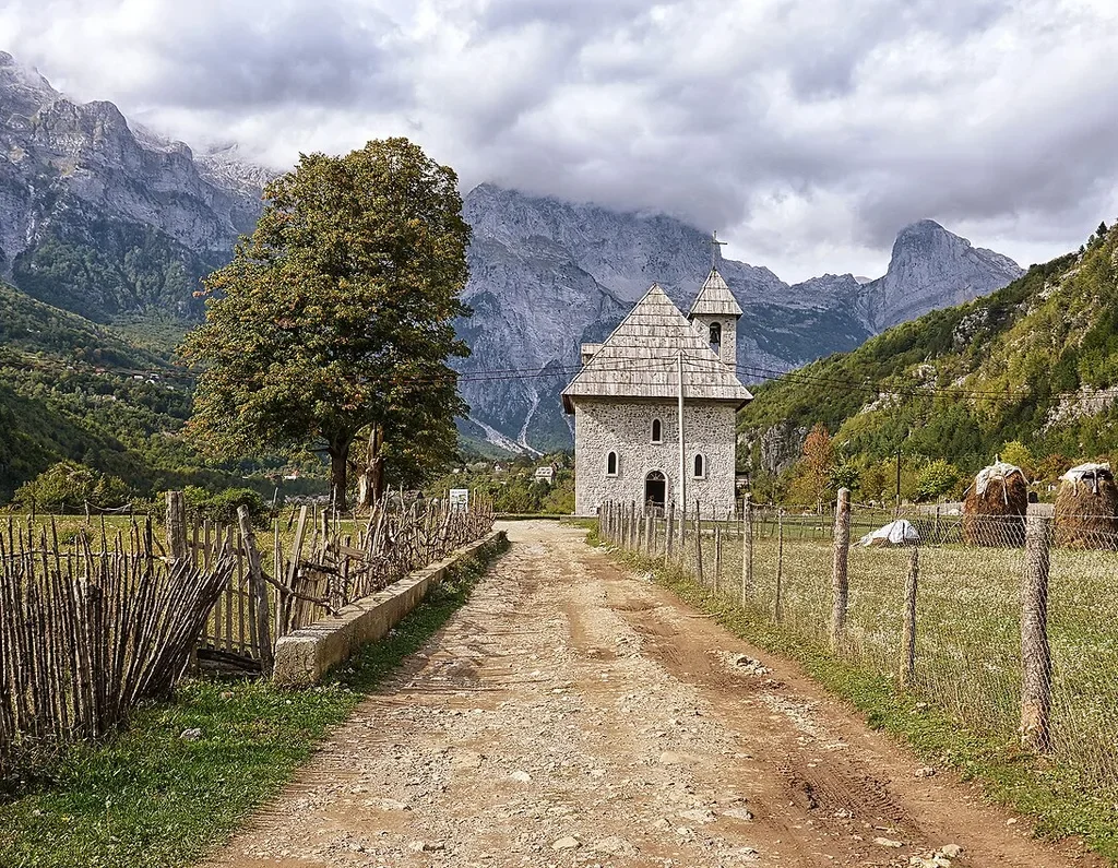
Theth is not a village in the compact, streets-and-a-square sense. It is a scattering of stone farmsteads spread along several kilometres of the Shala valley floor, in neighbourhoods with their own names, tied together by lanes, footbridges and the river, and walled in on every side by mountains that rise well over a vertical kilometre from the meadows. Local tradition says the settlement was founded some three to three and a half centuries ago by Catholic families who moved up into this defensible valley to keep their faith and their independence, under a common ancestor whose name the village still remembers. For most of the centuries since, Theth lived about as far from the state as it is possible to live in Europe – governed by its own elders, married and feuded by its own code, snowed in for months each year, and reached by mule path. The English traveller Edith Durham walked in here in 1908 and wrote the valley into her book High Albania, and the extraordinary thing, reading her now, is how much of what she described survived into living memory.
The building that anchors the village, in every photograph and in village life, is the church. It is a plain, solid, stone-built Catholic church raised in 1892, with a shingled roof, a small bell tower and a graveyard beside it, standing in open meadow near the middle of the settlement. Under the communist period it served the state in other roles – the valley remembers it as a schoolhouse and a health centre in those years – and after communism fell it was restored to worship, helped significantly by money sent home by Theth families who had emigrated to the United States. Stand in front of it at the end of the lane, with the haystacks in the meadow and the grey wall of peaks behind, and you are looking at the image the whole region is sold on. It also happens to be true – the church really is the centre of a living village, not a set piece, and Sunday still organises the week here in a way the hiking season has not changed.
What has changed, quickly, is everything around that image. The paved road brought cars, and cars brought building. Theth today has dozens of guesthouses, a campsite or two, bars, small shops, and construction that has not always respected the protected historic centre it sits in. The honest summary is that Theth is in the middle of an argument about what it is becoming – and that you will enjoy it most if you get slightly off its new main strip. Walk the lanes to the outer neighbourhoods, cross the river to the quieter meadows, sit with the church and the tower rather than photographing them at a run, and the older village is still there underneath the new one. And if you are choosing where in the region to spend an extra day, Theth is the valley that rewards it – it appears in our round-up of the best places to visit in Albania for exactly that reason.
The Lock-in Tower and the Kanun
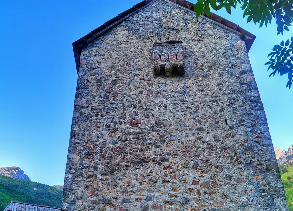
A short walk from the church stands the strangest and most serious building in the Albanian Alps – the Kulla e Ngujimit, the Lock-in Tower. It is a fortified tower-house of limestone, roughly four centuries old and associated with the Nikoll Koçeku family, three storeys high with walls pierced by little more than slits. Its purpose is written into its name. Under the customary law of the northern mountains, a man who had killed – and who was therefore himself a target in a blood feud – could be confined in this tower for his own protection, living inside its walls, sometimes for very long periods, while the elders of the valley negotiated with the injured family. Local tradition credits the tower with hosting the mediation of more than three hundred feuds. Today it is kept as a small museum, usually opened by a member of the family, and a visit – part tour, part history lesson delivered in the room where men once waited out their confinement – is the most thought-provoking hour you can spend in Theth.
To understand the tower you have to understand the code that built it, and the code deserves a careful explanation rather than a sensational one. The Kanun of Lekë Dukagjini is the customary law of the northern Albanian mountain tribes, attributed to a fifteenth-century prince and carried orally for centuries before the Franciscan scholar Shtjefën Gjeçovi wrote it down; his codification was published in 1933. It governed everything – property, marriage, hospitality, honour, and violence – in valleys the state did not reach. Its two most famous principles pull in opposite directions, and both are real. The first is besa, the pledged word, treated as sacred, and the hospitality built on it – a guest in your house was under your absolute protection, and the Kanun’s teaching that you cannot turn a guest away still shapes how these valleys receive strangers, which is to say completely. The second is gjakmarrja, blood vengeance, hedged about with rules that modern readers rarely expect – women and children were exempt from the feud, a man’s house was sanctuary, and mediation and formal reconciliation were built into the system as its intended end.
The twentieth century broke the Kanun twice. The communist state suppressed it by force between 1944 and 1991, and feuding was driven nearly to extinction – at the price of totalitarian control of everything else. After 1991, in the chaos of the state’s collapse, some dormant feuds revived in the northern mountains, and the tower’s story became current affairs again for a while. Today the feud is a receding reality and the Kanun survives mostly as heritage – in the tower museum, in the fierce local code of hospitality, and in the way these villages still run on word-of-honour. Visit the tower, listen to the family’s telling of it, and take it for what it is. Not a curiosity from a savage past, but the courthouse and sanctuary of a society that had to invent its own law because no other law would come up the valley – and any honest albanian alps travel guide should tell it that way.
The Grunas Waterfall
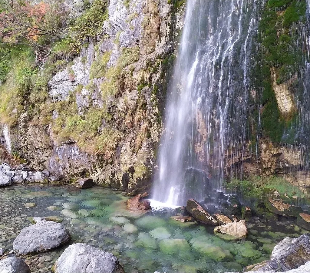
Not every good walk in Theth crosses a pass, and the village’s favourite short excursion is the Grunas waterfall. The path leaves the village lanes and follows the river upstream for roughly forty-five minutes, an easy, mostly level walk on a clear trail, to where the water slides and then drops some thirty metres down a mossy rock face into a clear green pool. It is an attractive rather than a spectacular fall – a single white ribbon against dark wet rock, with the water arriving in the pool in a permanent fine spray – and its charm is the setting. The little gorge around it is cool and ferny even in August, the pool is exactly as cold as it looks, and the walk there and back stitches together the prettiest pieces of the village’s home meadows and riverbanks.
Go early or late in the day in high summer and you may have it briefly to yourself; at midday in August, expect company, because every guesthouse in the valley sends its guests up this path and they are right to. Swimmers should know the pool stays properly cold even then – this is snowmelt that was on the peaks a few days ago, and it does not warm up for anyone. The fall is at its best in late spring and early summer, when snowmelt fattens it, and at its thinnest in a dry September, though the pool keeps its colour all season. Combine it with the walk back along the river and the Grunas canyon below the fall, where the water squeezes between polished rock walls, and you have a half day that shows you Theth’s water system in miniature – spring, fall, gorge and river, all within an hour of your guesthouse door. It is the walk to recommend to anyone in the party who is resting their legs for the pass, or sensibly skipping it.
The Blue Eye of Theth at Kaprre
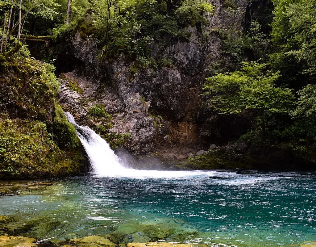
First, a necessary act of disambiguation, because Albania has two Blue Eyes and they are nowhere near each other. The famous one, the great karst spring near Saranda in the far south, is a different place entirely. The Blue Eye of Theth – Syri i Kaltërt – is a mountain pool in the Kaprre valley, in the side country above the hamlet of Nderlysaj, a solid walk from Theth village. It is not a spring bubbling up from underground in quite the southern style. It is a deep, still, blue-green basin in a narrow rock gorge, fed by a small waterfall that pours in at its head, and the colour – that saturated, unlikely turquoise in the middle of grey rock and green forest – is entirely real and entirely unphotogenic in one respect. No photograph quite prepares you for how cold it is.
The effort is the filter that keeps it special. Walked end to end from Theth, the trail board times the Blue Eye at a little over three hours each way, and most walkers make a long half day or full day of the round trip, taking in the Grunas waterfall on the way. The common shortcut is to ride part of the way – guesthouses arrange lifts along the rough track towards Nderlysaj – which trims the final approach to around an hour’s walk and turns the trip into an easy excursion. Either way the last stretch is on foot, down into the Kaprre gorge, where the path threads between boulders to the pool. Swimming is the done thing and the water is mountain-stream cold in a way that sorts the committed from the curious in about four seconds. Treat the Blue Eye as what it is – the reward at the end of Theth’s best full-day walk – and it will likely be the single most beautiful hour of your time in the valley.
The Theth to Valbona Hike – The Signature Crossing
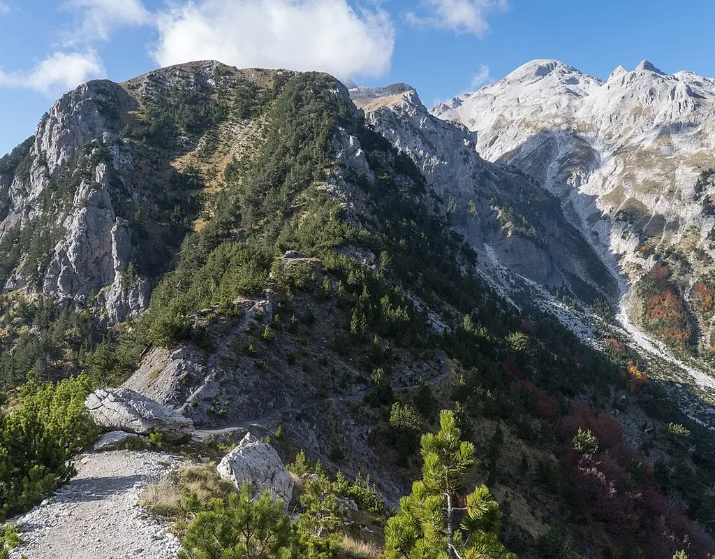
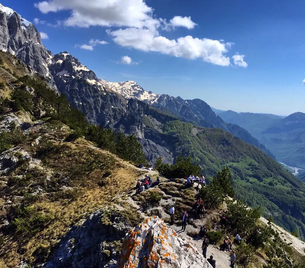
Sooner or later, every conversation about this region arrives at the same walk. The path from Theth over Valbona Pass to Valbona is the signature trek of the Albanian Alps, the walk the whole region’s modern fame is built on, and – unusually for such things – it deserves the reputation. In a single long day it takes you out of one complete valley world, up through beech forest and dwarf pine to a saddle at about 1,795 metres with the whole range arranged around you, and down a different river system into a different valley that feels like a different country. Published distances for the crossing vary by source – roughly 14 to 17 kilometres depending on where you start and stop the clock and whose GPS track you trust – and honest guides flag that range rather than pretend to a surveyed figure. What does not vary is the shape of the day. Six to nine hours door to door for most walkers, a proper climb of around a thousand metres, no village, shop or bed anywhere between the two ends, and a descent into Rragam and Valbona that always takes longer than the map suggests.
This guide will not walk you up it step by step, for a practical reason – this site already has a dedicated guide to the Theth to Valbona hike that covers the route stage by stage, the direction question, the signage, the water and weather discipline and the luggage transfer, and that is where the detail properly lives. What belongs here, in a regional albanian alps travel guide, is the crossing’s place in the bigger picture. It is Stage 1 of the Peaks of the Balkans, the long-distance circuit described later in this article. It is the hinge of the classic Shkodra loop, the human-powered link that turns two road-and-ferry journeys into one continuous journey. And it is the reason the guesthouse system exists in its current form, because the valley-to-valley traffic of walkers is what the family guesthouses at both ends are organised around, right down to the horse that can carry your bag over while you walk with a daypack.
Three judgements to carry into the detailed guide. First, the walk is a serious mountain day but not a technical one – no scrambling, no exposure that troubles most walkers, and a waymarked path throughout – provided it is attempted in season and in reasonable weather. Second, direction genuinely changes the day. Theth to Valbona climbs the steeper, more scenic side and descends the longer valley; Valbona to Theth reverses the effort and puts the ferry behind you instead of ahead. Third, and most important, the pass is a seasonal door. It is blocked by snow well into spring in most years and closes again with the autumn storms, and no itinerary built on crossing it should be fixed until the valleys themselves confirm it is open. Walkers die in these mountains by treating a summer path as a year-round one. In season, fit and prepared, it is simply one of the great day walks of Europe.
Valbona – The River Valley
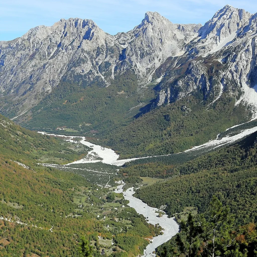
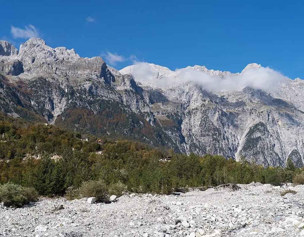
If Theth is a village in a bowl, Valbona is a valley in a line – a long, straight, glacial trough running some twenty-five kilometres or more from the foot of the pass down to the town of Bajram Curri, with the river braiding down its flat gravel floor and the guesthouses strung along the road that follows it. The river is the valley’s reason and its ruler. The Valbona is the longest river lying wholly within the Albanian Alps, around fifty kilometres from its springs to its meeting with the Drin, and it begins in high karst country south of Maja Jezercë, where snowmelt sinks and rises through limestone. In the upper valley it does something that stops every walker who notices it. Around Rragam, in dry weather, the river abandons its own bed and sinks entirely into the gravel, running underground and re-emerging further down the valley – a disappearing river, leaving a wide white motorway of stones that the road and the trail cross like a ford to nowhere.
The valley’s settlements match its shape. There is no single Valbona village in Theth’s sense. There is Valbonë itself, a loose hamlet near the valley’s middle; Dragobi, older and quieter, down the valley among walnut trees; Shoshan, where the river cuts a canyon on its way out; and Rragam, the last scatter of houses at the top, where the pass trail comes down. Between them, along the road and the side tracks, stand the guesthouses – family houses, converted barns and a few purpose-built small hotels – which are the valley’s entire accommodation stock and much of its economy. The valley floor sits considerably higher and colder than Theth’s, the light has a different, clearer quality, and the peaks stand closer and higher, with the great wall of the Jezercë and Kolata massifs closing the head of the valley. Hikers cross from Theth and consistently say the same two things – that Valbona feels wilder, and that they wish they had given it an extra day. Believe them, and plan the day.
One more piece of Valbona honesty belongs in a regional guide, because you will hear about it in the valley and should hear it straight. The river’s beauty made it a target for small hydropower schemes, and the proposals to dam and divert its upper reaches produced years of protest by valley residents and Albanian environmental campaigners, court cases, and national argument. In 2021 the country’s Supreme Court suspended the works and the contested contracts, and the river still runs free past the guesthouses. Ask in the valley and you will get the story with names and dates. It matters to how the place sees itself – as a community that fought for its river and, so far, won.
Rragam and the Old Mill
End of the road, top of the valley, first or last thing you see – Rragam is where the walking world and the driving world of Valbona shake hands. It is barely a hamlet, a scatter of houses and small guesthouses in open meadows where the valley narrows towards the pass trail, and it has the particular peace of a place that exists at walking pace. Stay up here rather than down the valley if you can. The mornings are cold and golden, the peaks fill the whole sky at the valley head, and the pass walk either begins at your door or ends there, depending on your direction – a luxury on a day when an extra hour of transfer at either end is the last thing your legs want.
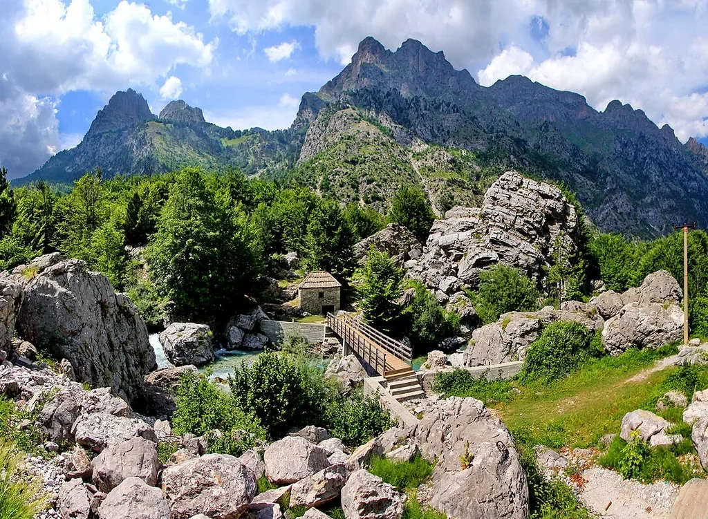
A short walk from Rragam, where a wooden footbridge crosses the river among a chaos of huge limestone boulders, stands the valley’s most photographed survivor – an old water mill, a small single-room stone hut with a shingled roof, sitting in its leat beside the stream. It is a modest thing, and all the better for it. For generations the valleys ground their corn and wheat in mills like this one, placed where the water could be borrowed and returned, and most of them are gone or roofless. This one still stands complete in its extraordinary setting – turquoise water, white boulders, and the wall of the Kolata peaks standing over everything – and the short stroll out to it from Rragam has become the valley’s ritual evening walk. Go at the end of the day, when the tour groups have gone down the valley and the light is raking across the boulders, and you will understand why every second postcard of Valbona is taken from this bridge.
The Koman Lake Ferry – The Journey That Is the Point

Lake Koman is not a lake in the natural sense, and knowing what it actually is makes the crossing better. It is the flooded gorge of the river Drin, dammed at Koman in the late 1970s and 1980s by a rock-fill dam some 130 metres high, built to feed a hydroelectric station that still supplies a large share of Albania’s power. When the water rose it drowned a canyon, and what it left is a ribbon of deep green water about thirty-four kilometres long, winding between limestone walls that rise hundreds of metres in places and pinch so narrow in others that the boat seems to be threading a river through a crack in the mountains. The ferry that runs its length, between Koman at the southern end and Fierzë at the northern, exists because the drowning of the gorge cut the road – it is the region’s floating highway, and everything else about it follows from that.
Understand the ferry as working transport first and you will enjoy it properly. The service is provided by operators including a vehicle ferry – the Berisha boat is the name you will hear most, a sturdy working car ferry – and smaller passenger-only boats, and between them they carry what the lakeshore villages cannot live without. Cars and pickups loaded to the roof, sacks of produce, building materials, schoolchildren, grandmothers, soldiers on leave, and, in season, a deck full of hikers with their boots still dusty from Valbona. There is no cruise-ship theatre to it, and that is its glory. You stand at the rail for roughly two and a half hours – published crossings run between about two and a half and three hours, and the honest traveller treats the timing as approximate – while the gorge unspools, side canyons open and close, tiny hamlets appear on ledges with their pocket-handkerchief fields, and the light moves on the walls. Travellers who have done the famous fjord crossings of Norway consistently rank this unknown Albanian boat ride beside them, and per kilometre of drama it may be the best-value boat journey in Europe.
The mechanics deserve the same respect as the scenery. The ferry is seasonal – in the shoulder months sailings thin out and in winter the service can pause, so a crossing is something you confirm, not something you assume. In high summer the morning sailing from Koman is the pinch point of the whole regional system, because it is the sailing that the Shkodra minibuses meet and that the Valbona minibuses connect from, and it fills. Book the through journey – Shkodra to Koman minibus, ferry, Fierzë to Valbona minibus – as one arrangement through your guesthouse or a Shkodra base, and let the people whose living depends on the connections make the connections. Then all you have to do is the easiest job in travel. Stand at the rail, and watch the gorge go by.
Peaks of the Balkans – The Alps in a Bigger Circuit

The pass walk does not exist on its own. It is the first stage of the Peaks of the Balkans, a circular long-distance trail of roughly 192 kilometres that loops through the Accursed Mountains in ten stages, crossing between Albania, Kosovo and Montenegro and visiting valleys on all three sides of the range that most visitors never reach – the Rugova mountains in Kosovo, the shepherd settlements under Montenegro’s Karanfili pinnacles, and a string of high summer pastures that exist because borders, for once, were drawn around a walking route rather than across one. The trail was developed in the years around 2012, with the German development agency GIZ working with local partners in all three countries, deliberately using a hiking route as a piece of peace-building and rural economics – guesthouses in border villages earn from the walkers the trail brings, in three countries at once. Most people who complete the whole circuit take nine to thirteen days, walking between roughly 670 and 2,300 metres, and sleep in the same guesthouse system described in this guide, extended across the borders.
For the reader of an albanian alps travel guide, the circuit matters in three practical ways. First, it explains the infrastructure you will use – the waymarking on the pass, the guesthouse half-board system, the luggage horses – all of which were built or strengthened for the circuit’s walkers. Second, it offers the obvious upgrade. If the Theth to Valbona day leaves you wanting the rest, the remaining stages are the rest, and the Albanian sections around Theth and Valbona can be extended with the Montenegrin and Kosovan stages on a longer trip. Third, the paperwork. Because several stages cross national borders at unofficial mountain crossings, the full circuit requires advance cross-border permits, with your passport details lodged with the authorities of the countries you will enter before you walk. Be clear about the scope of that rule, because it is widely misunderstood – the Theth to Valbona crossing lies entirely inside Albania and needs no permit, no permission and no paperwork of any kind. The permits are only for the stages that step over a border ridge, and arranging them through a guesthouse, agency or the trail’s own channels, well ahead, is simply part of the full circuit’s planning.
When to Go – A Short Season, Honestly
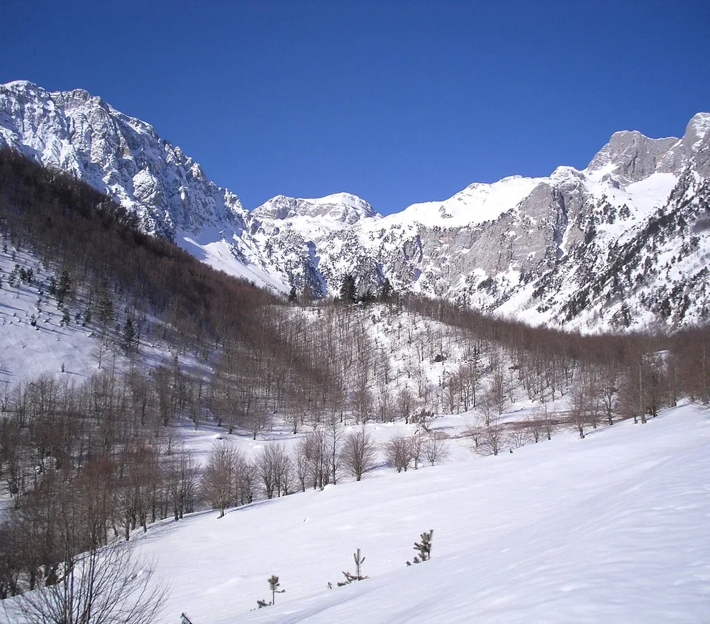
Here is the fact that governs every albanian alps travel guide, stated as plainly as it deserves. The season is short, and outside it the region does not merely get quiet – it closes, in the way mountain regions closed a century ago, by snow. The Valbona Pass is normally walkable from late May or June into October, with the exact opening set by the winter’s snowfall and the closing set by the autumn’s first storms. Theth’s road over Qafa e Thorës can be cut by snow and avalanche risk in the winter months. The ferry runs its full pattern in the warm season and thins or pauses in the cold. Village guesthouses mostly open for the same window and shut outside it, their families descending to the cities for the winter as their grandparents did. A trip in February is not an off-season bargain version of this article. It is a different, specialist, winter-mountaineering proposition, and it should be planned as one or not at all.
Within the season, the months have distinct characters, and choosing between them is a real decision. Late May and June bring the fullest rivers, the Grunas fall at its strongest, green meadows at their most flower-filled – and the real possibility that snow still blocks the pass in the season’s first weeks, so early itineraries need a plan B. July and August are the reliable heart of the season, the pass clear, every guesthouse open, every connection running – and the crowds at their peak, prices at their highest, and afternoon thunderstorms at their most theatrical, which is why experienced walkers start the pass at dawn in high summer. September is many locals’ favourite month – stable weather, thinning crowds, beech woods turning, the light going golden – with the caveat that services begin to wind down late in the month. October is a gamble with excellent odds some years and none in others, glorious in a settled autumn and finished the day the first big storm reloads the pass with snow. Choose your month by what you can flex. If your dates are fixed and the pass is the point of the trip, the centre of the season, late June to mid-September, is where the odds live.
Where to Stay – Guesthouse Culture
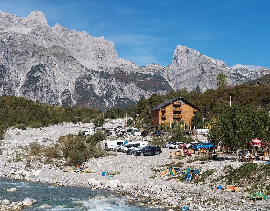
There are no big hotels in the Albanian Alps, and the region is better for it. What there is, in both valleys, is one of the most complete guesthouse cultures in Europe – family houses, many of them the traditional stone farmsteads of the valleys or new buildings in the same spirit, taking guests into spare rooms and converted barns, feeding them from the family kitchen, and running the informal logistics of the whole region from their front yards. The standard arrangement is half board by default – bed, a large home-cooked dinner and breakfast, often with packed food for the trail – because in a village with one small shop and no restaurant row, your guesthouse is your restaurant. Expect lamb and potatoes, stuffed peppers, village cheese, corn bread, garden salads, homemade raki offered with intent, and quantities calibrated for people who have been walking. Vegetarians are fed, well, with a little notice. Vegans should give more notice and modest expectations.
The system’s second function matters as much as the first. Your hosts are your transport desk, your weather service and your rescue plan’s first line. They book the furgon and the ferry, confirm the onward guesthouse, arrange the luggage horse, tell you whether the pass is clear and whether the afternoon looks like thunder, and notice if you do not arrive. This is the Kanun’s hospitality obligation wearing modern clothes, and the correct way to use it is directly – tell your host your whole plan, and let the valley network do what it has done for every traveller since the road arrived. Practically, book ahead in season, and in July and August book well ahead, because the best-known houses in both villages fill completely and the walk-up culture of other backpacking regions does not survive contact with August here. Outside the peak, a day or two ahead is usually enough. Pay in cash, in lek or euros as agreed, and agree the total – room, meals, transfers – before the first dinner, in the friendly open way that prevents the only misunderstandings this system ever produces.
The Honest Downsides – Roads, Weather and Thin Infrastructure
Every albanian alps travel guide owes you this section, because the region’s admirers – this one included – can make it sound like a lost paradise, and it is not that. It is a beautiful, demanding, thinly serviced mountain region in a poor country, and the gap between the postcards and the place is filled with specific, nameable difficulties. Start with the roads. Theth’s road is paved now, but it remains hours of hairpins above steep drops, driven by everyone from careful guesthouse drivers to overtired tourists in hire cars, and it punishes motion sickness and punishes haste more. Valbona’s valley road is easier, but the land route in and out is long, and the ferry route that avoids it is a three-leg chain with a seasonal boat in the middle. There is no version of reaching these valleys that is quick, and any itinerary that treats the transfers as dead time to be minimised will fight the region for its whole length.
The weather is the second honesty. These mountains make their own systems, fast. A dawn of perfect clarity over the pass can be a mid-afternoon electrical storm of real violence, with the temperature falling like a stone and the beech woods running with water, and the high limestone holds snowfields late and refreezes early. There is no mountain rescue infrastructure here comparable to the helicopter-and-hut system of the central Alps – help, if you need it, starts with your guesthouse, the village and a long carry or drive, and mobile coverage fades exactly where you would most want it. The correct response is not fear but the old-fashioned disciplines – dawn starts, proper boots and layers, route plans left with your host, travel insurance that covers mountain walking, and the humility to turn back. The third honesty is money and services. Carry your cash from Shkodra, in a mix of lek and euros, because card machines and ATMs are not things to build a plan on in either valley, supplies are village-shop basic, and anything specialised – medicine, gear repair, a particular food – is a Shkodra errand. Finally, the crowds and the concrete. In August the pass trail has lines of walkers waiting at its narrow points and Theth is building faster than its protected status seems able to govern. None of this cancels the place. All of it should be in your plan, priced in, before the ferry lands.
Frequently Asked Questions
How many days do I need for the Albanian Alps? Four days is the honest minimum for the classic loop this albanian alps travel guide is built around – a night in Shkodra, a night in Theth, the pass day ending in Valbona, and the ferry out, ideally with a night in Valbona before it. Five to seven days is better, buying you a rest day, the Blue Eye and Grunas walks in Theth, and time in Valbona beyond the trailhead. With ten days or more, the Peaks of the Balkans stages become a real option.
Can I do the whole trip without a car? Yes – the region is in fact designed, by history rather than intention, for the car-free traveller. The minibus and ferry chain from Shkodra, the guesthouse transfer network and the walk over the pass connect everything. Driving your own car helps only at the margins, and a hire car cannot follow you over the pass anyway, which is why most drivers end up doing the valleys as separate road trips and missing the loop.
Is the Theth to Valbona hike suitable for beginners? For fit beginners with proper boots who start early and walk in season and settled weather, yes – it is a long, clear, waymarked mountain path without technical difficulty. For anyone unfit, under-equipped, or tempted to attempt it in snow or storm, no. The distance and the climb are real, the weather is real, and there is nowhere to bail out to in the middle.
Do I need permits or a guide for the pass hike? No permit of any kind is needed for Theth to Valbona, which lies entirely within Albania. A guide is not required either – the trail is waymarked and well walked – though local guides are easy to hire through guesthouses and genuinely valuable for the bigger Peaks of the Balkans stages and for anyone whose navigation is untested. Cross-border permits apply only to the circuit stages that cross into Kosovo or Montenegro.
When does the Koman ferry run, and do I need to book it? The ferry is a seasonal service, running its full pattern through the warm months when the hiking season is open, with reduced or paused service in winter. This albanian alps travel guide deliberately prints no fixed times or prices, because both change and the operators’ current-season information is the only version worth trusting. In July and August, book the through journey from Shkodra in advance through your guesthouse or the operators – the morning sailing genuinely fills.
What should I pack that people forget? Cash from Shkodra, first and always. Then layers for a twenty-degree temperature swing in a day, waterproofs you trust, boots already broken in, a head torch for village lanes and early starts, sun protection for the treeless upper trail, and a bag arrangement that lets a horse carry your main luggage over the pass while you walk light. Everything else is optimisation.
The Short Version of This Albanian Alps Travel Guide
If this albanian alps travel guide has to shrink to one paragraph, it is this. Base yourself in Shkodra for a night and sort out cash, bookings and connections there. Ride the new road over the Thores Pass into Theth, give the village two nights so the church, the Lock-in Tower, the Grunas waterfall and the Blue Eye at Kaprre are pleasures rather than errands, then walk the pass to Valbona on a clear dawn, sleep in a Rragam or valley guesthouse with the river sinking into its gravel outside, and sail out down Lake Koman on the ferry like the journey is the destination – because here, it is.
Do it between late June and mid-September if the pass is the point, book the guesthouses and the ferry chain ahead in summer, carry cash, respect the weather as the region’s true government, and if the mountains offer you a second week, spend it on the Peaks of the Balkans. Folded into a longer Albania trip, the loop sits naturally at the northern end of the route in our Albania itinerary for 7 days – mountains first, then the long run south to the castles and the sea. The Accursed Mountains earned their name honestly. Go anyway. That is rather the point of them.
For the official background on the park’s beech forests, see UNESCO’s listing for the Ancient and Primeval Beech Forests of the Carpathians and Other Regions of Europe.