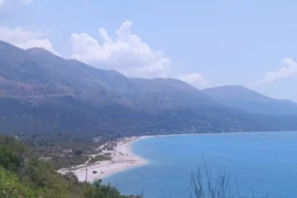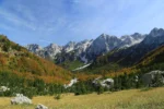

Most valleys in the Albanian Alps are a way through to somewhere else. Valbona is the exception, and it is the reason this valbona travel guide exists. The valley is a destination with its own complete geography — a turquoise river that rises from springs under the highest peak in the Dinaric Alps, runs some fifty kilometres down a trough of beech forest and hay meadows, and at its head simply stops, sinking into its own gravel bed a few kilometres short of the last village. Around that river sit four small villages, a scatter of hamlets, one road, no through route for any vehicle, and a ring of limestone walls that makes the whole place feel less like a valley than a room.
Travellers usually meet Valbona as half of a famous pair. They arrive on the Koman Lake ferry, sleep one night, walk over the pass to Theth at dawn and leave — and the valley deserves better than being the warm-up act for its own hike. Stay, and a different place appears. The valley has its own walks that never touch the pass: up the side valley of Kukaj to its viewpoint and old mill, down the river banks to Dragobi, out to the cold spring lake of Xhema. It has a guesthouse culture that is half the experience — your bed, your restaurant and your information office are the same family farmhouse. And it has an honest set of complications, from a season ruled by snow to a river that developers and villagers have fought over in court, which this guide will not tidy away.
So treat what follows as a stayer’s guide. It covers the two ways in — the ferry day across Koman Lake and the road through Bajram Curri — then works up the valley from its mouth to Rragam at its head, walk by walk and table by table, before dealing with the questions that decide whether a Valbona trip works at all: when to come, how many days to give it, what to pack, and what can go wrong. For the wider country first, start with our Albania travel guide; for where Valbona sits among the country’s highlights, see our list of the best places to visit in Albania. This page is the valley itself.
Valbona at a Glance

The essentials, briefly. Valbona is a high valley in Albania’s far north-east, in Kukës County and the Tropoja municipality, inside the Alps of Albania National Park. The village of Valbona sits at around 1,000 metres above sea level; the valley runs some 27 kilometres from the Shtrejti canyon at its mouth up to Valbona Pass at its head. Its river, at 50.6 kilometres the longest in the Albanian Alps, drains east to the Drin. Its beds are family guesthouses, its one town of any size is Bajram Curri roughly 25 kilometres down the road, and its season is set by snow, not by the calendar.
| Need to know | The short answer |
|---|---|
| Where | Far north-eastern Albania, Tropoja municipality, inside the Alps of Albania National Park |
| The two ways in | Koman Lake ferry to Fierzë, then minibus via Bajram Curri — or the road from Kukës and Bajram Curri |
| The valley’s shape | One trough, four park villages — Dragobi, Valbona, Çerem, Rragam — strung along a single road |
| The river | The Valbona, 50.6 km, the longest river in the Albanian Alps — and it vanishes into its bed at Rragam |
| The valley’s own walks | Kukaj valley and viewpoint, Xhema Lake, the Dragobi river banks, the Çerem and Motina side valleys |
| Sleeping | Family guesthouses, usually half board — your guesthouse is also your restaurant and your trail office |
| The famous walk | The pass to Theth — one section of this guide, with its own dedicated guide elsewhere on this site |
| Season | Late spring to mid-autumn for the full valley; winter is snow, silence and very few open doors |
| Money | Cash in lek, euros widely accepted in practice — draw cash before Bajram Curri, do not rely on a valley ATM |
| Entry | No park entrance fee and no permit needed to enter the valley |
Two consequences follow from that table, and they run through everything else in this valbona travel guide. The first is that Valbona is strung out, not centred — the settlement spreads along kilometres of valley floor, so which guesthouse you choose decides what is a stroll and what is a half-day walk, and the sections below keep returning to that geography. The second is that almost everything here is seasonal in a way a coastal town never is. The ferry connections, the guesthouse season, the pass, the side-valley tracks and even the river itself all answer to the same mountain year — full and green in early summer, dry-bedded by late summer, snowbound in winter. When to come is not a detail in Valbona. It is the decision the whole trip hangs on.
A Valley of Hamlets, Not a Village
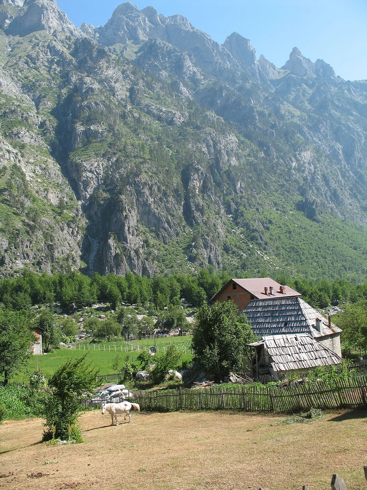
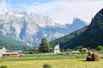
Valbona the village is, on paper, one settlement. On the ground it is a ribbon of hamlets — Valbona itself, Quku i Valbonës, Llomi, Fusha e Gjesë and others — spread along the flat floor where the river runs wide and shallow over white gravel. Each hamlet is a loose cluster of farmsteads in its own meadows: stone houses with steep roofs, hay barns, fenced gardens, a family graveyard on a knoll. Between one cluster and the next there may be ten minutes of lane, a stand of beech, a side stream to cross. Visitors looking for a centre — a square, a main street, a cluster of cafes — will walk the length of the settlement before accepting there is not one, and this guide suggests accepting it on day one, because the valley’s dispersed shape is precisely its character.
The four villages the old national park counted inside its boundary — Dragobi at the valley mouth, Valbona in the middle, Çerem up its side valley and Rragam at the head — were home, in the park literature’s oft-quoted figure, to 852 inhabitants, and even that number is old; like every high valley in Albania, Valbona has spent decades losing its young people to Tirana and to emigration, and many houses are summer homes or stand empty. What has changed in the last twenty years is the second economy. Tourism arrived up the ferry route and over the pass, and farmhouses across the valley floor have added guest rooms, dining terraces and hand-painted signs. The working farm did not disappear underneath the guesthouse — you will still be woken by it, fed from it, and quite possibly shown round it. That overlap, farm first and hotel second, is the thing to understand about sleeping and eating here, and it gets its own sections below.
One practical landmark does exist. The Valbona Tourism Center, the national park’s information point on the main road, sells a hiking map of the valley and can advise on accommodation and trail conditions, and it is the natural first stop for anyone arriving without a plan. Between that, your guesthouse host, and the hand-painted signboards at the valley entrance, Valbona runs on word of mouth rather than systems — times, connections and conditions are things you ask about, in person, the day before you need them. Travellers who find that charming tend to love the valley. Travellers who need everything confirmed in an app tend to find it hard work, and this valbona travel guide would rather say so now than later.
The Ferry Day – Koman Lake to Fierzë
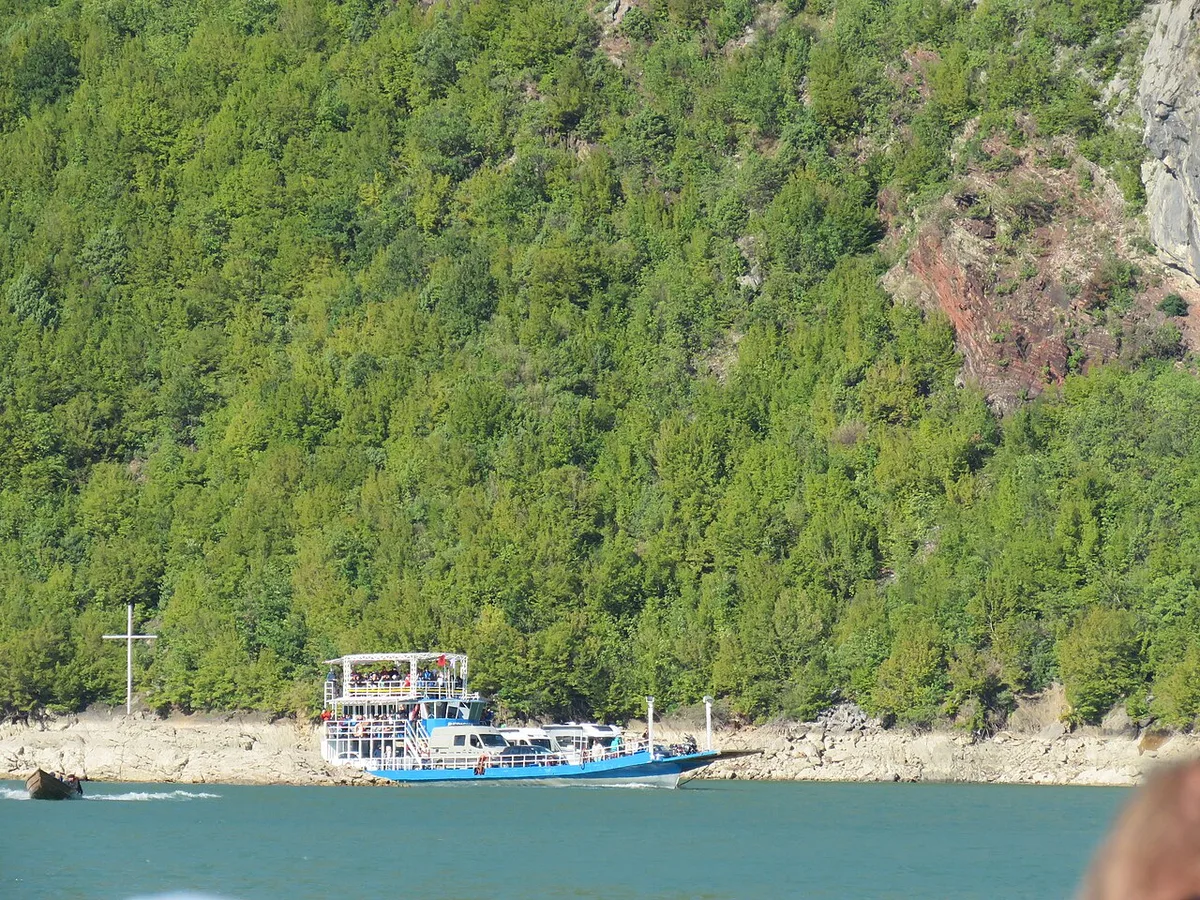
The classic way into Valbona is not a road at all. It is a boat, and the day it takes is one of the great travel days in the Balkans — the journey the Albania-wide guides describe when they send travellers north, and the arrival this valbona travel guide recommends to anyone whose dates allow it. The mechanism is simple, and it runs like a relay. An early minibus climbs out of Shkodra in the dark to the little port of Koman, where the Drin has been dammed into a long, narrow lake that winds between near-vertical green walls. There you board the morning ferry — a car ferry run by the Berisha company, which also runs a smaller passenger boat, with a second operator’s ferry appearing in high season — and the boat spends roughly two and a half hours threading the flooded gorge to Fierzë, on the lake’s far, mountain side. At Fierzë the relay completes itself: minibuses are waiting on the quay, and they carry you up through Bajram Curri and on into the valley.
Nothing about that paragraph should be read as a timetable, and deliberately so. Sailing days, departure times and which boat runs in which month all change with the season and the water level, they are set by the operators rather than published to a standard this guide can safely copy, and the one figure worth planning around is the shape of the day: it starts early, the crossing itself takes the better part of a morning, and Tirana to Valbona by this route totals roughly five hours in good conditions. Book through your guesthouse or the operators’ own channels — the Berisha ferries take bookings for vehicle space, which matters if you are driving, because in high summer the car deck fills and a vehicle that has not reserved its place may simply not sail. Foot passengers have an easier time of it, but in peak season the same advice applies: arrange the crossing before you are standing on the quay.
Why take a five-hour relay when a road exists? Because the lake is not a detour from the trip; it is the overture. Koman Lake is a drowned mountain valley, and the ferry passes under cliffs and side gorges with no road, no village and no phone signal for long stretches — a reminder, delivered slowly, of how enclosed this corner of Albania is. You arrive at Fierzë already slowed down to the valley’s pace, which is exactly the state Valbona asks of its visitors. The one honest cost is fragility. The ferry day is a chain of three links, and if any link is cancelled — weather on the lake, a boat out of service in the thin season — the day unravels. Build the crossing into the loose part of your itinerary, never into a day with a hard deadline at the other end, and confirm the sailing the day before, through your guesthouse, every single time.
The Road In – Bajram Curri and the Valley Road
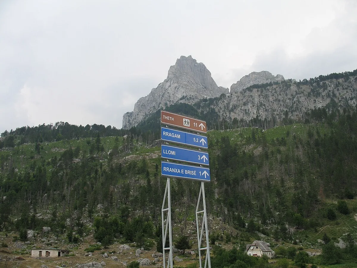
The second way in comes overland, and for drivers it is usually the way. Albania’s motorway runs from Tirana to Kukës, and from Kukës two roads reach Bajram Curri: the shorter line through Kosovo via Gjakova and the Qafa e Morinës crossing — a border formality to factor in, and a route whose rules for rental cars need checking with your hire company — or the entirely Albanian road via Krumë, a long, narrow mountain drive of around a hundred kilometres that asks for daylight and patience. From Bajram Curri, the last stretch is the valley road itself: roughly 25 kilometres up the trough of the Valbona, through Margegaj and Shoshan, to Dragobi and the valley floor. It is paved and steadily improving, but it is a mountain road in character — single in places, gravelled at the edges, and shared with livestock, tractors and the occasional flock taking its time.
Bajram Curri deserves its own paragraph, because every Valbona trip passes through it and most planning mistakes are made by skipping it. The town is the valley’s supply base and transport hub: the last banks and cash machines you can rely on, the last real shops, the place where minibuses for the valley are found and where a driver can ask, in person, about the road ahead. It is named for the national hero Bajram Curri, who died in 1925 in a cave above Dragobi, at the valley’s mouth, hiding from the forces of Ahmet Zogu — a piece of history the valley still tells about itself, and a reminder that this trough has been a refuge and a stronghold for far longer than it has been a holiday. Give the town an hour, draw your cash, buy what the valley cannot sell you, and treat any advice about connections gathered there as the freshest you will get.
Self-drivers should also understand what the road decides for them. There is exactly one way in and out by car — the same 25 kilometres back to Bajram Curri — so a Valbona stay is a there-and-back, not a leg of a driving loop, and the famous onward journey to Theth is made on foot, with your car either left behind or sent round by arrangement. In winter the calculation changes again: the valley road is kept open as far as conditions allow, but snow and ice can close or slow it without notice, and nobody should plan to drive into Valbona between late autumn and spring without checking conditions locally first. That theme — the season deciding — now follows us up the valley, because it governs the river too.
The Valbona River
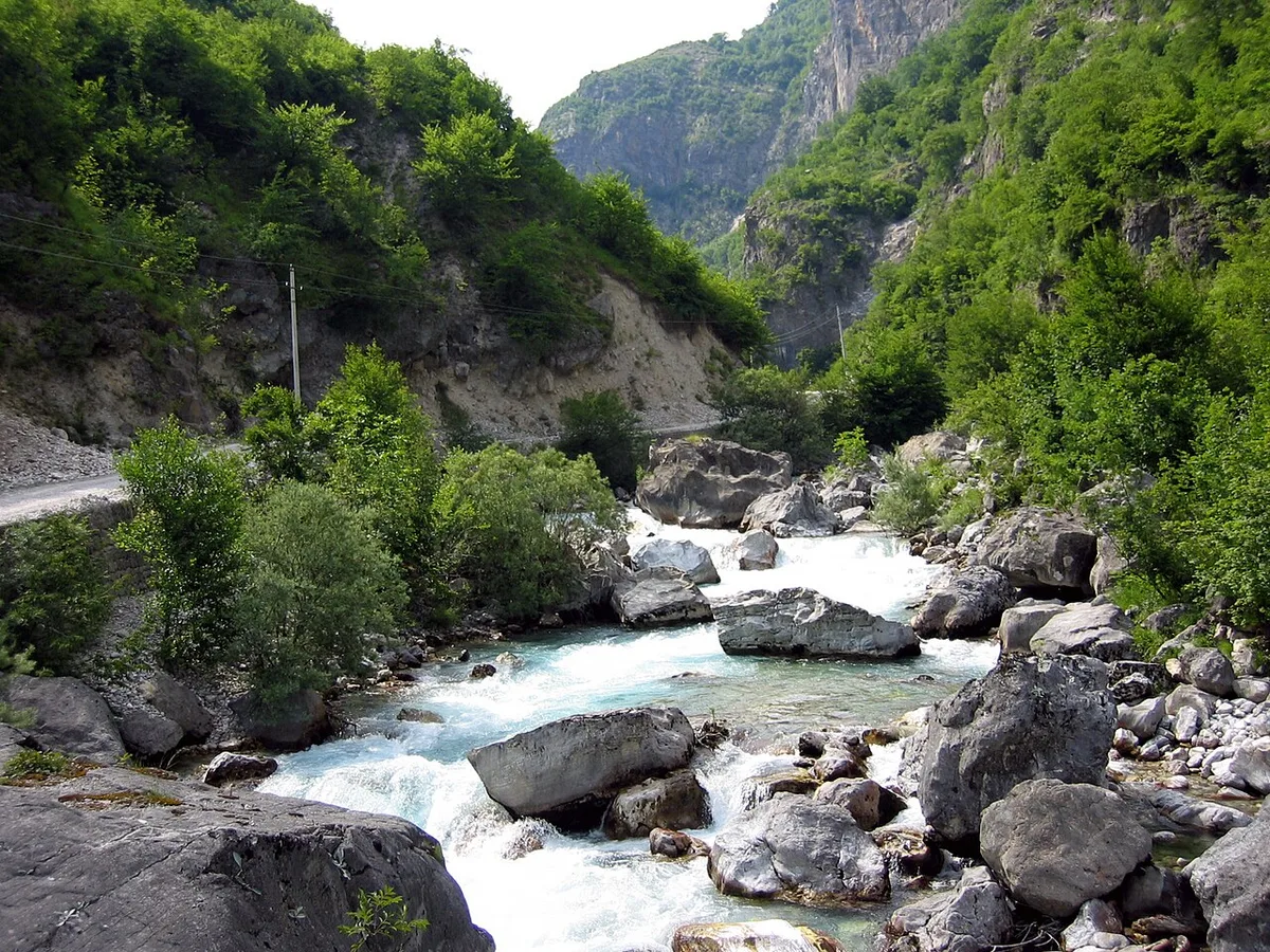
Everything in the valley is organised by one river. The Valbona rises from karst springs on the southern slopes of Maja Jezercë and east of Valbona Pass, gathers the side streams of the whole eastern Albanian Alps, and flows 50.6 kilometres — the longest course of any river in the range — down the trough, through the Shoshan gorge, past Bajram Curri’s outskirts and on to its meeting with the Drin near Fierzë. It is the valley’s water supply, its historic mill power, its swimming hole, its trout stream and its argument, all in one channel, and a valbona travel guide that treated it as scenery would miss the point of the place.
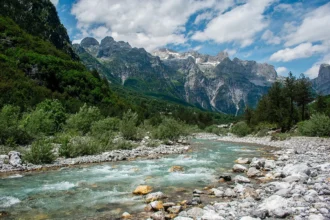
Start with the colour, because everyone does. The Valbona runs the improbable turquoise-green that limestone rivers run when they are fed by springs filtered through rock — water so clear that the white gravel of the bed shows through metres of it, and so cold that a summer swim is a short, gasping, wonderful affair. The river is at its fullest in late spring, when snowmelt swells it into a genuinely powerful stream, and it thins as the summer dries: side channels empty, the bed widens into pale gravel flats, and the flow gathers into fewer, deeper runs. Its fish are part of its fame — the river holds marble trout, a rare and prized fish of these limestone waters — and its banks are the valley’s easiest walking, a point the walk sections below lean on heavily. Swimming places are where locals say they are, deep pools below boulders and bridges; ask at your guesthouse rather than trusting a pin on a map, because the safe pools move with the river’s mood and the year’s water.
The river is also where the valley’s one real wound is, and honesty requires a section of it here rather than a whisper later. In the last decade, small hydropower plants were built on the Dragobi and Çerem streams — intakes, channels and pipes that take water out of the river system to make electricity — against years of protests by valley residents and environmental campaigners, who argued the projects threatened the river, the park and the tourism the valley lives by. The fight reached Albania’s Supreme Court, which in 2021 suspended the concession while the case continued, and the legal argument has dragged on since. A visitor today will see the concrete on the lower river, hear the story told with feeling at guesthouse tables, and notice that stretches of the bed run lower than the old photographs promise. This guide takes no side beyond the facts — but the facts are part of the valley now, and pretending the river is untouched would be its own kind of falsehood.
The River That Vanishes – Springs, the Waterfall and the Dry Bed
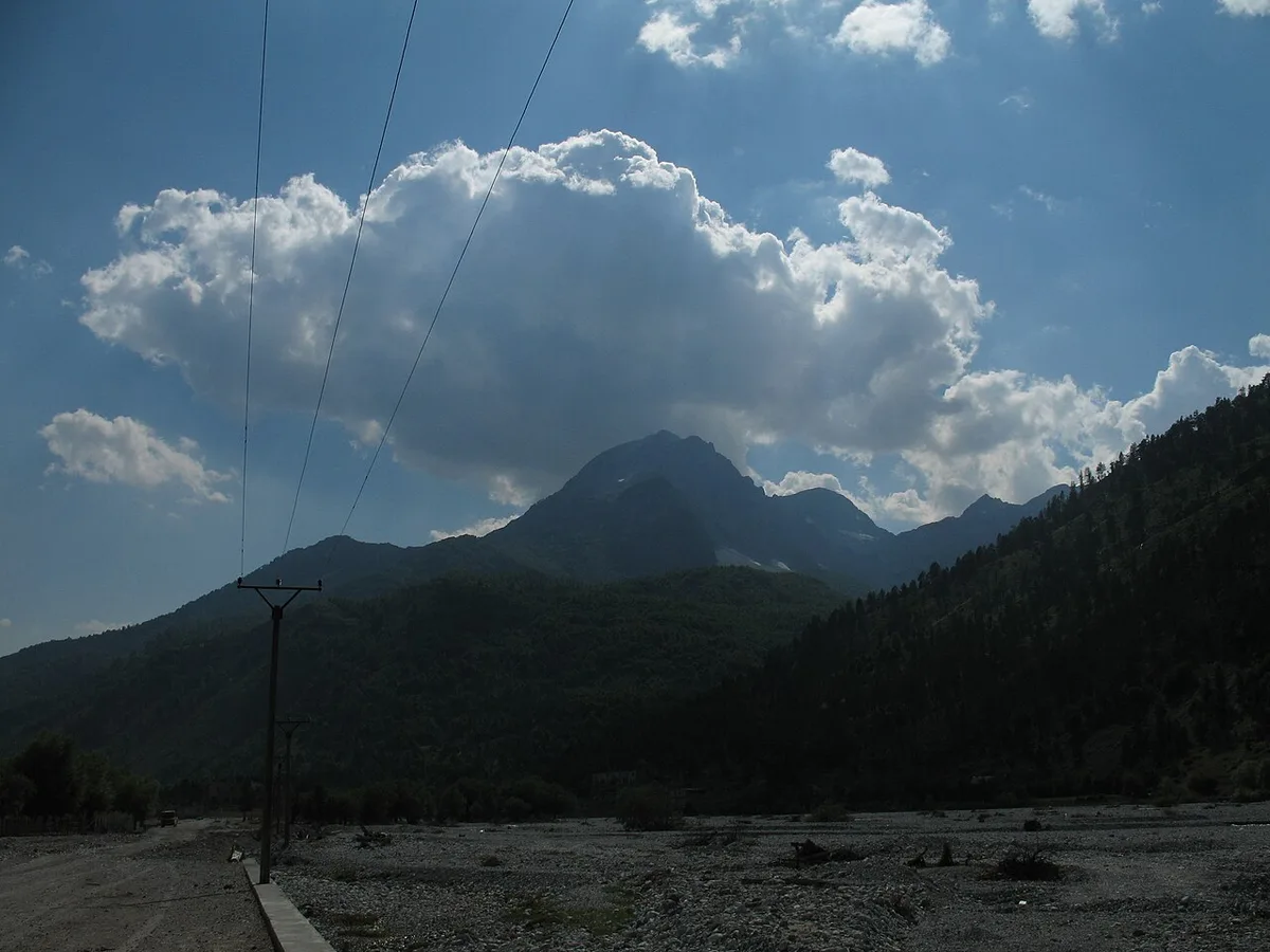
The upper river performs the neatest trick in Albanian geography. Below the springs at the valley head, the young Valbona gathers itself, drops over a waterfall of some fifty metres — the Valbona Waterfall, listed among the park’s natural monuments — and then, reaching the gritty flats of Rragam, does something a river is not supposed to do. It sinks. For roughly five kilometres the bed runs dry or near-dry on the surface, the whole flow travelling underground through the gravel and karst, before the water rises again around Valbona village and the river becomes a river once more. Walk the upper valley in late summer and you will cross a broad, pale desert of stones with a stream lost somewhere beneath it; walk it in May and the same bed is full and loud. Both are the same river, telling you what season it is.
The springs that feed this system are sights in their own right, and the park literature treats them as such — the Valbona Sources are named among the valley’s natural monuments, along with the great spruce of Rragam and the glacial valleys of Kukaj. Karst springs are the Alps’ plumbing made visible: water that fell as rain or snowmelt on the high limestone travels through the rock and emerges, cold and constant, at the valley floor. The greatest of them guards the valley’s mouth. At Shoshan, where the road enters the trough, a spring that local and park sources describe as one of the biggest in the Balkans bursts from the rock — the Shoshani source — and park literature credits it with a flow rivalling half the river’s own, while beside it the young gorge it feeds is described as a slot just two or three metres wide and fifty deep, cut as if with a knife. Treat the superlatives as the valley’s own telling rather than surveyed fact; treat the spring itself as unmissable if your route passes it, because it does.
For the walker, the dry bed is not a curiosity but a piece of route craft. The track up the valley head — to Rragam, and onward for those continuing towards the pass — crosses and recrosses these gravel flats, and in the melt season the crossings that were ankle-deep in August can be impassable braids in May. This is one more place where the valley’s rule applies: ask at the guesthouse in the morning, walk the river as it is that week, and do not navigate the upper valley from a photograph taken in a different season. The vanishing river rewards exactly the travellers who take it on its own terms.
The Lower Valley – Shoshan, Dragobi and Xhema Lake
The valley begins, for anyone arriving by road, with a narrowing. At Shoshan the trough tightens into its entrance gorge, the great spring boils out beside the road, and the road commits itself to the valley — from here there is one way forward and it is up. The first village inside is Dragobi, where the valley is still narrow and shaded, the houses older and closer to the river, and the atmosphere noticeably different from the open meadows above: this is the valley’s historic throat, the place its stories attach to. The cave above Dragobi where Bajram Curri died in 1925 is the lower valley’s one named historic site; the path up to it is a local walk to ask about rather than a signed excursion, and it is best treated exactly that way — guesthouse directions, daylight, and no expectations of interpretation panels.
Dragobi is also where the valley’s gentlest day walk lives. From Quku i Valbonës, in the middle valley, the river banks run east and down towards Dragobi in a long, easy ramble — a day spent on farm tracks and gravel banks beside the water, through the working valley rather than above it, ending among the lower village’s gardens. Nothing on this walk is dramatic, and that is its value: it is the walk that shows you the valley as a lived-in place — hay being cut, corn plots behind fences, the old mills on the side streams where the valley’s grain was ground for generations — rather than as a backdrop for the peaks. Take it on a day when the high country is in cloud, or as the deliberate slow day in a longer stay, and let the river set the pace.
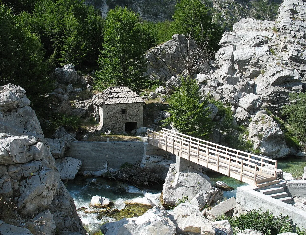
The lower valley’s other named sight sits a few kilometres below Valbona village, on the Dragobi road: Xhema Lake, a small natural lake — some five hundred square metres of water, at about 770 metres — fed from below by springs rising through its bed, ringed by limestone cliffs and beech trees, and cold in the way only spring-fed water is cold. Local descriptions credit it with depths of up to three metres in winter, when its springs run strongest. The walk out to it passes an old mill reached by a narrow footbridge, and there is a bathing spot on the stream above the lake for those who find the lake itself a degree too serious. Be honest with yourself about what Xhema is: a small, beautiful, very cold pool in the woods, not a lakeside resort — come for a woodland walk and a swim measured in minutes, and it will not disappoint. One caution, offered plainly by this valbona travel guide: we could find no freely licensed photograph that verifiably shows Xhema Lake, so this section is illustrated with the lower valley’s mill and footbridge instead. The lake deserves its obscurity respected rather than a wrong picture.
Rragam – The Last Village
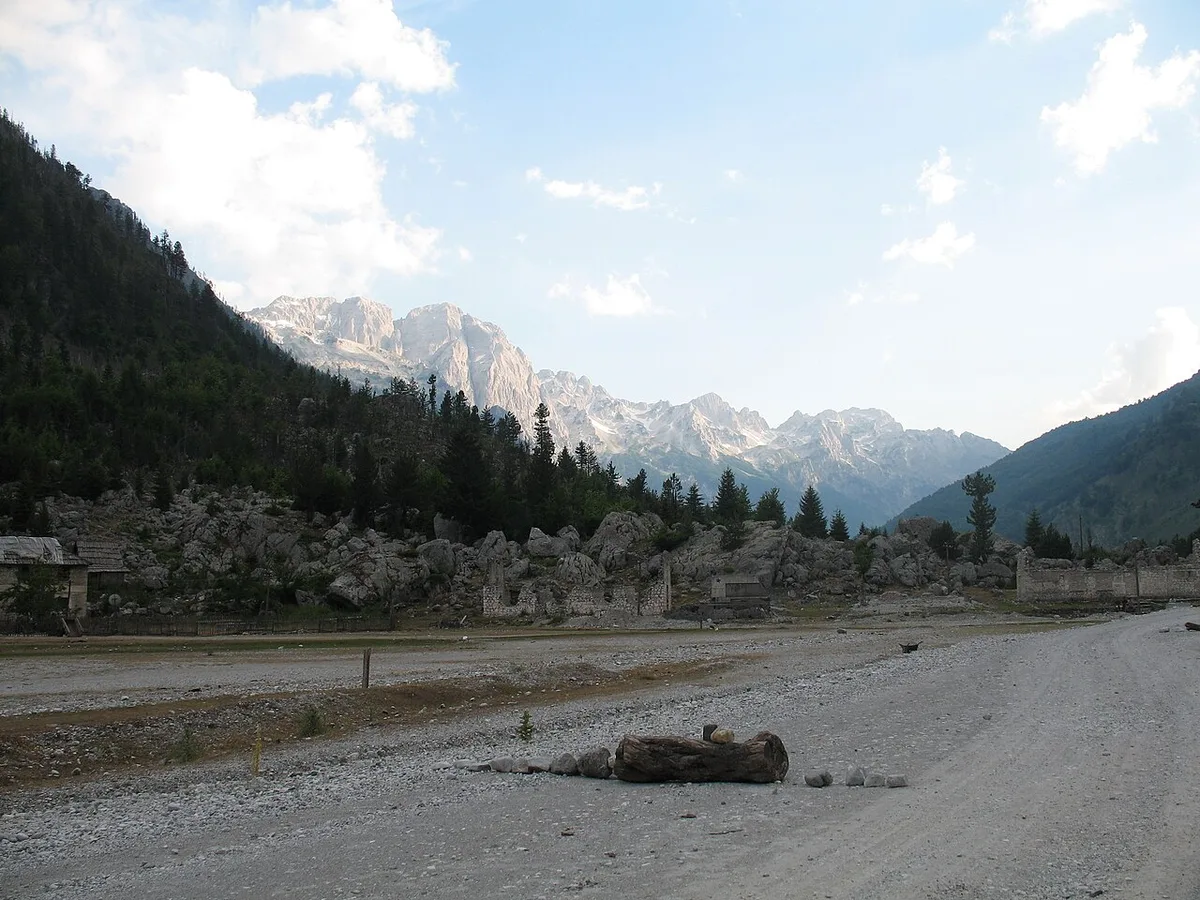
Every valley has an end, and Valbona’s is Rragam. The tarmac gives out at Fusha e Gjesë, the broad flat where the valley floor opens one last time, and from there the way to the last village is a track — a few kilometres of it, along and across the mostly dry riverbed — that vehicles with clearance and determination use, and everyone else walks. That small friction is the making of the place. Rragam, the final village before the river’s source, keeps the character the middle valley is slowly trading away: traditional stone houses, several now converted into guesthouses, hay meadows running up to the doors, the great spruce the park counts among its natural monuments, and above everything the closing wall of the valley head, with the pass path climbing out of sight to the west and the springs that start the river somewhere in the rocks ahead.
Most visitors meet Rragam in transit — it is the last settlement on the way to the pass, and its guesthouses are full of hikers eating early and sleeping early. Stay a night when you are not walking anywhere, and a different village appears. The upper valley in the early morning, before the through-hikers have passed, is the quietest inhabited place in this guide’s whole five-country project: no road noise, because the road effectively ended behind you; no through traffic, because there is nowhere through to go. The day’s walking from Rragam is the valley’s upper end itself — up towards the springs and the waterfall on paths your host will describe, across the gravel flats where the river runs underground beneath your boots, into the amphitheatre where the trough simply stops against the mountains.
Practical honesty about Rragam, because it matters to plans. The track in means luggage moves by arrangement — your guesthouse will send a vehicle down or carry bags by arrangement from Fusha e Gjesë; confirm it when you book, not when you are standing on the flat with a suitcase. Supplies are what the guesthouse has; there is no shop to speak of, no signal to rely on, and no evening economy beyond the guesthouse table — which, to be fair, is the point. And the season bites hardest here: the highest, last village is the first to empty and the last to open, and outside the warm months Rragam may have no open door at all. Sleep here in season, on a walking day or a deliberately idle one, and you will understand the valley better than a week in the middle can teach you.
The Kukaj Valley and the Viewpoint Walks
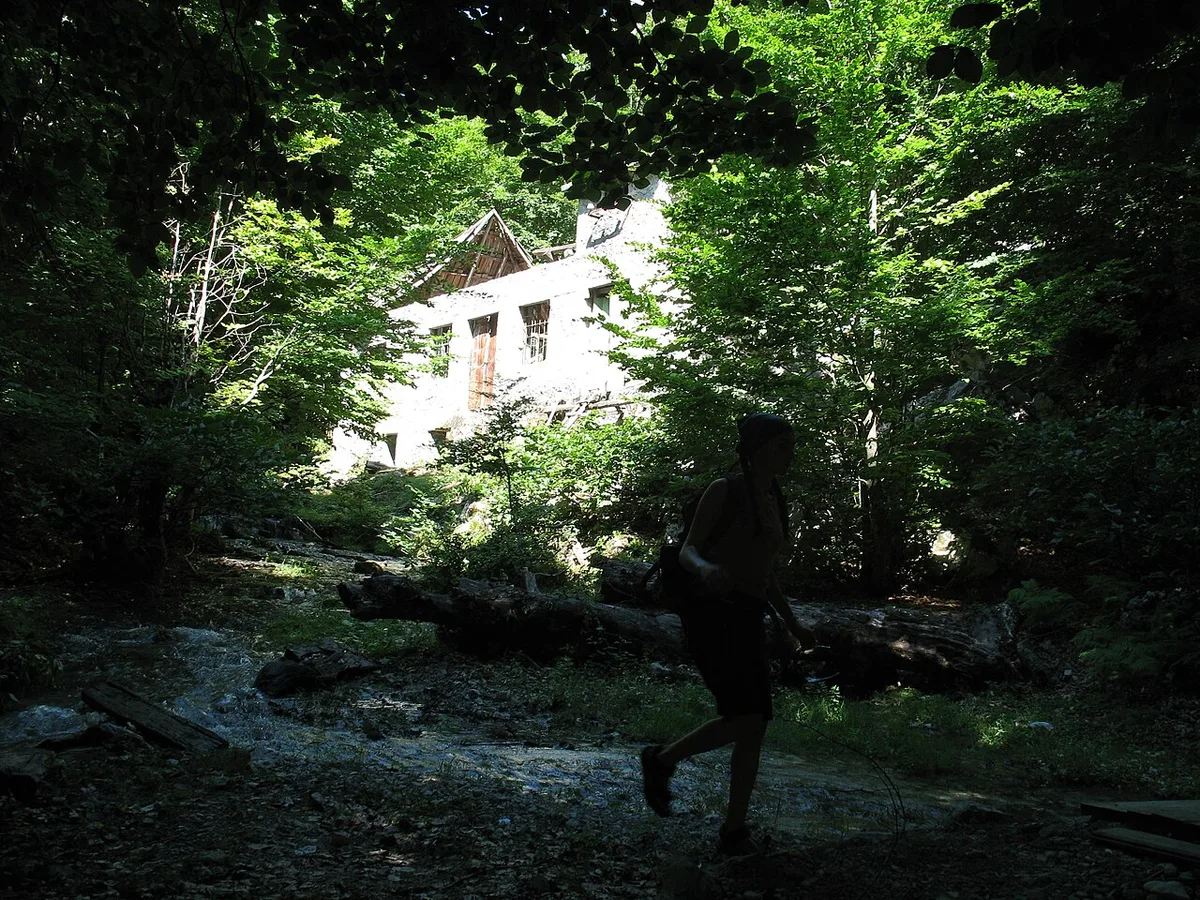
Ask a Valbona host what to do with a day that is not the pass, and the name that comes back is Kukaj. Kukaj is a hamlet and a small glacial side valley some three kilometres from Valbona village, reached on foot or by a vehicle that does not mind its track — no road traffic, no through route, just the valley’s own side door. The glacial valley of Kukaj is listed among the park’s natural monuments, a hanging trough of pasture and old ice-worked rock above the main floor, and the walk most often described for it is a gentle one by local standards: from Valbona up to the viewpoint above Kukaj and on to an old mill, a round of roughly nine kilometres that local hiking guides price at about four hours. The reward is the angle. From above Kukaj you look back along the whole trough — river flats, hamlets, the wall at the head — and the valley reads as one place for the first time, which is why this walk, more than any other, belongs early in a stay.
Around that headline walk sits a whole tier of valley-level walking that the pass crowds never see, and it is worth planning as a tier, with expectations set correctly. These are not engineered trails with waymarks every fifty metres; they are farm tracks, forest paths and riverside rambles that locals walk and visitors follow with a guesthouse sketch-map and a morning’s advice. The river-bank ramble down to Dragobi, covered in the lower-valley section, is the tier’s easiest member. The woods above the hamlets — beech and spruce, loud with birds in spring — hold the short loops for hot afternoons. The Snake Meadows viewpoint, Livadhet e Gjarpërit, at about 1,200 metres, is the tier’s named lookout, a meadow viewpoint reached by paths from the Çerem side. And everywhere, the pattern is the same: distances are short, route-finding is the real skill, and the guesthouse is the guidebook.
One discipline is worth stating in a valbona travel guide, because the mountains punish its absence. The valley’s own walks are valley walks; the moment a path starts climbing seriously — towards a col, a summit or the high pastures — it stops being a stroll and becomes mountaineering in a range that does not forgive casual preparation. Take the viewpoint walks with water, a layer and a turned-back-by time. Take anything higher with a local guide, arranged through your guesthouse, and with the weather asked about that morning. The line between the two is exactly the line local advice draws, which is the final reason this guide keeps sending you back to the same source: the people who live under these walls read them daily, and their reading is better than any printed one, including this.
Side Valleys – Çerem, Motina and the Stanet
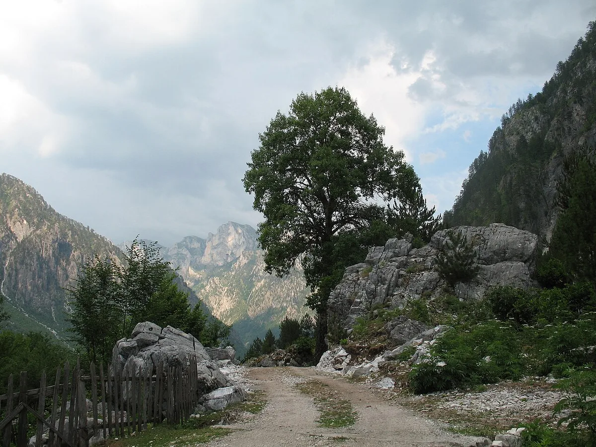
The main trough is only half the valley. Into it, from both sides, run the side valleys — and two of them have names, histories and guesthouses of their own. Çerem, the largest, cuts away some eight kilometres from the main road’s line and keeps a village at its end: stone houses, a few of them now guesthouses, pastures climbing towards the Montenegrin border and Maja e Kollatës, whose summit ridge — well above 2,500 metres, on the border itself — closes the view. Çerem is reached the way such places are reached here: on foot, or by a high-clearance vehicle on a rough track, arranged through a host. Nobody passes through Çerem by accident, and its evenings have the settled quiet of a place that tourism visits but has not reorganised.
Motina, the second side valley, is wilder and emptier — a hanging glacial valley some two and a half kilometres long, lying at about 1,100 metres between Maja e Hekurave and the Grykët e Hapura, the Open Jaws. Where Çerem is a village visit, Motina is a walk into the park’s emptier register: pasture, old summer farms, the stanet — the seasonal shepherd settlements that Albanian mountain families have used for centuries, occupied in the grazing months and silent outside them — and the high country beginning in earnest at the valley’s head. The Motina and Çerem streams are also, not incidentally, two of the three rivers the hydropower fight was fought over; the side valleys are where that argument is written on the landscape, in concrete channels across beautiful streams, and a visitor walking them will see both the wildness and the wound in the same hour.
How to visit the side valleys well comes down to three rules this guide will state plainly. First, they are day trips from a valley base or one-night extensions, not places to improvise at dusk — the tracks are rough, the light goes early behind the walls, and there is no passing traffic to flag down. Second, a local guide or a host’s precise directions are not a luxury here but the mechanism itself; the paths to the stanet and the high pastures are working paths, not marked routes. Third, go in the grazing season if the living culture is what you want: in high summer the stanet are occupied, the flocks are up, and the side valleys show the pastoral system they exist for. Come in October and you will find them beautiful and emptied — which is its own truth about this valley, but a different one.
The High Peaks Around the Valley
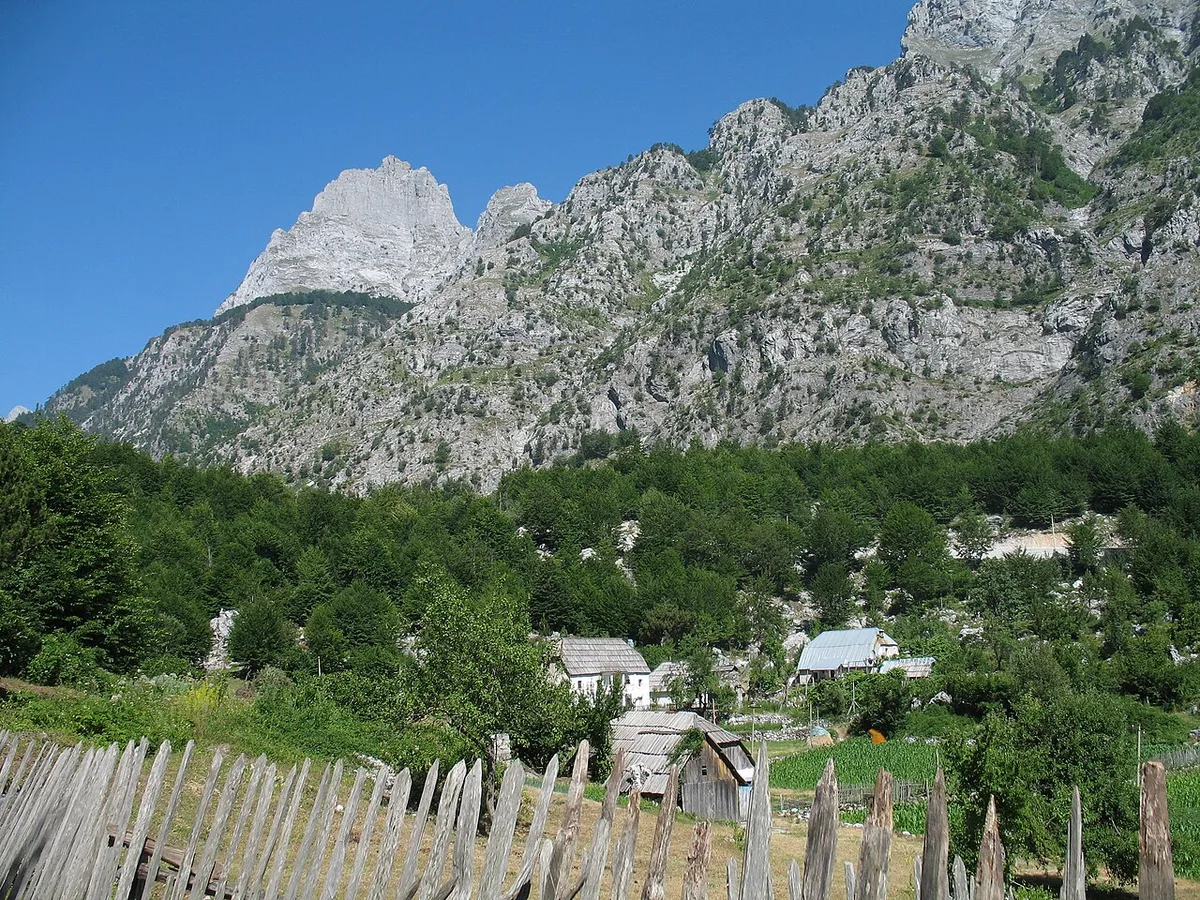
Stand anywhere on the valley floor and turn slowly. The trough you are standing in is a crack between giants, and naming them helps the view settle. To the west, closing the head of the valley beyond the pass, rises Maja Jezercë at 2,694 metres — the highest summit of the entire Dinaric Alps, a mountain whose glaciers were the ice that carved this trough in the first place. Around it the wall continues unbroken: Maja e Kollatës on the Montenegrin border to the north, Maja e Hekurave at 2,561 metres to the south, Maja Boshit above Rragam, and rank after rank of the pale, shattered limestone that gives the Accursed Mountains — Bjeshkët e Nemuna, the Cursed Peaks — their name and their look: grey-white rock, near-vertical, streaked with snow long after the valley floor has greened.
For most visitors, honestly, the peaks are a view rather than an objective, and there is no shame in that — the valley floor exists so that the wall can be looked at. But the high country is climbable, and the valley is a base for it. Recorded routes climb Maja e Boshit, at 2,416 metres, from the gravel flats at Fusha e Gjesë — a serious mountain day of some 1,700 metres of ascent, rewarded, in the words of those who log it, with three valleys at once: Valbona, Theth and Curraj i Epërm spread below the summit. The bigger summits — Jezercë above all — are multi-day undertakings by Alpine standards of seriousness, with glacier remnants, exposed rock and weather that changes in an hour. Nobody should read a valbona travel guide, or any guide, as sufficient preparation for them. The valley’s guesthouses can put experienced local guides into a plan; that is the route up, for anyone whose ambitions reach the wall itself.
What the peaks give every visitor, climber or not, is the valley’s light. Because the walls are high and the trough runs east to west, Valbona’s sun arrives late and leaves early by the clock, and the day’s best hours are the ones the walls create: the first light striking the limestone while the floor is still in shadow, the long evening when the rock holds the sun after the meadows have cooled. Photographers learn it in a day. Everyone else learns it by sitting on a guesthouse terrace at the right hour, doing nothing, which is the valley’s other great activity and the one its regulars defend most fiercely.
Sleeping in Valbona – Guesthouse Culture
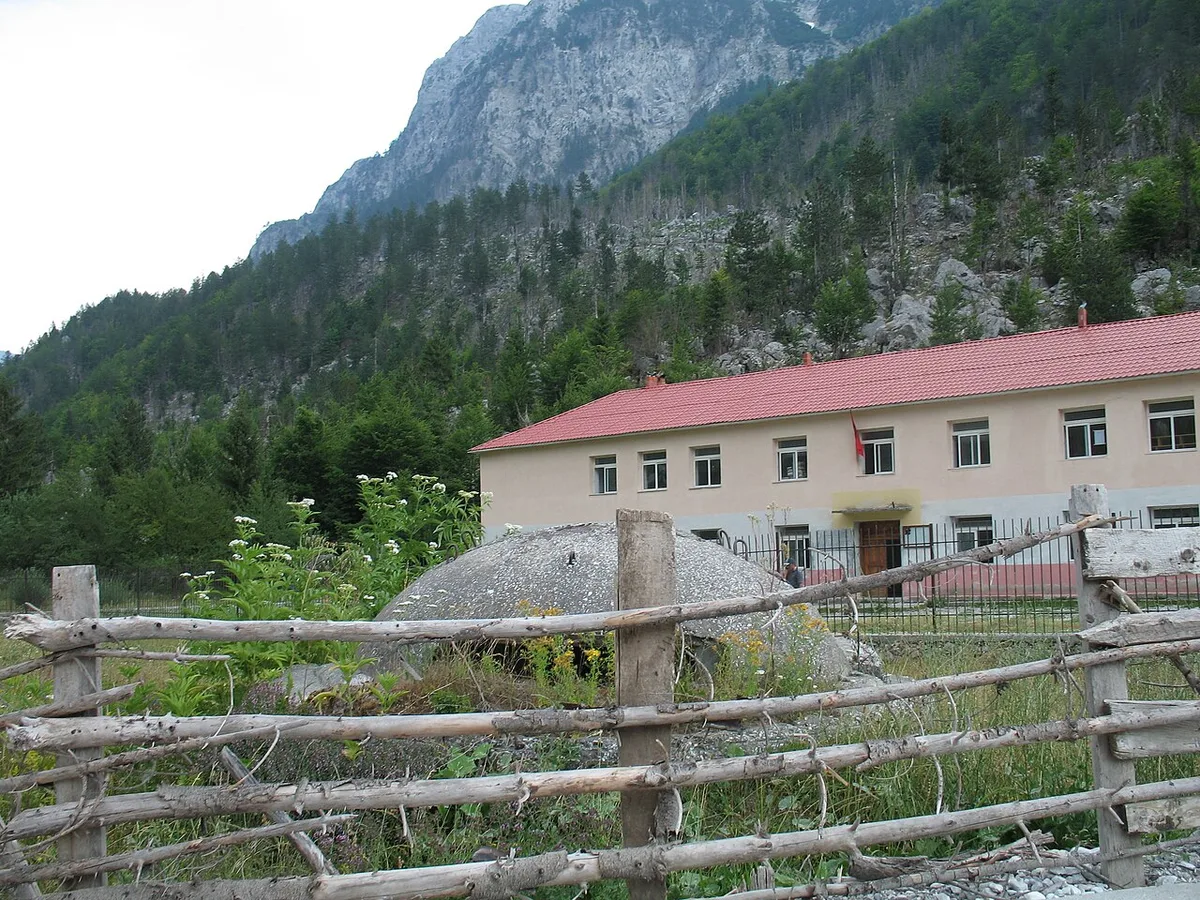
There are no hotels in Valbona in the sense a city traveller means, and the sooner that is understood the better the stay goes. What the valley has, strung along its floor from Dragobi to Rragam, is a generation of family guesthouses — farmhouses that grew rooms. They range from a couple of beds in a working farmhouse to substantial purpose-built places with dining rooms, terraces and their own signs on the road, and one of the first, the Tourist Info Point guesthouse beside the park’s information centre, has been receiving walkers since 2012. What they share matters more than how they differ: the family lives there, the food comes from the farm and the valley, the advice comes from people who walk these paths, and the building you sleep in was somebody’s home before it was your accommodation.
The operating system of a Valbona guesthouse is half board, and it runs on conversation rather than systems. You book — in season, book well ahead, because the valley’s beds are finite and August fills them — and from that moment the guesthouse is your logistics: they will tell you the current state of the ferry connections, send a vehicle to the right meeting point, feed you on arrival whatever the hour within reason, pack your walking lunch, agree tomorrow’s plan over tonight’s dinner, and hold your spare bag while you are up the valley. Payment is cash, in lek or euros as agreed; cards and valley cash machines are not things to build a plan on. Rooms have improved year by year — private bathrooms are now common in the bigger houses — but this is still a mountain valley at the end of a single road, and the traveller who needs a guaranteed standard should calibrate to a good farmhouse, not a resort.
Choosing where along the valley to sleep is the one real decision, and this valbona travel guide will make it for you as far as honesty allows. Sleep in the middle valley — Valbona village and Quku i Valbonës — for the widest choice, the easiest connections and the shortest transfers. Sleep at Rragam for the quiet, the valley head on your doorstep and the pass path outside the door, at the price of the rough track in and the thinnest services. Sleep towards Dragobi for the lower valley, the Xhema and river-bank walks, and the first arrival and last departure of any trip. And in every case, write to the host before you come with the two facts that shape a Valbona stay: when you arrive, and by which route. The valley runs on that message.
The Farm Table – What Valbona Eats

You will eat at your guesthouse, because there is effectively nowhere else — a restaurant or two of long standing exists in the valley, but the system is the guesthouse table — and in Valbona that limitation turns out to be the trip’s culinary good fortune. The valley’s farms produce what farms here have always produced: milk, cheese and yoghurt from cattle, sheep and goats on the high pastures; corn and potatoes and beans from the valley-floor plots; eggs, honey, garden vegetables; and meat from the farm’s own animals. The cooking is entirely traditional, the ingredients are what a European supermarket would call organic and a Valbona farmer calls dinner, and the distance between the pasture in the photograph above and the plate is measured in metres.
The dishes to hope for are the highland ones. Fërliq — lamb roasted on skewers — is the celebratory plate of these mountains. The river’s marble trout, where it is offered, is the valley’s delicacy, though a conscientious traveller will eat it sparingly, in season and only where it is properly sourced, because a famous fish in a small river is a finite thing. Flija, the many-layered pancake baked slowly under a metal lid heaped with embers and served with honey or yoghurt, belongs to the whole Albanian north and appears at festive tables here, along with mazë and the region’s pitja breads. Breakfasts are the guesthouse glory: eggs, white cheese, butter, jam, honey, hot milk, strong coffee. And over everything, at the beginning or the end of the meal as the house decides, comes raki — homemade, formidable, and offered with a hospitality that makes refusal a small diplomatic act. Accept a small one. It is part of the rent.
Two practical notes complete the table. The first is that the guesthouse kitchen works to its own rhythm and its own larder: menus are what the farm has, dietary requirements are handled with goodwill when they are explained early and simply — ideally when you book — and a packed lunch for a walking day is a normal request that should still be made the night before, not at dawn. The second is water: the valley’s springs are its pride, the tap water at guesthouses is mountain water, and locals will tell you, accurately in their experience, that it is the best in Albania. Bottled water exists for those who prefer it; most visitors end up refilling from the spring like everyone else, and remembering the taste afterwards more clearly than the peaks.
The National Park Frame – Valbona Valley and the Alps of Albania
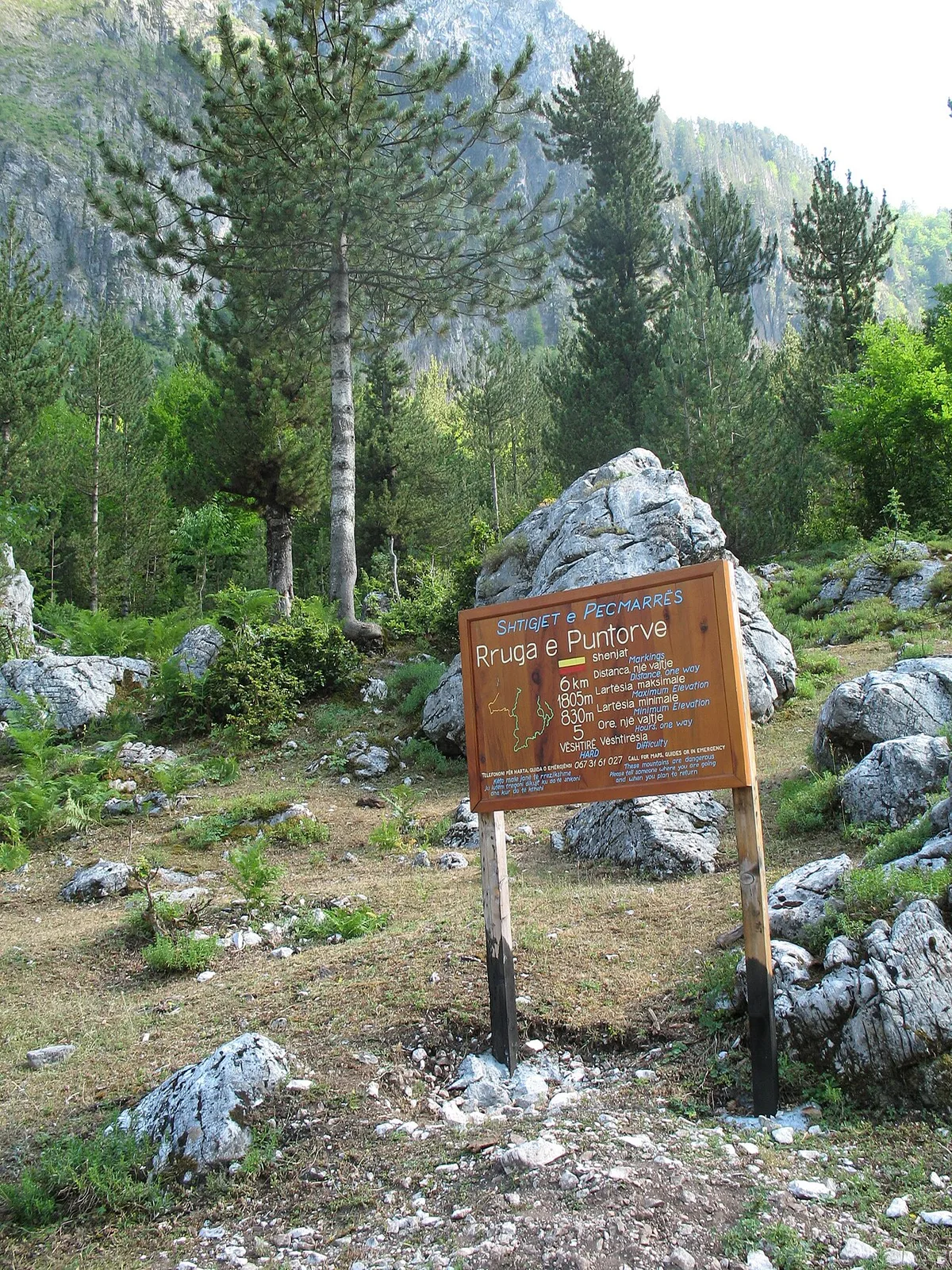
The valley you are walking in is a protected landscape twice over, and the frame matters because it explains both the rules and the place’s survival. Valbona Valley National Park was created on 15 January 1996, by a decision of Albania’s Council of Ministers, protecting 8,000 hectares of the valley and its walls as an IUCN Category II park. On 26 January 2022 that park was amalgamated — together with the old Theth National Park and the Gashi strict reserve — into a single, larger protected area, the Alps of Albania National Park, administered by the National Agency of Protected Areas, AKZM. Sources disagree about the merged park’s total area — figures in circulation do not reconcile — so this guide will not print one; what matters on the ground is that the valley’s protection did not lapse in the merger, and its administration now sits inside the bigger Alps-wide system.
What is being protected deserves its inventory. Forest covers the great majority of the old park — beech, chestnut and walnut on the lower slopes, and on the higher valley the finest stands of Norway spruce in Albania, a Central European tree at the southern edge of its world, growing here between roughly 850 and 1,200 metres where almost nowhere else in the country holds it in such numbers. The wildlife list reads like the Balkans at their wildest: brown bear, grey wolf, roe deer and chamois, golden eagles over the ridges, and the Balkan lynx — present, protected, and almost never seen, which is rather the point. The river system, the springs, the glacial side valleys and the named natural monuments — the Rragam spruce, the Valbona sources, the Kukaj glacial valleys — complete a whole that the park system exists to keep functioning rather than merely scenic.
For the visitor, the frame is mostly invisible, which is its success. There is no entrance fee to pay and no permit to obtain to enter the valley; the park’s presence shows itself in the information centre, the boards on the paths, the marking of the great routes, and in the long argument — the hydropower case above is its sharpest edge — over what protection means when development comes knocking. Behave as the frame asks: take litter out (the valley’s own hand-painted signs ask the same), keep to paths in the high country, leave the springs as you found them, and understand that the guesthouse economy you are enjoying is, in the park’s design, exactly the point — a living valley, farmed and hosted by its own people, is the conservation strategy, not a compromise with it.
The Pass to Theth – One Section, No More
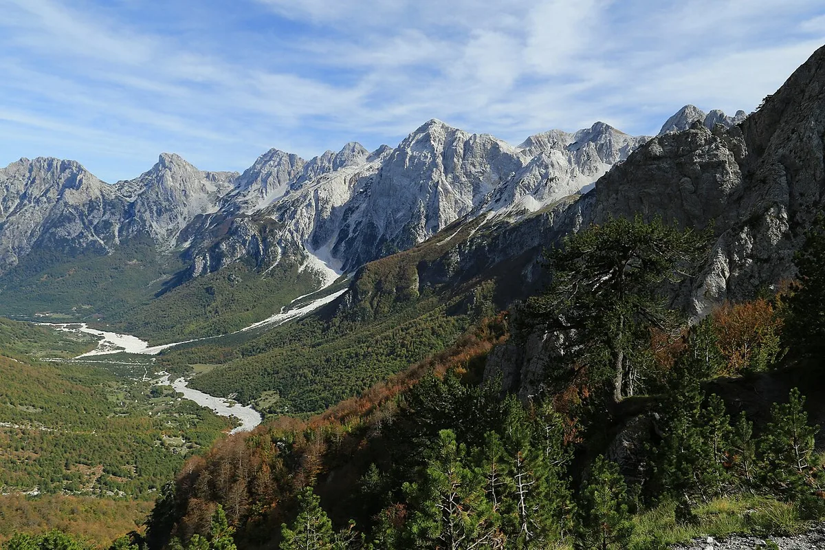
Yes, the famous walk starts here, and no, this guide is not going to walk it for you — deliberately. The path from Valbona over Valbona Pass to Theth is the best-known day hike in Albania, a full mountain day from the valley head at Rragam, up through the beech woods and over the col, and down into the Shala valley on the other side; it forms one leg of the long-distance Peaks of the Balkans trail, and it has its own dedicated guide elsewhere on this site, where the route, the timings and the logistics are covered step by step. What this valbona travel guide owes you is only the Valbona-side truth about it.
That truth is threefold. First, from Valbona the hike is a commitment, not an excursion: it is a one-way crossing to another valley, with your onward life — luggage transfers, the return to Shkodra, the next bed — rearranged around it, and it should be planned as the hinge of an itinerary, never squeezed into a spare afternoon. Second, the Valbona side sets the terms: the start is Rragam, so the night before belongs there or in the upper valley; the ascent is on the day’s early, cool side; and the season rules absolutely — the pass is a snow route outside the summer window, and no date in any guide, including this one, overrides the morning’s weather and your host’s reading of it. Third, walkers who cross from here leave the valley at its best angle: the view back down the braided river from the pass path, with the Grykat e Hapëta wall across the trough, is the single finest farewell Valbona offers. Cross if your trip is built for it. If it is not, the valley you are standing in is not a consolation prize; it is the destination this whole guide has been about.
Season and Snow – When Valbona Works and When It Does Not
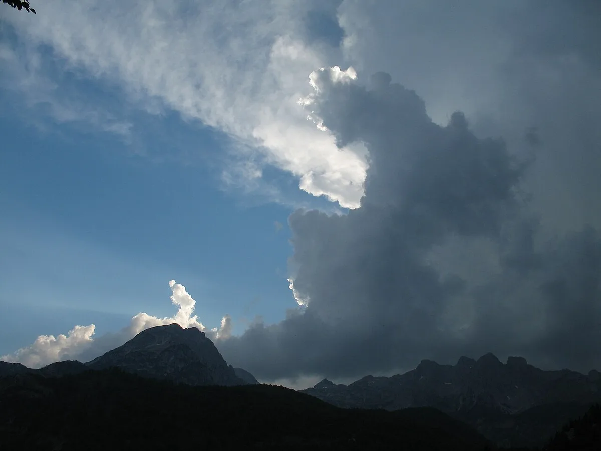
Valbona has the sternest climate of any inhabited valley in Albania, and its year divides into chapters that might as well be different destinations. Late spring — May into June — is the river’s chapter: snowmelt in the channel, waterfalls running, the meadows at their greenest, and the high paths still holding snow, so the valley is open while its roof is not. High summer, July and August, is the full valley: every guesthouse open, the ferry connections at their most frequent, the pass in daily use, the river low and clear and the swimming pools at their least punishing — and the crowds, such as they are in a place this enclosed, at their peak. Early autumn, September into October, is the connoisseur’s chapter: beech woods turning gold and rust under white rock, the through-hikers gone, the air washed clear — and the first snows capable of arriving on the high ground while the floor is still in shirtsleeves.
Then winter takes the valley back. This is one of the coldest corners of the country; snow lies for months — park and guide literature describes falls on the high ground from October or November towards March or April, accumulating to depths measured in metres — and the valley’s life contracts to the households that winter there. Guesthouses close, the ferry-and-minibus chain thins or pauses, the pass becomes a serious snow route, and the valley road can be slowed or cut by conditions without any authority publishing the fact. None of this is written with fixed dates, because the honest version has none: the valley closes when the snow says so and opens when it melts, and any winter or early-spring plan for Valbona must be built live, through a host who is actually there, with a generous margin for the trip simply not happening.
The planning consequence deserves stating as a rule of this valbona travel guide. Book the valley for the months when it is a valley — broadly, late May to mid-October for the full experience, high summer for the pass and the connections at their surest — and treat anything outside that window as an expedition to be negotiated with locals, not a holiday to be booked from a screen. Travellers who come in season sometimes complain the secret is out. Travellers who come in February do not complain at all, because almost none come — and the handful who do, and who are equipped for it, describe a silence they cannot find anywhere else in Europe. Both are telling the truth about the same place.
How Many Days Does Valbona Need
The shortest honest answer is three nights, and the reasoning shows why shorter stays misfire. One night in Valbona is a transit: you arrive in the afternoon from the ferry or the road, eat, sleep, and leave — you have seen the valley’s postcard angle and none of its life. Two nights buys one full day, which the pass will try to take, leaving the valley itself unvisited. Three nights gives the shape this guide recommends: an arrival day with a first short walk, a valley day for Kukaj or the side valleys, and a day for the river, the lower valley or the pass — with the guesthouse table, not a checklist, setting the tempo between them.
Longer stays repay in a particular currency. Four or five nights lets the valley stop being an itinerary and become a routine: mornings on the farm tracks, the long light on the wall, a second side valley, a day doing almost nothing in a place exceptionally good at almost nothing. A week is not too long for walkers working through the valley’s own tier — Kukaj, Çerem, Motina, the river banks, the springs and Xhema — or for anyone using Valbona as the deep-rest chapter of a longer Albanian trip, paired with Theth across the pass or Shkodra below the ferry. What Valbona does not reward is the opposite pattern: the valley bolted onto a rushed national tour as a single night between transfers. If the days cannot be found, the honest fix is to drop somewhere else. Albania’s south will keep; a misjudged Valbona is a five-hour journey to sleep beside a river you never met.
Build the days around the fixed points and let the rest breathe. The ferry day, if you take it, consumes a day by itself and lands you in the valley by afternoon. The pass, if you walk it, consumes a day and relocates you. Everything else in this valbona travel guide is elastic — walks that expand or contract with the weather, a side valley traded for a slow morning, the river day moved for the rain. That elasticity is not a flaw in the plan. In a valley run by snow, water and word of mouth, it is the plan.
Packing and Practicalities

Pack for a mountain valley that runs on cash, weather and walking, and most practical questions answer themselves. Money first: draw lek in Shkodra or Bajram Curri, carry more than the estimate, and expect euros to be accepted at guesthouses at a rate agreed in person; the valley has no cash machine to rescue a thin wallet, and card payment should be treated as a pleasant surprise, never a plan. Connectivity second: mobile signal exists in much of the valley but thins at the head and dies in the side valleys; guesthouses increasingly offer Wi-Fi, but the traveller whose trip depends on a connection has chosen the wrong valley — download maps and documents offline before the ferry, and let the disconnection be part of the purchase.
Clothing is a mountain list, whatever the month on the ticket. Walking boots or strong trail shoes for everything beyond the lanes; layers that assume the temperature will fall off a cliff when the sun leaves the floor, because it will; a waterproof shell that is actually waterproof, because the storms in the photograph at the season section build in an hour; sun protection for a high valley where the light bounces off limestone; and a headtorch, because village lanes are unlit and the walk back from a neighbouring guesthouse is part of the social life. Add a swimsuit for the river pools, a book for the terrace, and whatever your guesthouse cannot supply — the valley’s shops are minimal, and Bajram Curri is the last real chance for batteries, blister care and forgotten chargers.
The last practicalities are behavioural, and they are the ones the valley’s hand-painted entrance signs are really about. Carry litter out; the bins a village provides are not an alpine waste system. Ask before photographing people at work, and accept a no with the same grace as the hospitality. Keep gates as you found them and dogs will mostly return the courtesy. Drink the spring water, eat what is put in front of you, learn the word faleminderit — thank you — and use it often. Valbona runs on a small community’s tolerance of a growing number of guests; the practicalities that matter most are the ones that keep that tolerance true.
The Honest Downsides

A valbona travel guide that only praised would be a brochure, so here is the other ledger. The access is fragile: a single road, a seasonal ferry chain, and connections that run on habit rather than published timetables mean Valbona trips can unravel in ways a traveller cannot fix from inside the valley — a cancelled sailing or a blocked road costs a day, and the valley offers no alternative route to improvise with. Build slack into any itinerary that has a flight at the end of it, and keep the night before a hard departure somewhere with options, which means Shkodra or Tirana, not Rragam.
The infrastructure is a mountain village’s, not a resort’s, and the gaps are real. Medical help is far away in an emergency; Bajram Curri is the first rung and anything serious means Shkodra or beyond. The mobile signal and Wi-Fi that exist will fail somebody at some point in every stay. The food, for all its freshness, is a farm kitchen’s repertoire — travellers who need variety across a week will feel its limits, and vegetarians should say so plainly and early, because meat is the default grammar of the highland table. The river, in dry summers, runs lower and thinner than its legend in the very stretches the brochures photograph, and the hydropower concrete on the lower streams is a genuine scar that no caption can tidy. In August the valley’s finite beds fill, its best guesthouses book out, and the tranquillity is shared with every other person who read the same recommendations.
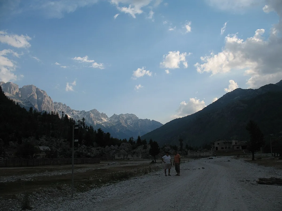
And the deepest downside is demographic, written on the landscape in the photograph above. For every farmhouse that became a guesthouse, another stands empty as its family works abroad; winter Valbona is a fraction of summer Valbona; and the culture visitors come to admire — the farms, the stanet, the shepherd’s calendar — survives under an economic pressure no amount of tourism has yet solved. None of this is a reason not to come. It is a reason to come as a guest rather than a consumer: stay in the family houses, eat the farm food, hire the local guides, spend in the valley rather than through it. Valbona’s fragilities and its qualities are the same facts seen from two sides, and the traveller who understands that will have the best of it.
Valbona Questions, Answered

Is Valbona worth visiting if I am not walking the pass to Theth?
Yes — that is the premise of this whole valbona travel guide. The valley’s own walks (Kukaj, the side valleys, the river banks, Xhema Lake), its guesthouse culture and its scenery fill three or four days without the pass ever entering the plan. The pass is one famous day; the valley is the destination it starts from.
How do I get to Valbona without a car?
By the relay this guide describes: minibus from Shkodra to Koman, the morning ferry across Koman Lake to Fierzë, and a waiting minibus onward via Bajram Curri into the valley. Guesthouses arrange and confirm the links; book the chain through your host, confirm the sailing the day before, and never build it into a day with a hard deadline.
When is the best time to visit Valbona?
For the full valley, late May to mid-October. Late spring brings the river at its best and the meadows at their greenest; July and August bring every service running and the pass at its busiest; September and early October bring autumn colour and quiet. Winter is snow, closed guesthouses and no reliable connections — a specialist trip, not a holiday booking.
Can I visit Valbona in winter?
Only as a deliberately planned, locally negotiated expedition. Snow lies for months, most guesthouses shut, connections thin or pause, and the pass becomes a serious snow route. If a host who is in the valley confirms they are open and the road is passable, a winter stay offers extraordinary quiet — but build it live, with margins, never from a screen months ahead.
How many days do I need in Valbona?
Three nights is the honest minimum: an arrival day, a valley day, and a day for the pass or a side valley. Four or five nights is better. One night is a transit stop that shows you the postcard and none of the place.
Do I need to book guesthouses in advance?
In season, yes — the valley’s beds are finite, July and August fill the best houses, and your guesthouse is also your transport adviser and restaurant. Book ahead, tell your host your arrival date and route, and agree the details — meals, meeting points, luggage — before you travel.
Is there an entrance fee for the national park?
No. There is no fee to pay and no permit needed to enter the Valbona valley. The park’s information centre in the valley sells a hiking map and advises on trails and conditions, and is worth the stop for exactly that.
Can I swim in the Valbona river?
Yes, in the deep pools in the warm months — and briefly, because spring-fed limestone water is seriously cold even in August. Ask at your guesthouse where the safe pools are this season; they move with the river. Xhema Lake, near Dragobi, is the valley’s other swim, colder still.
Is Valbona suitable for children?
For families who like farms, rivers and walking, very much so — the valley floor is gentle, the guesthouses are family houses by definition, and the Kukaj and river-bank walks suit shorter legs. The cautions are the honest ones: long transfer days, cold swimming water, far-away medical help, and a winter season that is no place for a family holiday.
The Short Version – a One-Paragraph Valbona Travel Guide
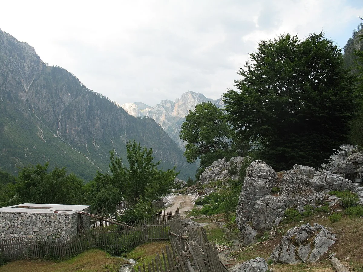
Come by the lake if you can — minibus, ferry, minibus, a five-hour overture that lands you slowed down — and give the valley three nights at the very least, in a family guesthouse, in the season between late May and mid-October. Walk its own ground before its famous exit: Kukaj’s viewpoint, the river banks down to Dragobi, the cold mirror of Xhema Lake, a side valley if the days allow. Eat at the farm table, drink the spring water, let your host’s morning reading of the weather outrank any plan you brought with you, and keep cash in your pocket and slack in your itinerary, because this valley runs on snow, water and word of mouth. Valbona is filed in most travellers’ heads as the start of a hike. Leave it filed as what it is — the great enclosed valley of Albania’s east, a destination entire in itself. For the country around it, our Albania travel guide is the place to begin.