History of Jordan – Nabataeans, Empires and the Making of a Kingdom
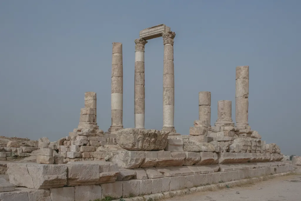
Jordan is a young country standing on very old ground, and holding both halves of that sentence at once is the key to travelling well here. The kingdom itself dates only from the twentieth century. The land was already ancient when Rome was young — a corridor between Arabia, the Mediterranean and Mesopotamia that caravans crossed, empires fought over and small kingdoms defended, leaving a layer of remains in almost every valley. A traveller in Jordan is never just visiting places. They are walking through a sequence, and the sequence has an order, and once you know the order the whole country becomes easier to read.
That is what this page is for. It is not a textbook and it does not try to settle scholarly arguments; where the evidence is genuinely debated, it says so. It is the story behind the sites, told in the order the sites themselves make sense — the Nabataean caravan kingdom that carved Petra, the Roman centuries that built Jerash, the Byzantine churches and mosaics of Madaba, the Crusader castles on the highland road, the long Ottoman quiet, and the short, dramatic twentieth century that produced the modern kingdom. Read it before you go and the ruins stop being a list. Read it after a day at Petra and you will understand why the city is where it is, and why it looks the way it does. For the places themselves, our guide to the best places to visit in Jordan is the companion to this page — that one for the stops, this one for the story that joins them.
One honest note on dates before the story starts. Jordan’s deep chronology is reconstructed from inscriptions, coins and archaeology, and for the earliest periods the dating is approximate and sometimes genuinely contested — Petra’s own beginnings are the famous example, hedged properly in its section below. The dates this article leans on hardest are the fixed points that no serious account disputes, the annexation of the Nabataean kingdom by Rome in 106 CE, the battle of Yarmouk in 636, the founding of the Emirate of Transjordan in 1921, independence in 1946, the peace treaty with Israel in 1994 and the accession of King Abdullah II in 1999. Everything between those anchors is given in the broad shape the evidence supports, and no precision is claimed that the evidence cannot carry.
Timeline at a Glance
Here is the whole story on one screen before it is told properly. Eight eras, each with a place where it still stands in stone. If you only remember one thing from this page, remember the order — caravan kingdom first, Rome second, and the castles and the railway much later than most visitors assume.
| Era | Dates | Where you see it today |
|---|---|---|
| First farmers and early kingdoms | Ancient eras, up to the 4th century BC | Pella, the Amman Citadel |
| The Nabataeans | Until 106 CE | Petra and Little Petra |
| Rome and the Decapolis | 106 CE to the 4th century | Jerash, Umm Qais, Amman |
| Byzantium and early Islam | 4th century to 636 and after | Madaba, Mount Nebo, the desert castles |
| Crusaders and the Islamic centuries | 12th century onwards | Kerak, Shobak, Aqaba |
| The Ottoman centuries | 16th century to the First World War | Hejaz Railway stations, Aqaba Castle |
| Revolt, emirate and independence | 1916 to 1946 | The Wadi Rum railway, Amman |
| The modern kingdom | 1946 to today | Amman and the Jordan of the present day |
Read the table downwards and you are reading Jordan south to north and back again, because the eras are not distributed evenly across the map. The earliest great city is in the far south at Petra, the grandest Roman remains are in the north at Jerash, the Byzantine layer sits in the centre at Madaba, and the modern story gathers in Amman, roughly where the oldest story of all began, on the Citadel hill above the downtown streets. A single trip down the King’s Highway crosses most of the table in order, which is why that road, and not the fast desert highway, is the history traveller’s route through Jordan.
Before the Nabataeans – Farmers, Towns and Iron Age Kingdoms
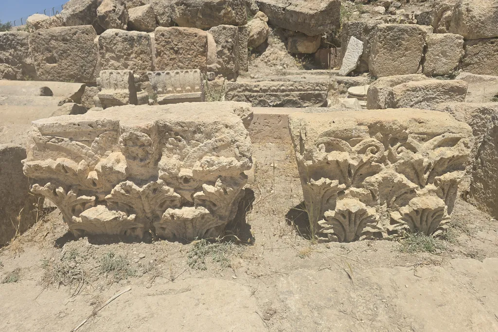
People have lived in this landscape for as long as people have lived anywhere in the region, and Jordan’s position explains why. The land sits at the western edge of the Fertile Crescent, where the highlands catch enough rain for farming and herding and the valleys below run warm and green, and from the earliest farming age onwards it held villages and then towns. One of the most famous is Ain Ghazal, a Neolithic village at the edge of modern Amman whose plaster statues are among the oldest large human figures made anywhere — a reminder, standing in a museum case in the capital, that the story of settled life in Jordan begins thousands of years before any kingdom whose name we know. Sites like Pella in the northern valley were occupied across an almost unbroken span of these early eras, which is why their ruins today are mounds of many periods rather than the remains of one.
By the Iron Age the land east of the Jordan River had organised itself into the small kingdoms the region is first known by — Ammon in the centre, with its capital at Rabbath Ammon on and around Amman’s Citadel hill, Moab in the highlands south of the Dead Sea, and Edom in the rocky country further south, towards what would become Petra. These were real, literate, arguing states — the Moabite Stone, a royal inscription of the king of Moab found near the town of Dhiban, is one of the most famous ancient texts of the whole Levant — and they lived in the shadow of larger powers pressing in from every side, Egypt, Assyria, Babylon and Persia among them. When Alexander the Great’s conquests redrew the region in the fourth century BC, Jordan became a disputed borderland between the Hellenistic kingdoms that inherited his empire, fought over by the Ptolemies of Egypt and the Seleucids of Syria for generations.
That long, unsettled borderland period is the cradle of the next act, and it matters to a traveller for one simple reason. Empires that fight over a corridor weaken in the corridor first, and into that weakening, along the desert fringe where imperial armies were least interested in going, there moved a people of Arab caravan traders who were learning to do something nobody else in the region could do as well. They could live in the dry country, move goods through it, and find water where maps showed none. Their name was the Nabataeans, and the city they built out of that skill is the reason most visitors come to Jordan at all.
The Nabataeans and Petra – A Kingdom Built on Caravans and Water
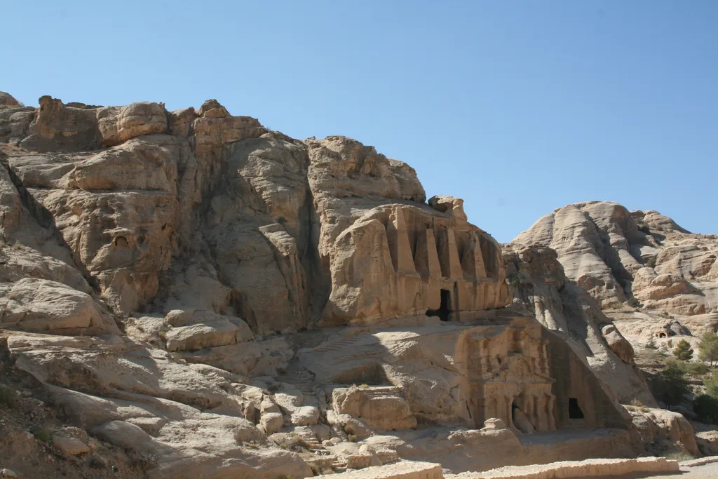
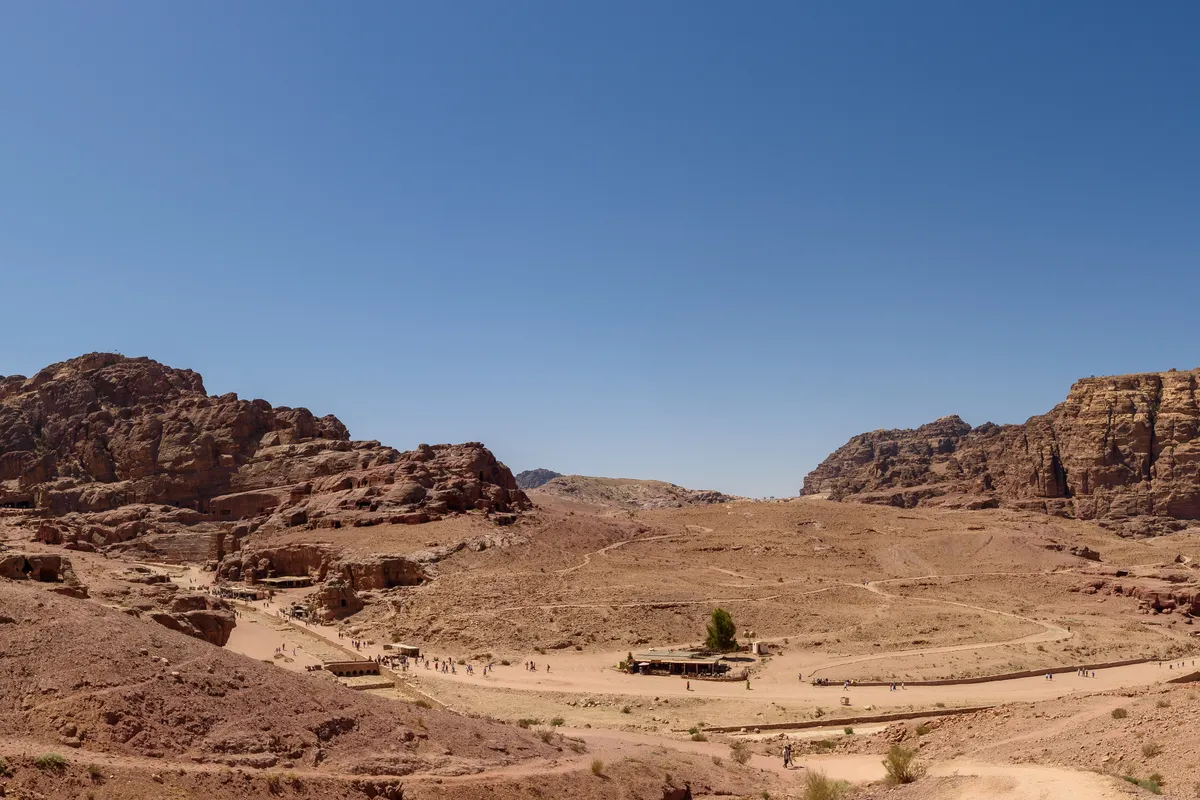
The Nabataeans appear in the historical record in the centuries before Rome, first referenced as desert traders and raiders in the fourth century BC, and the honest account of their rise has to begin with a hedge, because their early chronology is genuinely debated. Travellers’ guides often give Petra a tidy founding date around 312 BC, but that date rests on inference rather than on any inscription, and archaeological evidence of a settled Nabataean capital at Petra is firm from around the second century BC rather than earlier. What is not debated is the shape of what they built. From their base in the mountains of southern Jordan the Nabataeans came to dominate the caravan trade that carried frankincense, myrrh and spices from southern Arabia north to the Mediterranean ports and to Damascus, taxing and protecting the traffic as it passed through their hands, and growing rich on a route that much richer empires depended on.
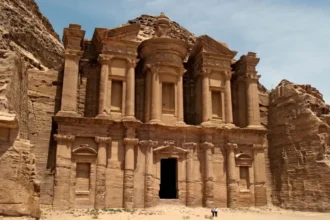
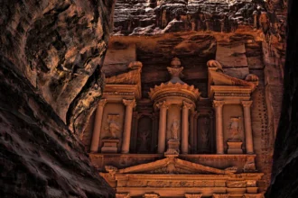
The second half of their genius was water. Petra sits in dry sandstone mountains where rain falls rarely and violently, and the Nabataeans turned that liability into the foundation of a city, damming the wadis, cutting channels along the canyon walls — the Siq, the gorge into Petra, carries the remains of the system along its length — and sealing cisterns that held the winter floods against the summer. A hidden city with its own water, at a crossroads of trade, defended by mountains, was almost unassailable, and for roughly two centuries the Nabataean kingdom stood as an independent Arab state in a region of empires, its kings treated as partners and buffers by a Rome that found it more useful intact than conquered. The architecture that survives, the Treasury and the Monastery and the royal tombs, is the visible spending of caravan wealth, cut into rock that the same water system had made habitable.
The end, when it came in 106 CE, was administrative rather than dramatic. On the death of the last Nabataean king, the emperor Trajan annexed the kingdom and reorganised it as the Roman province of Arabia Petraea, and Petra itself continued as a prosperous Roman city for generations — the colonnaded street and the enlarged theatre are Rome building on a Nabataean foundation, not replacing it. What faded the city, slowly, was change rather than catastrophe, trade routes shifting towards the sea and other roads, and earthquakes in the centuries that followed damaging what remained, until the great facades stood in a quiet valley known to the local Bedouin and largely forgotten by the wider world. The Swiss explorer Johann Ludwig Burckhardt reached the ruins in disguise in 1812 and carried the news back to Europe, which is why Petra’s modern fame dates from the nineteenth century rather than from antiquity. Our Petra travel guide walks the city in the order its builders laid it out, and it reads differently once this chapter of the story is in place.
Rome and the Decapolis – The Great Building Centuries
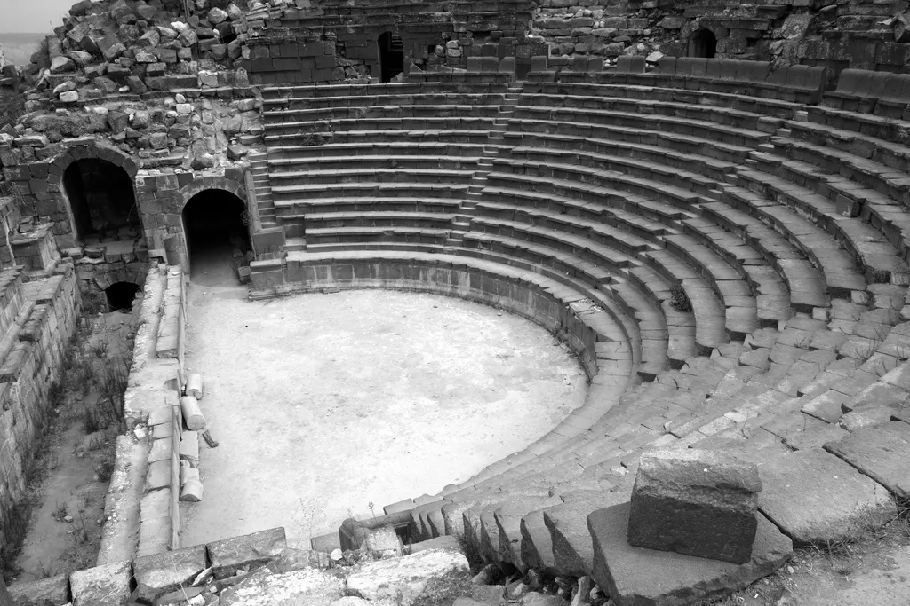
Rome had been the power behind Jordan’s politics since the first century BC, when Pompey’s campaigns brought the region inside the Roman sphere, but direct rule east of the Jordan came in stages, and 106 CE was the decisive one. With the Nabataean kingdom absorbed, the whole of what is now Jordan lay inside the empire, and the empire did what it did everywhere — it built. Roads were paved and mile-marked across the highlands, the great north-to-south route that later ages would call the King’s Highway among them. Aqueducts carried water to cities that grew to a scale the region had never supported, and temples, theatres, baths and colonnaded streets rose in a recognisably Roman language of stone that a visitor can still read at site after site today.
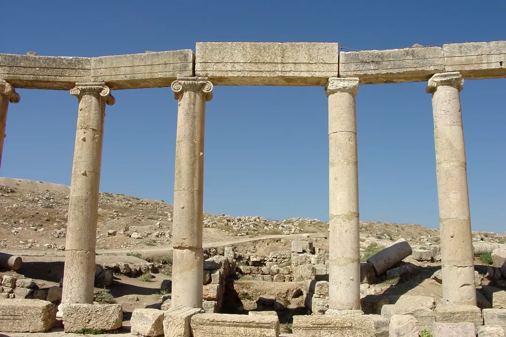
The showpieces of that building age were the cities of the Decapolis, a group of ten cities — the name is Greek for ten cities — whose culture was Greek in language and Roman in power, planted across the fertile north of Jordan and its borders. Gerasa, modern Jerash, is the survivor that defines them, a colonnaded city of theatres, temples and an extraordinary oval plaza that ranks among the best-preserved Roman cities anywhere. Gadara, modern Umm Qais, was famous in its own time as a city of poets and philosophers, its theatres cut from the dark local basalt, looking out over the Jordan Valley and the hills beyond. Philadelphia, modern Amman, was a Decapolis city too, which is why a Roman theatre and a hilltop temple stand in the middle of a modern Arab capital. Pella, in the valley below, completes the set most visitors can reach, its ruins stacking Roman remains onto the far older mound beneath them.
What matters for the traveller is the layering, because Rome in Jordan rarely erased what came before and was rarely erased by what came after. Petra’s Roman street runs through a Nabataean city. Amman’s Citadel carries a Roman temple above an Ammonite hill and below later palaces. Jerash’s churches belong to the next era but stand inside a Roman street plan. Jordan’s Roman layer is therefore not a set of isolated ruins but the connective tissue of the whole country’s archaeology, the middle chapter that almost every major site passes through, and the reason a history-focused trip spends as long in the green Roman north as it does in the famous desert south.
Byzantium and Early Islam – Churches, Mosaics and a New Faith
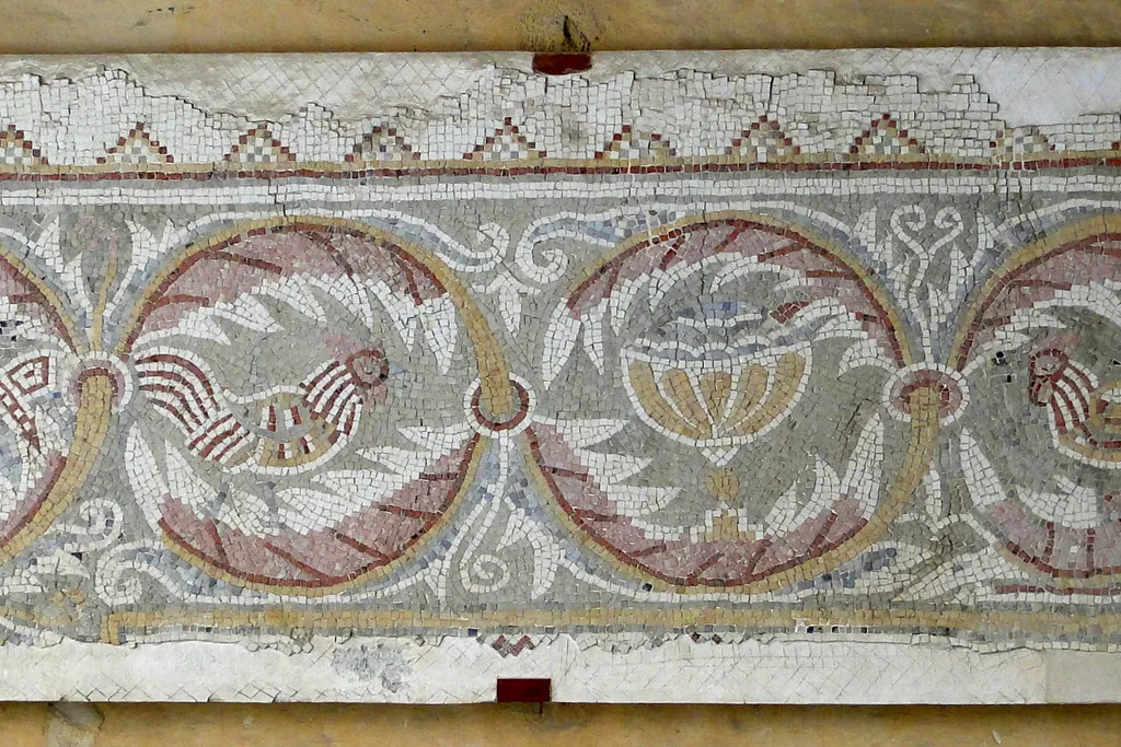
When the Roman Empire divided, Jordan fell to its eastern, Greek-speaking half, the empire we call Byzantine, and for three centuries the country was a prosperous Christian land of towns, villages and churches. This is the layer modern visitors most often walk over without noticing, because it lives at floor level — Jordan’s Byzantine heritage is written in mosaic, in the church pavements of Madaba and Mount Nebo and a hundred smaller sites, where craftsmen laid pictures in stone of cities, seasons, animals and scripture. The supreme survivor is the Madaba Map, a mosaic map of the Holy Land made in the sixth century for the floor of the Church of St George in Madaba, the oldest surviving map of the region in any medium and still, in its careful depiction of Jerusalem, a document scholars argue over. A map on a church floor is a perfect emblem of the age, learned, devout and confident that the world could be pictured whole.
That world changed with extraordinary speed in the seventh century. In 636, at the battle of Yarmouk, fought near the river gorge that now marks Jordan’s northern border country, the armies of the early Islamic caliphate defeated the Byzantine forces decisively, and the region passed under Muslim rule — the hinge on which Jordan’s whole later history turns. What followed was conversion and Arabisation over generations rather than in a day, and under the Umayyad caliphs, ruling from nearby Damascus in the century after Yarmouk, Jordan was close to the centre of power for the first time since Petra’s prime. The proof stands in the desert east of Amman, where the Umayyad elite built the small palaces and bath houses now called the desert castles, most famously Qasr Amra, whose walls carry frescoes of dancers, musicians and hunting scenes that startle anyone who expects early Islamic art to be only geometry.
As the caliphate’s centre moved east to Baghdad under the Abbasids, Jordan drifted back towards the edge of empires, a provincial land of farmers, pilgrims and garrisons, quieter than before and building less. Churches and mosques stood side by side in its towns for long stretches of this period, and the mosaic floors of Madaba were buried and preserved by the quiet rather than destroyed by it. For the traveller, this era explains two things that otherwise puzzle — why so much of Jordan’s finest early art is underfoot in church floors, and why a region so rich in remains has so few great standing buildings from these particular centuries. The wealth had moved on, and the next people to build largely in Jordan would arrive with an army and a cross.
Crusaders and the Islamic Centuries – Castles on the Highland Road
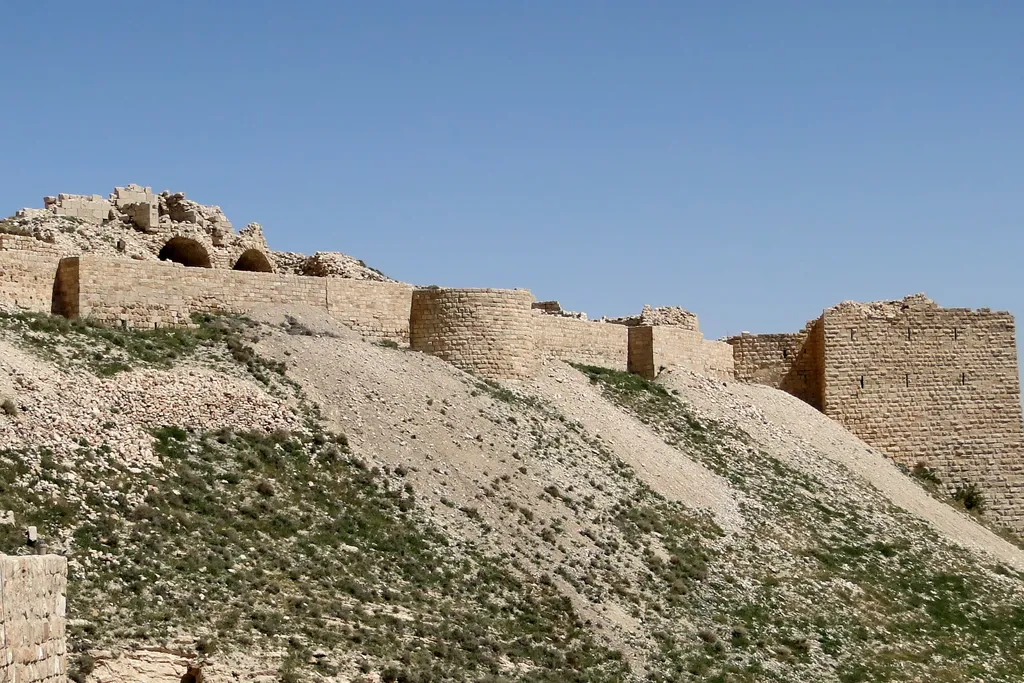
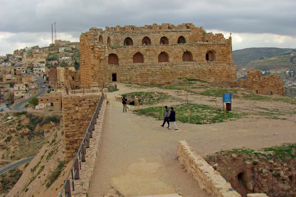
The Crusades brought Europe’s wars to Jordan in the twelfth century, when the Crusader kingdom of Jerusalem reached east of the river and organised its lands there as the lordship its rulers called Oultrejordain, the land beyond the Jordan. Its purpose was strategic and commercial in equal measure — to guard the eastern frontier, and to tax and threaten the great caravan road that ran down the highlands between Damascus and Arabia, the same corridor the Nabataeans had grown rich on a thousand years earlier. To hold it, the Crusaders built the castles that still dominate the route. Montreal, at Shobak in the south, was among the earliest, raised on a conical hill within sight of the road. Kerak, further north, became the lordship’s stronghold and its most famous address, a vast fortress of passages and halls above the town, whose most notorious lord, Reynald de Châtillon, used it as a base for attacks on caravans and pilgrims that helped provoke the reckoning that followed.
The reckoning was Saladin. In the late twelfth century his forces took Kerak after a hard resistance and the Crusader presence east of the Jordan ended, roughly within a human lifetime of its beginning — a useful corrective for travellers who imagine the Crusader castles as ancient fixtures of the landscape. They are, in the span of Jordan’s story, a brief and violent episode, and their afterlife was longer than their first life. Under the Ayyubid and then the Mamluk rulers who followed, Kerak remained an important fortress and at times a near-capital of the region in its own right, strengthened and reworked, while the highland road settled into its other great role of these centuries, as part of the pilgrimage route by which generations of the faithful travelled from Damascus towards Mecca, guarded by forts and watered by state-built cisterns.
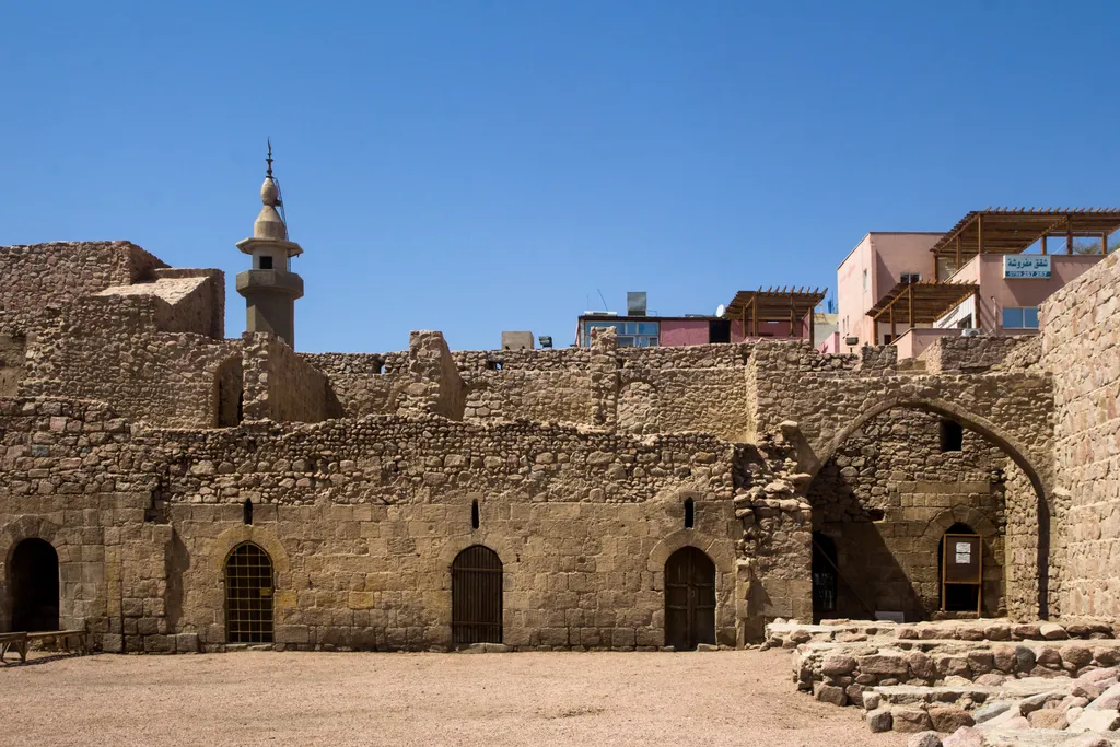
Aqaba, at the head of the Red Sea gulf, carries this period in stone as clearly as the highland castles do, its fort rebuilt across these Islamic centuries to guard the port and the pilgrim road where they met the sea. By the time the Ottoman Turks absorbed the region in the sixteenth century, the pattern of Jordan’s medieval centuries was complete — a land valued by empires chiefly as a road, taxed at its castles, crossed by caravans and pilgrims, and otherwise left largely to its towns, its tribes and its farmers. That pattern, more than any single dynasty, is what the Ottoman centuries inherited, and it held, with one transformative interruption, for four hundred years.
The Ottoman Centuries and the Hejaz Railway – A Quiet Land and a Line of Steel
From the sixteenth century until the First World War, Jordan was a district of the Ottoman Empire, administered as part of the province centred on Damascus, and for most of those four centuries it was one of the empire’s quieter corners. There were no great building ages and no court cities here in the Ottoman centuries. Authority in the highlands and the desert fringe was exercised lightly and often indirectly, real power on the ground sitting with town notables and the Bedouin tribes of the desert and steppe, while the state’s permanent concern was the one it had inherited — the pilgrimage road to Mecca, which it guarded with a chain of small forts and reservoirs down the eastern desert. Amman itself dwindled in these centuries to a ruin field and a small settlement, an almost unbelievable fact to hold in mind while standing in today’s sprawling capital, and it only began growing again in the late nineteenth century, when Circassian refugees from the Caucasus were settled there by the empire.
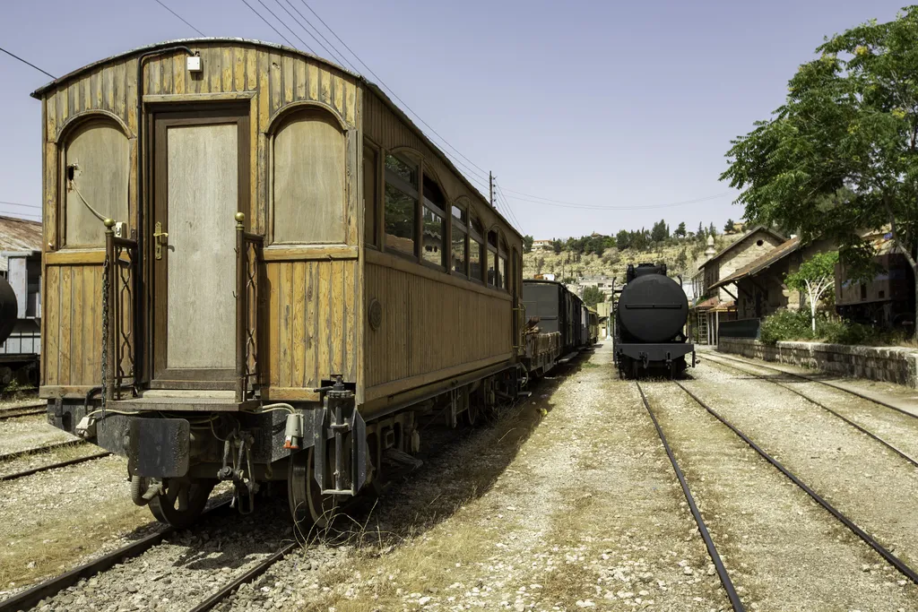
Then, in the first decade of the twentieth century, the Ottomans built the thing that would change the country’s fate — the Hejaz Railway, a line of steel running from Damascus south through Jordan towards Medina in the Hejaz, built to carry pilgrims to the holy cities faster and more safely than the caravan road ever could, and to bind the empire’s Arab provinces to its centre. Its stations became anchors in a land of few fixed points. Amman grew around its station and its yards, Ma’an in the south became a railway town, and bridges, water towers and station buildings stamped a new, industrial layer onto the ancient corridor, one the traveller can still see at Amman’s working heritage station and in the desert sidings of the south.
The railway’s historical irony is that it barely served its intended purpose before becoming a target. The pilgrim traffic it was built for had only a few seasons before the First World War, and in that war the line’s strategic value made it the spine and the prize of the fighting in Jordan, attacked, defended and cut by the forces of the Arab Revolt. The quiet Ottoman centuries, in other words, ended not with a whimper but with a war fought along a railway line, and the kingdom that eventually emerged from that war would keep the railway’s geography — a state strung along a north-to-south line, with its capital at the station town of Amman.
Revolt, Emirate and Independence – The Twentieth-Century Founding
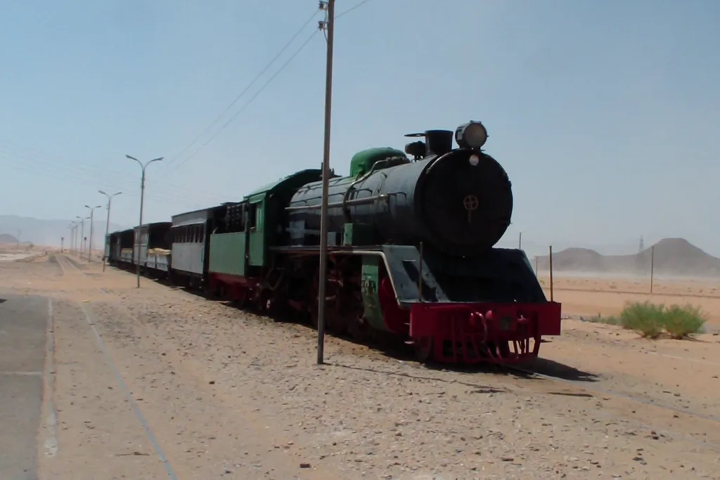
In 1916, Sharif Hussein of Mecca, the Hashemite guardian of Islam’s holiest city, raised the Great Arab Revolt against the Ottoman Empire, in alliance with Britain and in expectation of an independent Arab state in the lands the revolt would free. The revolt’s war was substantially Jordan’s war. Arab forces under the Sharif’s sons, among them Abdullah and Faisal, moved north up the Hejaz corridor, striking the railway, taking the Red Sea port of Aqaba in 1917 in the revolt’s most celebrated stroke, and fighting through the highlands towards Damascus as the Ottoman order collapsed. Wadi Rum’s cliffs and the desert railway country are the landscape of that campaign, which is why a desert famous for older wonders carries a twentieth-century story as its most recent layer.
What followed the victory was not the single Arab kingdom the revolt’s leaders had expected, but a patchwork of mandates in which Britain held Palestine and the land east of the Jordan. In 1921 that eastern territory was organised as the Emirate of Transjordan, with Abdullah, the Sharif’s son, as its emir, ruling from Amman under British protection and subsidy. The emirate was poor, thinly populated and bordered by deserts and stronger neighbours, and its quarter-century of existence was spent building the skeleton of a state — an administration, a small army in the Arab Legion, and a capital growing out of the Circassian and railway town. Travellers sometimes hear the emirate dismissed as an artificial creation, and its borders were indeed drawn in the diplomacy of the period rather than grown from older states, but the same is true of many durable countries, and Transjordan’s institutions proved sturdier than the circumstances of their founding promised.
In 1946 the mandate ended and the emirate became fully independent as the Hashemite Kingdom — first styled of Transjordan, and soon after simply of Jordan, the name it keeps today. Abdullah became its first king. His assassination a few years later, and the brief reign that followed, brought his grandson Hussein to the throne as a teenager in the early 1950s, and the state Abdullah founded and Hussein led through the rest of the century is the direct ancestor of the Jordan a traveller visits now. The founding story matters to a visitor for a practical reason as much as a scholarly one. It explains the monarchy whose portraits hang everywhere, the Hashemite family’s claim rooted in the revolt and in Mecca, and the choice of Amman, the station town on the Citadel hill, as the capital of a kingdom assembled along a railway line.
The Modern Kingdom – King Hussein, Peace and King Abdullah II

The second half of the twentieth century in Jordan is, to a large degree, the reign of one man. King Hussein ruled from the early 1950s until his death in 1999, one of the longest reigns of the modern world, and across those decades Jordan was transformed from a poor desert emirate into a developed, urbanised state — Amman swelling from a small town into a metropolis of hills and suburbs, universities, hospitals and an educated workforce becoming the country’s real resources in a land with few others. The reign was not a quiet one. Jordan sat at the centre of the region’s conflicts, its population repeatedly reshaped by waves of Palestinian refugees from the wars around it, and the West Bank, held by Jordan after 1948, was lost in the war of 1967 — a fact this article records plainly and briefly, because a history told for travellers should name the events that shaped the country without pretending to adjudicate them.
The reign’s defining diplomatic act came in 1994, when Jordan signed a peace treaty with Israel, only the second such treaty between Israel and an Arab state, settling the border and opening the era, which continues, in which Jordan’s ancient sites could be visited as part of a stable, open country rather than a front-line state. For the traveller, that treaty is not an abstraction. It is one of the reasons the Jordan of Petra hotels, desert camps and King’s Highway road trips exists in its present form, and why the country’s tourism story and its modern political story cannot honestly be told apart.
King Hussein died in 1999 and was succeeded by his son, the present king, Abdullah II, under whom Jordan has continued as a constitutional monarchy with a reputation, carefully maintained, for steadiness in an unsteady region. Modern Amman, the Abdali towers a short walk from the Roman theatre, is the visible result — a capital that has grown faster than almost any other layer of the country’s past, wrapped around hills that carry Ammonite, Roman, Byzantine and Umayyad remains. The modern kingdom is the shortest chapter in this article and the shortest in the ground as well, less than a century of statehood over thousands of years of settlement, and that proportion is exactly the thing to carry into the sites. The state is new. Almost everything it guards is not.
Reading the Sites With This Story – Petra, Jerash, Madaba and Kerak
History earns its place in a trip when it changes what your eyes do at a site, so here is the whole story translated back into the four places most travellers will stand in. At Petra, read downwards from the wealth to the water. The Treasury’s facade is caravan money made visible, the theatre’s expansion is Rome inheriting the city after 106 CE, the churches tucked among the ruins are the Byzantine afterlife, and the water channels along the Siq are the real Nabataean masterpiece, the engineering that made all the carving possible. Travellers who arrive knowing that sequence stop photographing a facade and start reading a city, and our Petra travel guide is written to be walked in exactly that order.
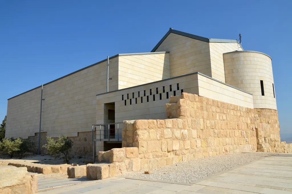
At Jerash, read the city as an argument about empire. The colonnaded streets, the oval plaza, the theatres and the temples are Rome and the Decapolis declaring that this valley in the green north was not a frontier but a centre, and the churches fitted later into the Roman plan are the Byzantine chapter written inside the Roman one. At Madaba, lower your eyes. The history there is at floor level, in the mosaic map of the sixth century and the pavements around it, and it tells the Byzantine story better than any standing wall could — a Christian town picturing its world in stone at the moment before Yarmouk changed it. Between those two stops, Mount Nebo adds the viewpoint of tradition, the hill from which Moses is said to have seen the Promised Land, its church and mosaics part of the same Byzantine layer as Madaba’s floors.
At Kerak, read the castle as a tax office with battlements. Its size makes sense only when you know it existed to dominate the caravan and pilgrim road below, first for its Crusader lords in the twelfth century, then for the Muslim rulers who kept and strengthened it for the same purpose, and the road it guards is the King’s Highway you have just driven to reach it. Pull the four together and the pattern of the whole article stands in one itinerary — Nabataean south, Roman north, Byzantine centre, Crusader highlands, an Ottoman railway to ride part of the way and a young kingdom holding the whole inheritance. The best places to visit in Jordan guide gives each of these places its practical due; this page’s job was to give them their order, and a traveller carrying both will find the sites answering questions they did not know they had.
Questions Travellers Ask About Jordan’s Past
How old is Jordan? Both answers are true, depending on what the question means. As a state, Jordan dates from the Emirate of Transjordan in 1921 and from independence in 1946 — a young country by any measure. As a lived-in land, it is among the oldest continuously settled landscapes in the world, with farming villages thousands of years old and Iron Age kingdoms whose names survive in inscriptions. Most of the surprise travellers feel here comes from that gap between a new flag and very old ground.
Who exactly were the Nabataeans? An Arab people of the desert fringe who turned caravan trade into a kingdom. They grew rich protecting and taxing the incense and spice routes between southern Arabia and the Mediterranean, mastered the harvesting of water in dry mountains, and made Petra their capital, before Rome annexed their kingdom in 106 CE. Their early chronology is genuinely debated — the evidence for a settled capital is firm from around the second century BC — but their achievement is not in doubt, because it is still standing in the cliffs.
Why are there so many Roman ruins in Jordan? Because Jordan was not Rome’s frontier but its interior. After 106 CE the whole country lay inside the empire for centuries, wealthy enough from trade and farming to build at full Roman scale, and its Decapolis cities in the north — Jerash above all — were rich, Greek-speaking centres that paved, colonnaded and theatred themselves like cities anywhere in the Roman world. Dry air, later quiet and stone construction did the rest, and preserved them.
What is the Madaba Map, and why does it matter? A mosaic map of the Holy Land laid in the sixth century in the floor of the Church of St George at Madaba, and the oldest surviving map of the region. It matters twice over — as evidence, because its depiction of Byzantine Jerusalem and the towns of the region preserves details found nowhere else, and as a sign of its age, a Christian culture confident enough to picture its whole sacred geography under the feet of a congregation.
If I only have time for the history, where should I concentrate? Petra for the Nabataeans, Jerash for Rome, Madaba and Mount Nebo for Byzantium, Kerak or Shobak for the Crusader centuries, and Amman — Citadel, theatre and Hejaz station together — for the whole stack from Ammonites to the modern kingdom in a single walkable centre. That set covers every era in this article except the deep past, and Pella adds that on the way north. A trip shaped like that is a history degree in a week, with better lunches.
Old Land, Young Kingdom
The shortest true summary of Jordan’s past is the sentence this article began with, and it bears repeating at the end because the country will keep demonstrating it to you. The land is old — farmed in the first ages of farming, ruled by Ammon and Moab and Edom, enriched by Nabataean caravans, built over by Rome, floored with Byzantine mosaics, castled by Crusaders and Mamluks, quieted by Ottomans and woken by a railway. The kingdom is young — an emirate of 1921, an independence of 1946, two long reigns, a peace treaty, and a capital that is still growing up its hills. Jordan’s particular pleasure as a destination is that neither half hides the other. The new state maintains the old layers, signs them, guards them, and its own story is told openly alongside them.
So read the sites in their order when you go. Start with the water channels in the Siq and end, if your route allows, with a train or a station platform in Amman, where the kingdom began. Stand in Jerash’s plaza knowing the empire that built it had just absorbed the kingdom that built Petra, and stand in Kerak’s halls knowing its lords held the road below for taxation as much as for God. A country that can be understood on one trip is a rare thing, and Jordan, for all the millennia stacked inside it, can be — because its history is not a confusion but a sequence, and the sequence, now, is yours.