Theth to Valbona Hike – the Albanian Alps Pass Walk, Done Properly
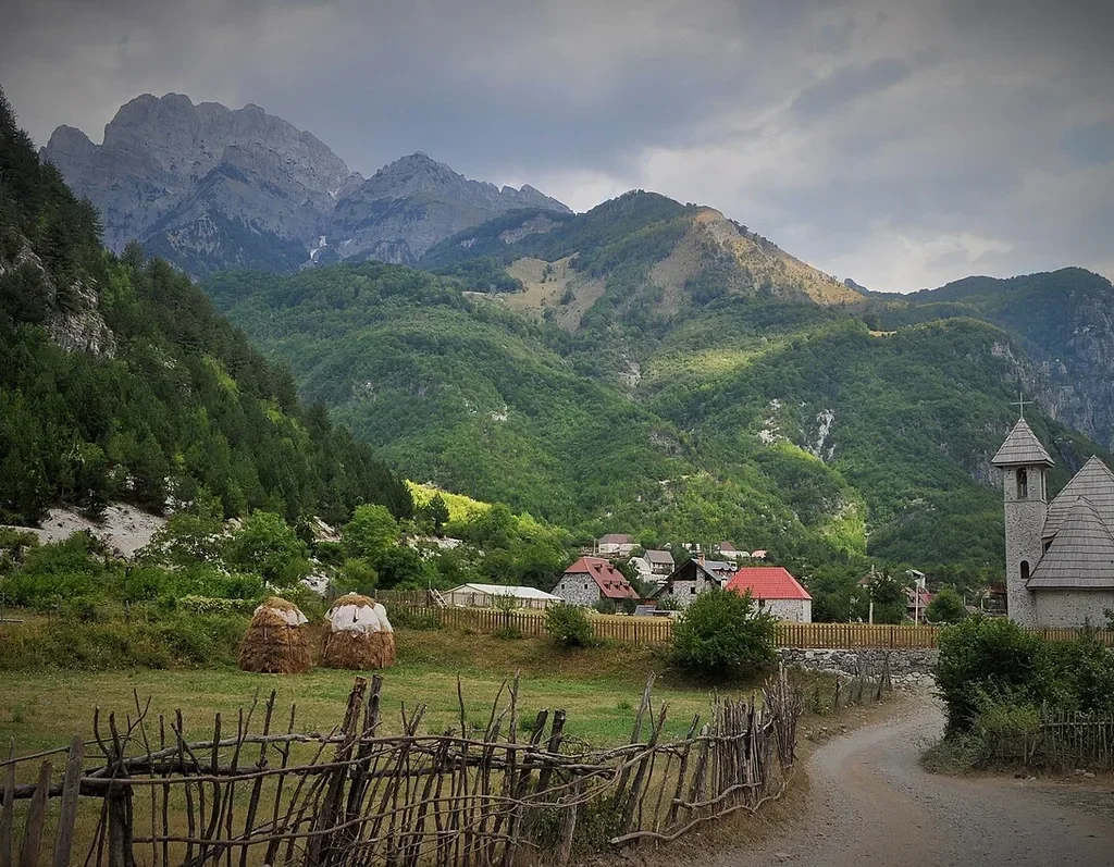
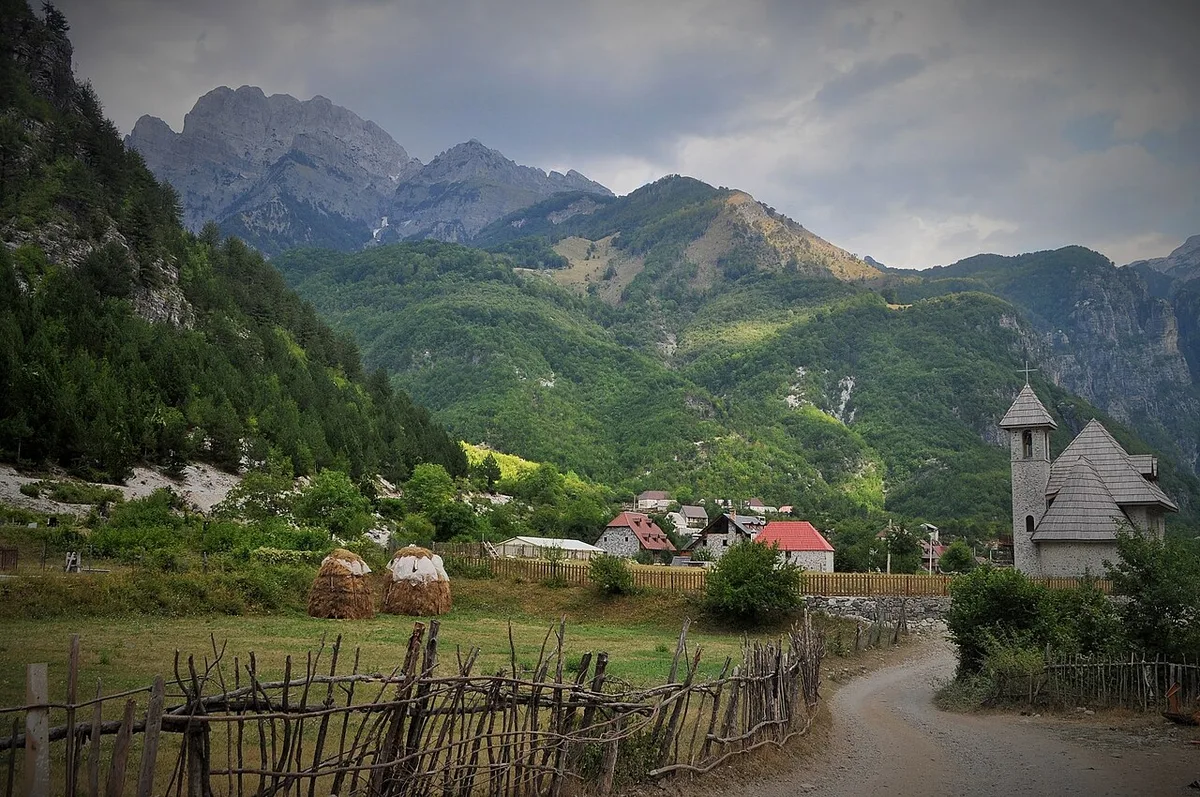
Every mountain country has one walk that becomes its shorthand, and in Albania it is this one: out of Theth at dawn, up through beech forest and alpine meadow to a high limestone saddle, and down the far side into a second valley, a second village and a bed for the night. The Theth to Valbona hike crosses Qafa e Valbonës – Valbona Pass – on an old mule track that linked the tribal territories of Shala and Nikaj long before it linked guesthouses, in a single long day. Two remote valleys, one serious climb, and not a metre of it on tarmac.
Two clarifications belong at the top, because the internet muddles both. First, the whole walk is inside Albania. Theth and Valbona are Albanian villages in the same range, the Bjeshkët e Nemuna – the Accursed Mountains – and crossing the pass involves no border and no passport stamp; the border formalities walkers read about belong to other stages of the Peaks of the Balkans network, whose most famous single stage this is. Second, there is no road over the pass and no shortcut back: once you climb out of one valley, the only way to a bed is over the top – which is why the walk needs the planning this guide gives it.
Both valleys now sit inside the Alps of Albania National Park, created in January 2022 by merging the old Theth and Valbona Valley national parks, and the trail between them is the park’s signature walk. The wider country picture sits in our Albania travel guide; this page is the crossing itself, told in walking order, with its numbers given as the ranges honest sources give. A note on this guide’s policy, stated once: we print no prices and no timetables. Fares, ferry schedules and guesthouse rates here change season by season, so anything printed would be quietly wrong by the time you travel. Journey times are given as approximations, and the mechanisms – how each leg is booked, carried and connected – are explained in full.
Theth to Valbona Hike at a Glance
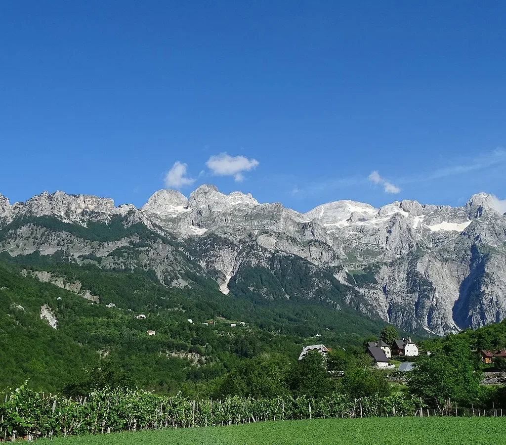
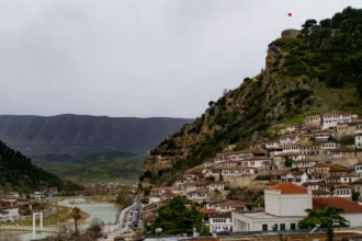
Theth spreads along the floor of the Shala valley at roughly 750 metres, a scatter of hamlets rather than a single village centre, and Valbona lies a similar distance above sea level in the next valley east. Between them the ridge rises to roughly twice that height.
| Route | Point to point in one day – no road crosses the pass |
| Start | Theth village (the trailhead board stands at 747 m) |
| Finish | Valbona village, via Rragam and Fusha e Gjesë |
| Distance | About 14-18 km, depending on where you start and stop the clock |
| Ascent | Roughly 1,000-1,200 m of climbing from the Theth side |
| High point | Valbona Pass (Qafa e Valbonës), usually quoted at 1,795 m |
| Time needed | 6-9 hours including stops; the Theth trail board says 5 h 50 min |
| Season | Late May or early June to early October – the snow decides |
| Marking | White-red-white paint marks and fingerposts; a Peaks of the Balkans stage |
| Difficulty | Moderate – a long, honest mountain day, with no technical ground |
| Sleep | Guesthouses at both ends; nothing on the pass itself |
That distance spread needs one sentence of defence. The official stage page lists 16.4 km, while its own GPS description measures 13.9 km of trail; guidebooks quote 16-17 km. They are measuring honestly – from different doors. Guesthouse to guesthouse, plan on the longer figures. The pass height works the same way: 1,795 m is the trail authorities’ figure, GPS tracks come in lower, and some books round it to 1,800 m. Treat every number here as a planning range.
The Route, Part One – Out of Theth and Up Through the Beech Forest
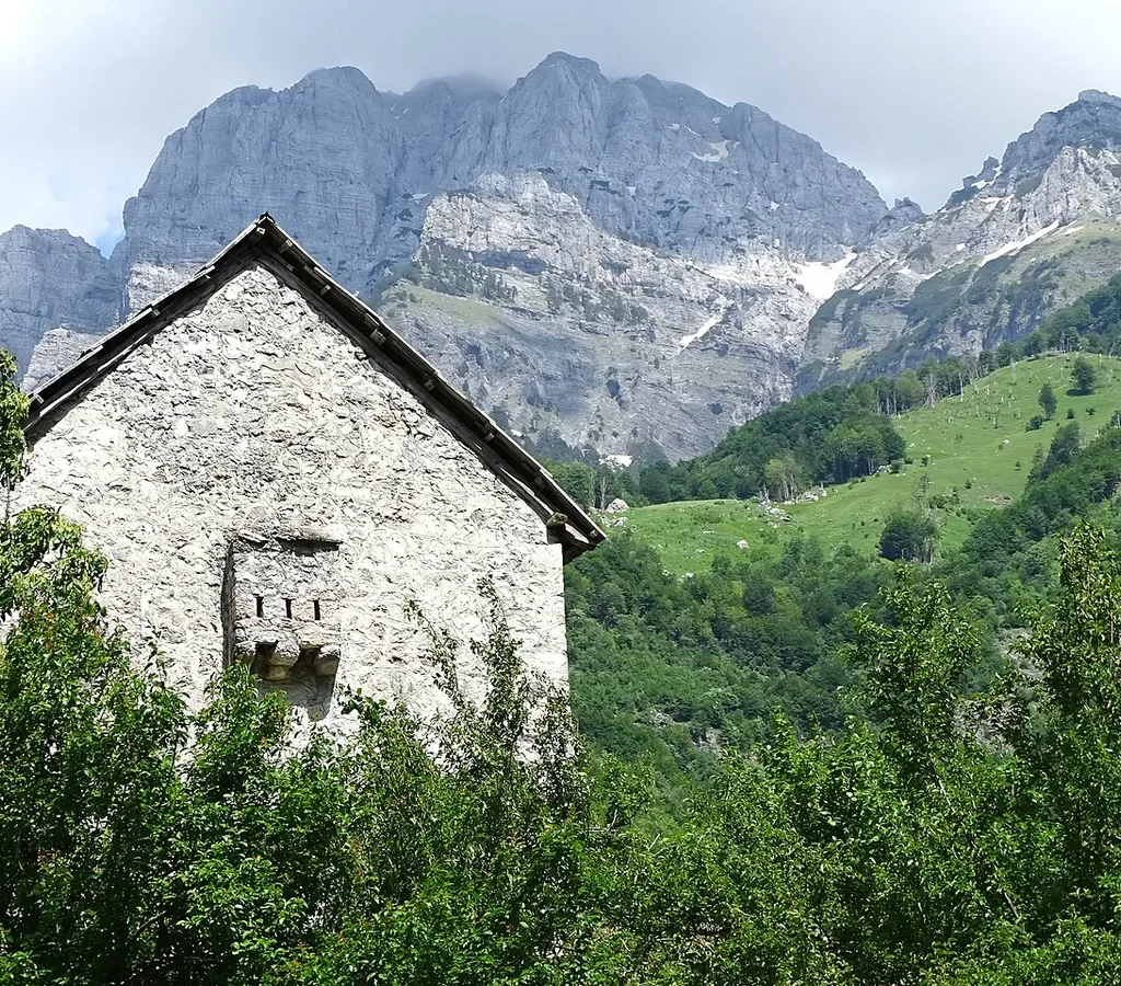
The walk begins where Theth begins, at the bridge over the river in the heart of the village, where the trail board stands at 747 metres and points the day’s timings at you in yellow: 3 hours 30 to the pass, 5 hours 20 to Rragam, 5 hours 50 to Valbonë. Believe their shape rather than their speed – they are fit local times, and most visitors should add an hour or two of stops before treating them as a plan. From the bridge the route follows the gravel road beside the Theth River, crosses a small footbridge, and reaches a junction of signposts where the long-distance trail splits – one way towards Gusinje in Montenegro, the other, yours, towards the Valbona Valley. If the signposts and your map app ever disagree on this walk, follow the signposts – they describe the ground you are standing on.
The road section climbs gently past the first houses of Gjelaj, the hamlet at the valley’s upper end, and this is the day’s one legitimate shortcut: a vehicle transfer from Theth to Gjelaj can be arranged through guesthouses, cutting the lower road walk for walkers whose day needs trimming. Beyond Gjelaj the route narrows to a proper footpath and enters the section most walkers remember second-best: old-growth beech and birch forest, cool even in August, climbing in shade on leaf litter. The forest opens onto an alpine meadow – the ascent’s natural rest stop – where, from mid-May to late October by the trail authority’s account, a small coffee hut (Zef Rrgalla’s) sells drinks and snacks in season. It is the last commercial anything until the far side of the pass, and the right place to eat and refill before the final climb.
That final climb is the day’s honest work – roughly an hour to an hour and a half of steady, stony ascent on an open slope, the forest behind you and the limestone world taking over. Nothing on it is technical, but it is exposed to whatever the weather is doing, which is why the experienced local advice is unanimous about starting early: walkers who leave Theth around dawn do this climb in cool air and reach the saddle before the afternoon, when summer thunderstorms build over these ridges. The pass reveals itself the way good passes do – not as a summit moment but as a widening, the slope easing, the far side of the world appearing one step at a time.
The Route, Part Two – the Pass, and the Long Way Down to Valbona
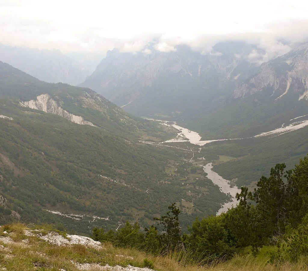
Valbona Pass is a broad, open saddle, and its gift is that it faces both ways. Behind you, the Theth valley lies small and green under its own wall of peaks. In front, east, the Valbona valley runs away in the opposite style entirely – a wide glacial trough, its river a pale braid of gravel channels, with the serrated ridge of the range’s highest ground on the horizon. The biggest name in that view is Maja Jezercë, at 2,694 metres the highest peak in Albania and the whole Dinaric chain, which stands over the same massif. Take the pass slowly: it is the one point where both halves of the walk can be read at once – and the last easy decision point, because the descent, once started, commits you to Valbona.
The way down begins with gravel switchbacks, zigzagging north and then northeast off the saddle, and then crosses a dry streambed to reach the descent’s one fixed point: a small café, Simoni’s, set beside a fresh mountain spring. In season it is a genuine refreshment stop and the reliable water refill of the eastern side. Treat its opening as seasonal rather than guaranteed, and never plan your water around it alone. From the spring the trail bears left and drops more steeply towards Rragam, the first settlement of the Valbona side – this steeper, rockier character is the thing to remember if you are weighing up directions, because what is a knee-testing descent in this direction is a stout climb in the other.
At Rragam the mountain path hands you back to the valley’s machinery. A 4WD track runs east along the riverbed to Fusha e Gjesë, the meadow where the asphalt road ends and where the walking, for most people, effectively finishes – guesthouses cluster along the valley road from here through Valbona village, and a lift or a gentle final stroll covers the remaining distance. Door to door, the trail board’s 5 hours 50 has become, for almost everybody, a day of six to nine hours. The pass feels like the finish line from below; it is the halfway point, and the walkers who budget their water, daylight and knees for the whole crossing rather than the climb are the ones who arrive in Valbona in the mood the valley deserves.
Which Direction Is Better – Theth to Valbona, or Valbona to Theth?
The walk has two directions, and each wins on different grounds. The classic crossing, still the most chosen, runs Theth to Valbona. Its logic is gravitational: the big climb comes first, in the morning cool, on fresh legs, and the longer descent into Valbona – switchbacks, spring café, the steep drop to Rragam, the softening valley track – is spread over more kilometres and more variety. You crest the pass knowing the hardest metre is behind you, and Valbona’s guesthouses make a gentler landing than Theth’s enclosed amphitheatre.
The case for Valbona to Theth is real, and local operators who run the loop both ways make it often. The ascent from Rragam is shorter, so the steep climbing is concentrated and finished sooner; the descent into Theth, though rockier in its upper section, runs through beech forest in afternoon shade rather than down an open slope in sun; and there is a logistics dividend that decides many itineraries – from Theth, the return to Shkodër is a single direct road journey, whereas finishing in Valbona means chaining a minibus, a lake ferry and another minibus to get back. Knee-sufferers are often steered this way too: better to climb the steep section above Rragam than descend it tired.
What should actually decide it is the loop, not the gradient. Most walkers start from Shkodër, and the order in which they want the road journey and the Komani Lake ferry determines the direction more sensibly than any argument about knees. Ride the ferry first and you walk Valbona to Theth; take the mountain road first and you walk Theth to Valbona. Both days are the same mountain. The classic loop section below sets out both orientations; the only firm advice is to pick the loop first and let the direction follow – and, whichever way you walk it, to start at dawn.
When to Walk – the Season, and the Snow That Sets It
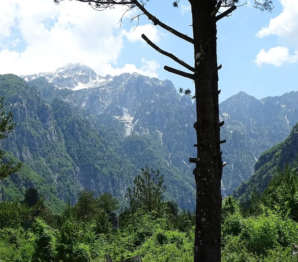
This is a summer walk with long shoulders, and the shoulders need respecting. The core season, when the pass is reliably clear, the guesthouses are open and the trail’s cafés are trading, runs from about mid-June to mid-September, and most sources extend the workable window from late May to early October. The trail authority’s stage notes have the Theth-side coffee hut operating mid-May to late October – as good a proxy as any for the season’s outer edges. Within that window, June and September are the connoisseur’s months – thinner crowds, kinder temperatures, meadows in flower, beech forest turning – while July and August bring the fullest guesthouses and the strongest argument for dawn starts.
Snow is the season’s editor, and it does not work to a calendar. The pass sits high enough that snow lies on its shaded approaches well into spring: in a typical year the crossing opens in late May or early June, but in heavy snow years hard snow patches survive on the north-facing ground below the pass into mid-June, and the descent gully on the Valbona side can hold dangerous snow later than any date printed in a guide. Autumn reverses it: the first storms can whiten the pass from late September, and a walk becomes a mountaineering proposition after fresh snow. The rule local operators repeat is to ask at your guesthouse the night before, not at your desk the month before: conditions here are a local, current fact.
The villages keep the same calendar: both largely close down outside the season – guesthouses shut, the ferry stops, and the valleys return to the families who farm them. A winter crossing exists for equipped mountaineers with local knowledge – at least one specialist operator publishes winter variants precisely because the summer trail is not safely followable under snow. For the walk described in this guide – the marked summer trail, walked in boots rather than crampons – the season is the one above, and no itinerary should be built on stretching it.
Fitness, Difficulty and the Honest Warnings
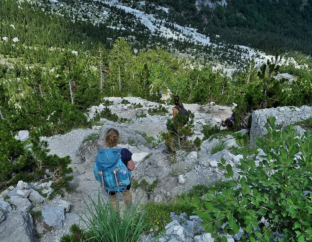
The official rating for this stage is “moderate”, and for once the official rating is fair – with a footnote the size of the mountain. There is no technical ground: no scrambling, no glacier, no via ferrata. What there is, is length and height stacked together – something in the region of a thousand metres of climbing and a full day’s distance, on a trail that is frequently rough, stony and steep in its gradients. A walker who regularly does full-day hill walks in the Lakes, Snowdonia or the Alps will find the crossing a satisfying but normal day. A walker whose preparation is weekend strolls should treat the At a Glance numbers as the warning they are, and build up to it: there is no bail-out option partway – the only exits are the two valleys you are walking between.
The serious warning belongs to snow, and it should be stated the way local operators state it. The descent from the pass towards Valbona crosses ground where lingering spring snow and ice have caused fatal accidents – the specialist operator BN Adventure, which guides this trail in all seasons, describes the descent gully as the one place on the entire Peaks of the Balkans network where a fatal accident has occurred, and a warning sign at the pass marks a closed gully where walkers died in snow and ice. The mechanism is simple and worth understanding: snow bridges and hard old snow survive in the shaded gully after the rest of the trail is clear, and a slip on that slope, in boots, without an axe, does not stop. The practical translation is absolute – if there is snow or ice on the descent and you are not equipped and experienced for it, turn around at the pass. The view is the same, the guesthouse behind you will feed you, and the mountain will be there in July.
The everyday warnings are milder and mostly about timing. Summer heat on the open final climb is the commonest problem after fitness, and it is solved by the dawn start every section of this guide recommends. Afternoon thunderstorms are the second: the pass is the most lightning-exposed point of the day, one more reason the experienced pattern is pass by late morning, valley by mid-afternoon. Footwear is the third – the trail’s stony sections, and especially the descent to Rragam, punish trainers and reward boots with ankle support. None of this makes the walk dangerous in season. All of it makes this a mountain day, not a promenade.
Waymarking and Navigation – Paint, Fingerposts and a Downloaded Track
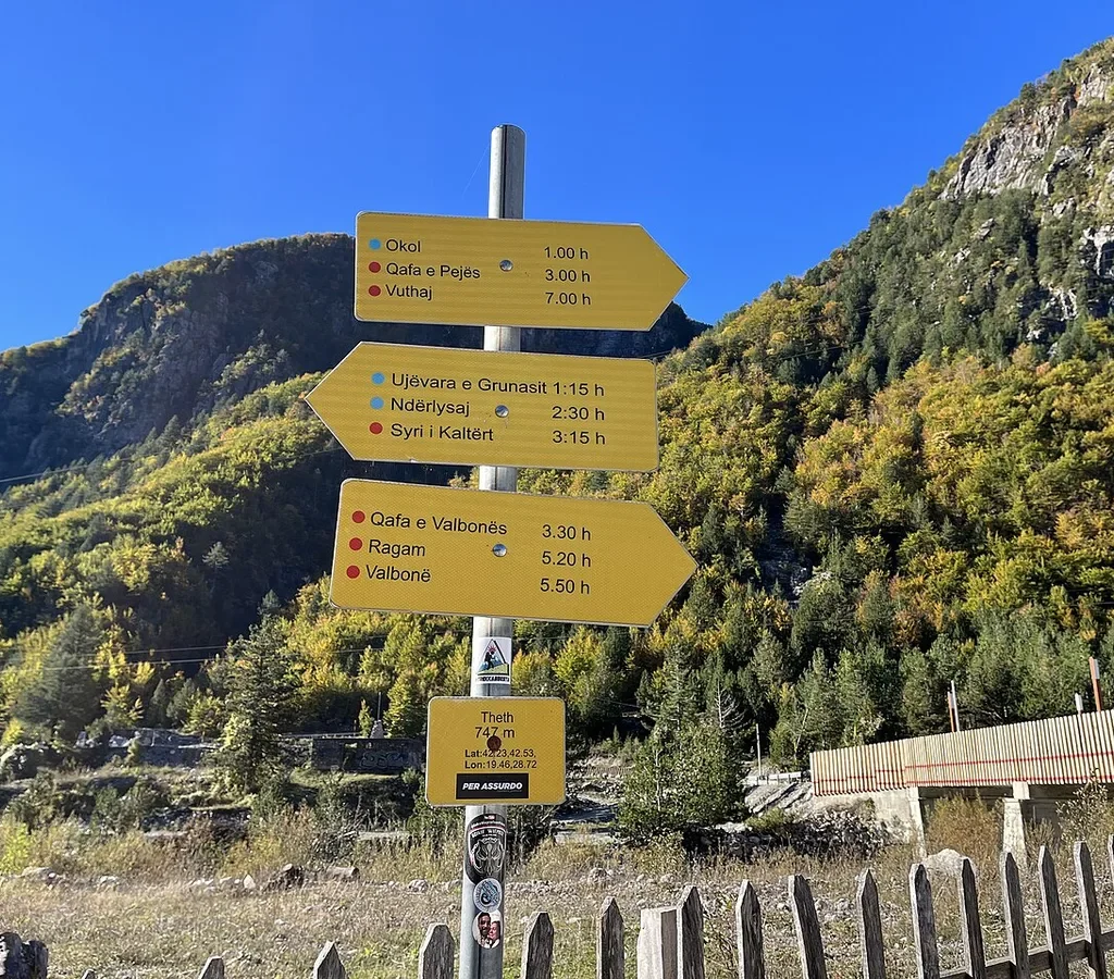
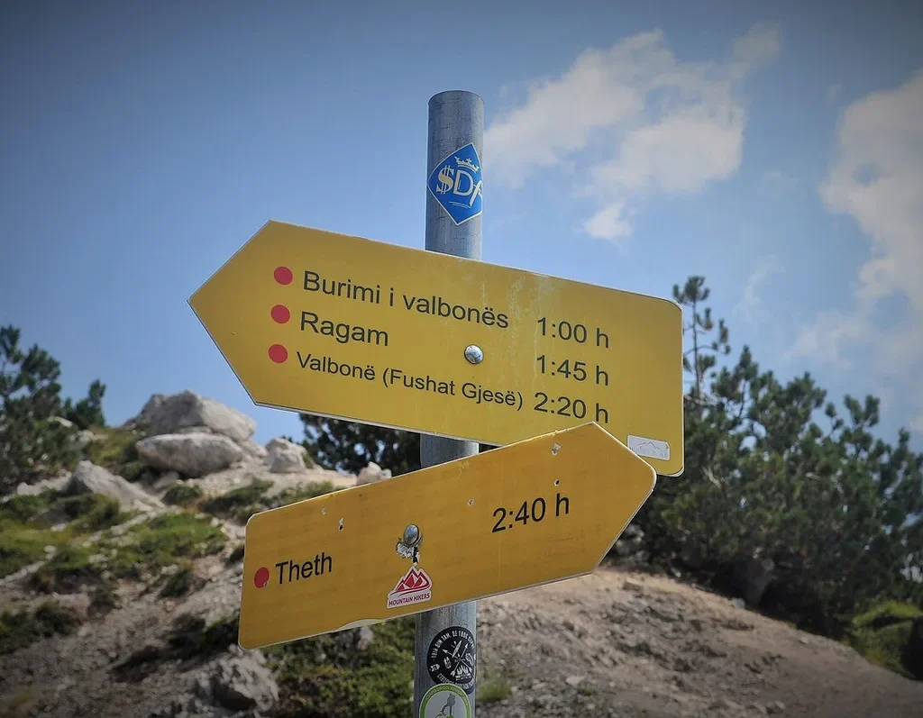
For a trail in a range this wild, the marking is genuinely good: white-red-white paint flashes in the Peaks of the Balkans manner, and yellow fingerposts at the junctions that matter – the Theth trailhead, the split below Gjelaj where the Montenegro route diverges, and the pass itself, where the post times Rragam at 1:45 and Valbona at 2:20 against 2:40 back to Theth. In 2025 the National Agency of Protected Areas completed an upgrade of some 15 kilometres of this trail, with new orientation signs, viewing platforms and rest areas along the route – and in clear weather an attentive walker should rarely face a decision harder than choosing the marked fork over the unmarked one.
Navigation still deserves a backup. The paint marks are a fair-weather system: in the cloud that regularly swallows this pass, flashes on grey rock are far less obvious than in sunshine. The trail also braids in places, where feet have worn alternatives around meadows and streambeds, and on a tired afternoon the wrong braid costs time and temper. The standard defences cost nothing: the official Peaks of the Balkans stage page for this crossing publishes a free GPX track of the stage alongside its elevation profile – load it, and an offline map of the range, before you lose signal, because signal in these valleys is a rumour in places.
Do you need a guide? Legally and practically, no permit or guide is required for this stage, and in season hundreds of walkers a week cross independently. A local guide earns their fee differently here: for the stories and the tribal history the mule track carries, for pacing a mixed-ability group, for the luggage and guesthouse machinery they arrange in one phone call, and for judgement on exactly the days – early season, late season, bad forecast – when judgement is the whole game. First-timers in the range, and anyone walking at the season’s edges, should weigh that honestly rather than treating independence as a badge.
Luggage Transfer – How Your Bag Crosses a Pass With No Road
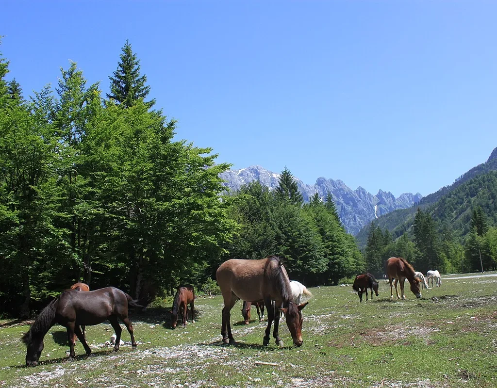
The pass has no road, so luggage logistics on this walk reduce to a short, elegant list of options, and every guesthouse keeper in both valleys can work all of them. The classic solution is the oldest one: your main bag crosses on a horse or mule, as freight crossed this pass for centuries. The arrangement is made through your guesthouse at the sending end or through a local operator – you hand over the bag in the morning, walk with a daypack, and the bag is waiting, or arrives shortly after you, at the guesthouse on the far side. Tour operators build the same transfer into self-guided programmes, with sensible conditions: a soft bag, not a suitcase (a hard case cannot be lashed to a packsaddle), and a weight limit around 15 kg per piece. Pack with that in mind and the mechanism becomes invisible.
The loop offers a second, lazier solution that many walkers prefer. Because the loop starts and finishes in Shkodër, a bag you do not need in the mountains can simply stay there, left with your hotel while you walk light. On a three or four day circuit it is often the smartest arrangement of all: the mountains get your hiking kit and nothing else. What does not work is the road shortcut: there is no vehicle route between the valleys shorter than the enormous detour through Shkodër and Bajram Curri, so a bag sent by car is a day’s journey of its own – possible in an emergency, pointless as a plan.
One more leg of the system catches people out: the short hops at the trail’s ends. Guesthouses in Valbona routinely arrange a lift up the valley to the Rragam trailhead for walkers starting in that direction, and down from Fusha e Gjesë for walkers finishing there, and on the Theth side the Gjelaj transfer trims the road section in the same spirit. None of these are official services with printed schedules; they are the valleys’ own arrangements, made the night before through the people feeding you. Ask at dinner, not at dawn.
Sleeping and Eating at Both Ends – the Guesthouse System
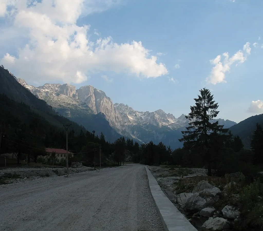
Both valleys run on the same institution: the family guesthouse, a stone farmhouse converted – or increasingly purpose-built – to feed and sleep walkers. There is no accommodation of any kind between the two villages, which is why the walk is a single indivisible day; but at each end the system is mature. You sleep in a family home and eat what the family cooks – breakfast before the walk, a packed lunch assembled at dawn, and dinner on arrival, which after six to nine hours on a mountain tastes like the finest cooking in Europe – and your hosts double as the valley’s information service, booking your minibus, ferry and luggage horse over the same table.
The two valleys have slightly different characters. Theth’s guesthouses spread through its hamlets along the valley floor, so “staying in Theth” can mean a twenty-minute walk from the trailhead – worth knowing when you book, and when you set the morning’s alarm. Valbona’s line the valley road for kilometres below Rragam, and the distance to the trailhead is again a real variable – one reason the Rragam lift exists. In the peak weeks the good houses fill, and booking ahead stops being a preference and becomes the plan; at the season’s shoulders, arriving unbooked is a gamble in villages with no overspill. Rates are deliberately not printed here – houses set their own, season by season. The mechanism is uniform: book direct or through the Shkodër operators who coordinate the loop, and confirm which end of the village you are sleeping in.
Practicalities follow from the remoteness. Neither valley has a bank or cash machine to rely on – the last dependable ATMs are the ones you pass on the way in, in Shkodër or Bajram Curri on the Valbona approach – so the mountains run on cash, in lek, carried in. Card payment is the exception, not the rule, and mobile signal exists in patches. What the guesthouses provide in place of infrastructure is the thing walkers actually remember: home cooking in quantity, raki that appears without being ordered, and a send-off culture in which your host checks your boots, your water and your weather before pointing you at the pass. Both valleys, incidentally, feature in our round-up of the best places to visit in Albania – the crossing may be the headline, but neither village is only a trailhead.
The Classic Loop – Shkodër, the Komani Ferry and the Roads at Both Ends
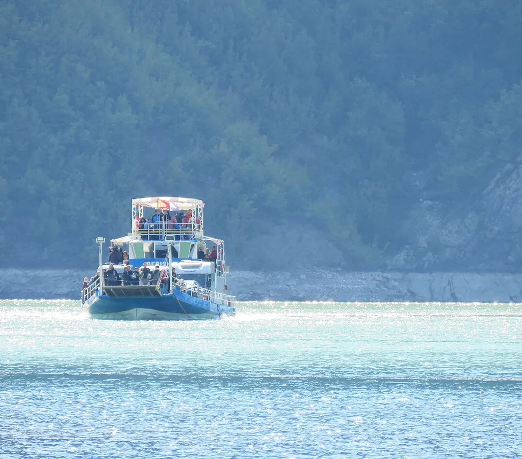
Almost nobody starts this walk at a trailhead. The standard approach is a loop out of Shkodër, the northern city that serves as the Albanian Alps’ base camp, and it comes in two orientations. In the first, you take the mountain road north to Theth – most operators quote between two and three hours now that the once-feared track has been largely asphalted – walk the crossing to Valbona, then return the long way round the water: minibus down the valley to Fierzë, the ferry across Komani Lake to Koman, and a final minibus back to Shkodër. In the second orientation the whole thing runs in reverse – ferry first, Valbona first, the walk done Valbona to Theth, and home down the mountain road. Three days is the honest minimum for either version; four, with a spare night in one of the valleys, is the comfortable one.
The ferry is not a connector in that loop – it is a co-headliner. Komani Lake is a reservoir on the Drin, and the crossing threads a flooded limestone gorge for roughly two and a half hours, past cliffs that have earned it the most repeated comparison in Albanian travel: Norway’s fjords, at Balkan prices and without the crowds. It is also a working boat – the lifeline of the shore villages – carrying cars, minibuses and locals alongside the backpackers. The service is seasonal – roughly April to early November – and in high summer the morning sailing out of Koman fills, vehicles especially; the standing advice is to book the ferry, and the through-minibus connections sold as one ticket from Shkodër, a few days ahead in peak season.
The legs connect with a choreography that looks fragile on paper and works in practice: minibuses meet the ferry at Fierzë for the hour up the valley to Valbona, and Theth road departures are timed for morning arrivals with a day to settle before the walk. Timings here are deliberately approximate – your guesthouse’s version, given the night before, outranks anything in print. What can be said firmly is the shape: one road leg, one ferry leg, one walk, three to four days. It is as neat a short expedition as Europe offers.
Water and Weather Discipline – the Two Things the Pass Controls
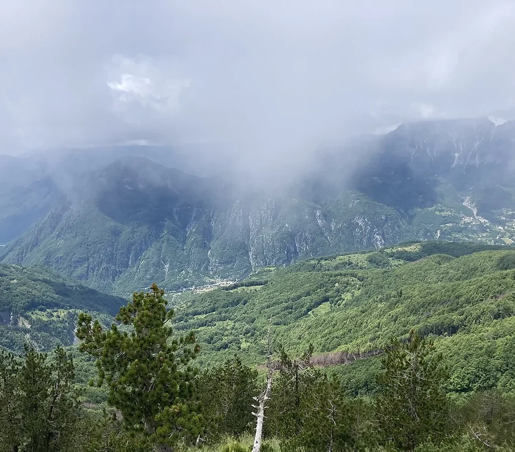
Water on this crossing is a tale of two unequal halves. The Theth side offers the coffee hut in season and streams low down, but the upper mountain – meadow, final climb, pass – is dry limestone with nothing reliable to drink. The Valbona side is kinder: the spring beside the café below the pass is the descent’s refill point. The working rule local guides repeat is to leave carrying everything the climb needs – most guidance converges on at least a couple of litres per person in summer – and treat every source after that as a bonus, not a plan. Trail-side springs in these mountains can run dry in a hot late summer, exactly when you need them most, and a dry September crossing on one small bottle is the commonest self-inflicted misery on this route.
Weather discipline is the same lesson from the other side. The pass is high, open and a long way from shelter in both directions, and the Accursed Mountains generate fast, local weather: a clear dawn in Theth guarantees nothing about the saddle at noon. The established pattern – pass by late morning, off the exposed ground before the afternoon – is the accumulated answer to summer thunderstorms, sudden cloud that erases the waymarks, and wind. Check the forecast the night before at your guesthouse, and treat a bad one as a reason to spend the spare day in the valley: the loop’s four-day version exists precisely to hold it.
The last piece of discipline is the one nobody enjoys hearing: the walk can be abandoned honourably at exactly one point – the pass, and only back the way you came. Beyond the spring on the descent you are committed to Valbona; before the final climb you are committed to nothing. Walkers who feel the day going wrong – a turned ankle, weather building – should decide at the saddle, while both valleys are still options. The trail is not going anywhere; it has been there since the mule trains.
One Park, Two Valleys – the Alps of Albania National Park
The ground this walk crosses has changed its legal name more recently than most maps admit. Theth was declared a national park in 1966, Valbona Valley followed in 1996, and for half a century the crossing passed from one park into another at the pass. On 26 January 2022 the Albanian government merged the two – together with the Gashi strict nature reserve – into a single protected area, the Alps of Albania National Park (Parku Kombëtar Alpet e Shqipërisë): at some 82,800 hectares it is the largest national park in the country, administered by the National Agency of Protected Areas, and the pass is now inside one park, not on a boundary between two. Older books and websites still describe the walk in two-park terms; the trail did not change, only the letterhead.
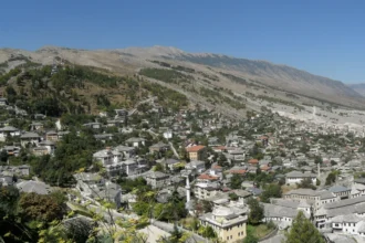
The park status is more than trivia for the walker: it is why the trail got its 2025 upgrade of signs, platforms and rest areas, and it carries the ordinary obligations of a national park anywhere – stay on the marked trail, take litter out, leave the wildflowers standing. Expect the high valleys to be grazed and lived in, not wilderness-empty: these villages predate the park by centuries. Theth adds one more layer of protection of its own: the village was declared a Protected Historic Centre in 2017, a status that guards its stone architecture – which is why the church, the tower houses and the old lanes at the start of this walk look the way they do.
The Peaks of the Balkans, the ten-day international trail this crossing belongs to, crosses real borders elsewhere on its circuit – into Kosovo and Montenegro, with permits arranged in advance for those stages. This stage does none of that. Theth, the pass and Valbona are all Albania, all one park, one currency, one language, one set of rules. Walkers who arrive braced for frontier formalities can stand down: the only documents the day requires are a booking for dinner at the far end.
Extra Days at Both Ends – What the Crossing Leaves Behind
The loop’s tightest version treats both villages as dormitories, and it is the version this guide most wants to argue you out of. Theth in particular carries a whole second day inside its valley. The little stone church, built in 1892, is the village’s portrait – and a plaque on its wall records that on 2 February 1917 the Franciscan Shtjefën Gjeçovi opened an Albanian-language school here, when that was a political act. A few minutes away stands the Lock-in Tower, the Kulla e Ngujimit – a fortified stone tower in which, under the old Kanun of Lekë Dukagjini, a man caught in a blood feud could shut himself away in safety while the elders negotiated the reconciliation that would let him come out. It now works as a small museum, and between church, tower and stone lanes, Theth’s history is as concentrated as anywhere in the Albanian mountains.
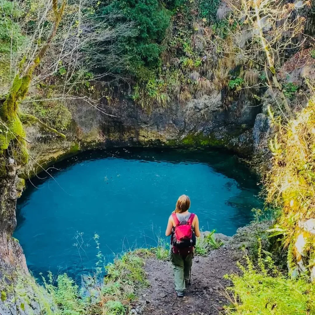
Theth’s other classic is a walk, not a building: the Blue Eye of Theth. The disambiguation matters – Albania has two famous Blue Eyes, and this spring pool and waterfall in the Kaprre valley above Ndërlysaj is not the great karst spring near Saranda; it is a quieter, colder thing, a deep blue basin under a small falls in a wooded gorge. It is also a real walk, not a stroll: Theth’s trail board times Syri i Kaltërt at 3 hours 15 minutes one way, with most accounts putting the round trip at five to six hours via the Grunas Waterfall – itself a 30-metre fall about 45 minutes from the village. A vehicle ride part-way, to Ndërlysaj, trims it to a final hour or so on foot. Either way, it converts Theth from a trailhead into a destination.
Valbona repays the same generosity in a different key: the valley is the destination as much as the village, and a spare day there goes on the river, the side valleys, or simply sitting in the amphitheatre of peaks the descent promised. The range’s longer ambitions start here too: the Peaks of the Balkans continues from Valbona towards Çerem and the Montenegrin and Kosovan stages, and Maja Jezercë stands over the head of the valley. The pattern this guide recommends is the pattern the valleys reward: a night in each village as the skeleton, a spare night in one of them as the flesh. Build the loop at four days and let the extra day fall where the weather puts it.
Theth to Valbona Hike – Frequently Asked Questions
How long does the Theth to Valbona hike take?
Plan a full day. Theth’s trail board times it at 5 hours 50, the Peaks of the Balkans stage page estimates 7 hours, and most walkers take six to nine hours door to door with stops. Fast, fit parties do it in five to six; nobody should plan connections on less than a whole day – there is no transport to bail out to in between.
Do you need a guide for the Theth to Valbona hike?
No. The trail is well waymarked, no permit or guide is required, and in season it is walked independently by hundreds of people a week. A local guide is worth their fee for groups, for mixed-ability parties, for walkers travelling at the edges of the season when route judgement matters, and for anyone who wants the luggage transfers, guesthouses and loop transport arranged with one phone call – but the way itself, in summer, is followable by any walker used to marked mountain trails.
Is there a border crossing or permit on the Theth to Valbona hike?
No – the most common misunderstanding about the walk. Theth, the pass and Valbona are all inside Albania, in a single national park: no border, no passport, no permit. The border-permit system belongs to other Peaks of the Balkans stages, which cross into Kosovo and Montenegro elsewhere on the circuit. Walking only Theth to Valbona, there is no paperwork of any kind.
When is Valbona Pass free of snow?
In a typical year the crossing opens in late May or early June and stays walkable until early October, with mid-June to mid-September the reliable core. Snow is the variable, not the calendar: hard patches can survive on the shaded descent into mid-June after a heavy winter, and fresh autumn snow can close the pass from late September. Ask your guesthouse the night before you walk, and treat snow or ice on the descent as a reason to turn back at the pass.
Can you hike Theth to Valbona as a day trip from Shkodër?
Not sensibly. The walk alone is a full mountain day, and both trailheads are hours from the city. The realistic minimum is the three-day loop: a day in, the crossing, a day out via the other leg. Four days, with a spare night in one valley, is the version that survives bad weather. Anyone selling it as a day trip is selling you the transfers and skipping the mountain.
What happens to your luggage on the Theth to Valbona hike?
Three honest options. Carry it – a light pack is entirely manageable if you pack like a hiker. Send it over the pass on a horse or mule, arranged through your guesthouse or a loop operator; the bag must be soft, not a suitcase, and typically under about 15 kg. Or leave the big bag in Shkodër with your hotel and walk the whole loop light. What does not exist is a road transfer between the valleys – the only road route is the long way round, via Shkodër and Bajram Curri.
The Short Version
Sleep in a guesthouse in Theth, walk out at dawn past the church and the trail board, climb through beech forest and meadow to Valbona Pass, and descend past the spring café and Rragam into the Valbona valley for dinner. Six to nine hours, roughly a thousand metres of climbing, one of the great one-day crossings of Europe. Do it between mid-June and mid-September if you can, start early, carry your water, let a horse carry your bag, and come back to Shkodër by the Komani Lake ferry so the journey home is half the point. Then give one of the valleys the extra night it deserves – the other half of this walk is everything you would otherwise walk straight past.